Earth
2007 Schools Wikipedia Selection. Related subjects: The Planets
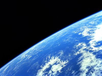
 The Blue Marble, taken from Apollo 17. |
|
| Orbital characteristics ( Epoch J2000) | |
|---|---|
| Aphelion | 152,097,701 km (1.016 710 333 5 AU) |
| Perihelion | 147,098,074 km (0.983 289 891 2 AU) |
| Semi-major axis | 149,597,887.5 km (1.000 000 112 4 AU) |
| Semi-minor axis | 149,576,999.826 km (0.999 860 486 9 AU) |
| Orbital circumference | 924,375,700 km ( 6.179 069 900 7 AU) |
| Orbital eccentricity | 0.016 710 219 |
| Sidereal orbit period | 365.256 366 d (1.000 017 5 a) |
| Synodic period | n/a |
| Max. orbital speed | 30.287 km/s (109,033 km/h) |
| Average orbital speed | 29.783 km/s (107,218 km/h) |
| Min. orbital speed | 29.291 km/s (105,448 km/h) |
| Orbital inclination to ecliptic | 0 (7.25° to Sun's equator) |
| Longitude of the ascending node | 348.739 36° |
| Argument of the perihelion | 114.207 83° |
| Satellites | 1 (the Moon) (see also 3753 Cruithne) |
| Physical characteristics | |
| Aspect Ratio | 0.996 647 1 |
| Ellipticity | 0.003 352 9 |
| Equatorial radius | 6,378.137 km |
| Polar radius | 6,356.752 km |
| Mean radius | 6,372.797 km |
| Equatorial circumference | 40,075.02 km |
| Meridional circumference | 40,007.86 km |
| Mean circumference | 40,041.47 km |
| Surface area | 510,065,600 km² |
| Land area | 148,939,100 km² (29.2 %) |
| Water area | 361,126,400 km² (70.8 %) |
| Volume | 1.083 207 3×10¹² km³ |
| Mass | 5.9742×1024 kg |
| Density | 5,515.3 kg/m³ |
| Equatorial surface gravity | 9.780 1 m/s² (0.997 32 g) |
| Escape velocity | 11.186 km/s |
| Sidereal rotation period | 0.997 258 d (23.934 h) |
| Rotational velocity at equator | 465.11 m/s |
| Axial tilt | 23.439 281° |
| Right ascension of North pole | 0° (0 h 0 min 0 s) |
| Declination | +90° |
| Albedo | 0.367 |
| Surface temperature | 185 K (-88.3 °C) min 287 K (14 °C) mean 331 K (57.7 °C) max |
| Surface pressure | 101.3 kPa ( MSL) |
| Adjective | Terrestrial, Terran, Telluric, Tellurian, Earthly, Earthling (lifeforms) |
| Atmospheric constituents | |
| Nitrogen | 78.08 % |
| Oxygen | 20.94 % |
| Argon | 0.93 % |
| Carbon dioxide | 0.038 % |
| Water vapor | Trace (varies with climate) |
Earth ( IPA: /ˈəː(ɹ)θ/, often referred to as the Earth, Terra, the World or Planet Earth) is the third planet in the solar system in terms of distance from the Sun, and the fifth largest. It is also the largest of its planetary system's terrestrial planets, making it the largest solid body in the solar system, and it is the only place in the universe known to humans to support life. It is also the densest planet in the solar system. Widely accepted scientific evidence indicates that the Earth was formed around 4.57 billion years ago and its natural satellite, the Moon, was orbiting it shortly thereafter, around 4.53 billion years ago.
The outer surface is divided into several tectonic plates that gradually migrate across the surface over geologic time spans. The interior of the planet remains active, with a thick layer of convecting yet solid mantle and an iron core that generates a magnetic field. Its atmospheric conditions have been significantly altered by the presence of life forms, which create an ecological balance that modifies the surface conditions. About 71% of the surface is covered in salt-water oceans, and the remainder consists of continents and islands.
There is significant interaction between the Earth and its space environment. The relatively large moon provides ocean tides and has gradually modified the length of the planet's rotation period. A cometary bombardment during the early history of the planet is believed to have played a role in the formation of the oceans. Later, asteroid impacts are understood to have caused significant changes to the surface environment. Long term periodic changes in the orbit of the planet may also be responsible for the ice ages that have covered significant portions of the surface in glacial sheets.
Lexicography
In American English usage, the name can be capitalized or spelled in lowercase interchangeably, either when used absolutely or prefixed with "the" (i.e. Earth, the Earth, earth or the earth). Many deliberately spell the name of the planet with a capital, both as "Earth" or "the Earth". This is to distinguish it as a proper noun, distinct from the senses of the term as a count noun or verb (e.g. referring to soil, the ground, earthing in the electrical sense, etc.). Oxford Spelling recognizes the lowercase form as the most common, with the capitalized form as a variant of it. Another convention that is very common is to spell the name with a capital when occurring absolutely (e.g. Earth's atmosphere) and lowercase when preceded by "the" (e.g. the atmosphere of the earth). The term almost exclusively exists in lowercase when appearing in common phrases, even without "the" preceding it (e.g. it doesn't cost the earth; what on earth are you doing?).
Terms that refer to the Earth can use the Latin root terr-, as in terraform and terrestrial. An alternative Latin root is tellur-, which is used in words such as tellurian and tellurium. Such terms derive from Latin terra and tellus, which refer variously to the world, the element earth, the earth goddess and so forth. Scientific terms such as geography, geocentric and geothermal use the Greek prefix geo- (γαιο-, gaio-), from gē (again meaning "earth"). In many science fiction books and video games, Earth is referred to as Terra or Gaia. Astronauts refer to the Earth as "Terra Firma".
The English word "earth" has cognates in many modern and ancient languages. Examples in modern tongues include aarde in Afrikaans and Dutch, and Erde in German. The root has cognates in extinct languages such as ertha in Old Saxon and ert (meaning "ground") in Middle Irish, derived from the Old English eorðe. All of these words derive from the Proto-Indo-European base *er-.
Several Semitic languages have words for "earth" similar to those in Indo-European languages. Arabic has ard; Akkadian, irtsitu; Aramaic, araa; Phoenician, erets (which appears in the Mesha Stele); and Hebrew, ארץ (arets, or erets when not preceded by a definite article, or when followed by a noun modifier). The etymological connection between the words in Indo-European and Semitic languages are uncertain, though, and may simply be coincidence.
The standard name for people from Earth is Earthling, although Terran, Gaian, and Earther are alternate names that have been used in Science fiction.
Words for Earth in other languages include: Terre (French), पृथ्वी pr̥thvī (Sanskrit), Maa ( Finnish and Estonian), Pamînt ( Romanian), Föld ( Hungarian), Ziemia ( Polish), Zemlja (Russian and Serbian), Tierra (Spanish), Terra ( Italian), Diqiu ( Mandarin), Deiqao ( Cantonese), Jigu ( Korean), Bumi ( Malay), Chikyuu ( Japanese), Jorden ( Danish, Norwegian, Swedish), Gi, Choma ( Greek), Dunia ( Swahili), Âlem, Dünya الْمَسْكُونَة (Arabic), Dinê ( Kurdish), Ergir երկիր ( Armenian), Jehun, Zamin ( Persian), and Acun, Yeryüzü, Yerküre ( Turkish)., כדור הארץ (Hebrew), Bhoomi ( Telugu)
History
Based on the available evidence, current scientists have been able to reconstruct detailed information about the planet's past. Earth is believed to have formed around 4.57 billion years ago out of the solar nebula, along with the Sun and the other planets. Initially molten, the outer layer of the planet cooled when water began accumulating in the atmosphere when the planet was about half its current radius, resulting in the solid crust. The moon formed soon afterwards, possibly as the result of the impact with a Mars-sized object known as Theia. Outgassing and volcanic activity produced the primordial atmosphere; condensing water vapor, augmented by ice delivered by comets, produced the oceans. The highly energetic chemistry is believed to have produced a self-replicating molecule around 4 billion years ago, and half a billion years later, the last common ancestor of all life lived.
The development of photosynthesis allowed the sun's energy to be harvested directly; the resultant oxygen accumulated in the atmosphere and gave rise to the ozone layer. The incorporation of smaller cells within larger ones resulted in the development of complex cells called eukaryotes. Cells within colonies became increasingly specialized, resulting in true multicellular organisms. Aided by the absorption of harmful ultraviolet radiation by the ozone layer, life colonized the surface of Earth.
Over hundreds of millions of years, continents formed and broke up as the surface of Earth continually reshaped itself. The continents have migrated across the surface of the Earth, occasionally combining to form a supercontinent. Roughly 750 million years ago (mya), the earliest known supercontinent Rodinia, began to break apart. The continents later recombined to form Pannotia, 600–540 mya, then finally Pangaea, which broke apart 180 mya.
Since the 1960s, it has been hypothesized that severe glacial action between 750 and 580 mya, during the Neoproterozoic, covered much of the planet in a sheet of ice. This hypothesis has been termed "Snowball Earth", and is of particular interest because it preceded the Cambrian explosion, when multicellular lifeforms began to proliferate.
Since the Cambrian explosion, about 535 mya, there have been five mass extinctions. The last occurred 65 mya, when a meteorite collision probably triggered the extinction of the (non-avian) dinosaurs and other large reptiles, but spared small animals such as mammals, which then resembled shrews. Over the past 65 million years, mammalian life has diversified, and several mya, a small African ape gained the ability to stand upright. This enabled tool use and encouraged communication that provided the nutrition and stimulation needed for a larger brain. The development of agriculture, and then civilization, allowed humans to influence the Earth in a short timespan as no other life form had, affecting both the nature and quantity of other life forms, and the global climate.
Shape
The Earth's shape is very close to an oblate spheroid, although the precise shape (the geoid) varies from this by up to 100 meters (327 ft). The average diameter of the reference spheroid is approximately 12,742 km (more roughly, 40,000 km/π). The rotation of the Earth causes the equator to bulge out slightly so that the equatorial diameter is 43 km larger than the pole to pole diameter. The largest local deviations in the rocky surface of the Earth are Mount Everest (8,850 m above local sea level) and the Mariana Trench (10,924 m below local sea level). Hence compared to a perfect ellipsoid, the Earth has a tolerance of about one part in about 584, or 0.17%. For comparison, this is less than the 0.22% tolerance allowed in billiard balls. Because of the bulge, the feature farthest from the centre of the Earth is actually Mount Chimborazo in Ecuador.
Composition
The mass of the Earth is approximately 5980 yottagrams (5.98 ×1024 kg). It is composed mostly of iron (35.0%), oxygen (28.0%), silicon (17.0%), magnesium (15.7%), nickel (1.5%), calcium (1.4%) and aluminium (1.4%).
Internal structure
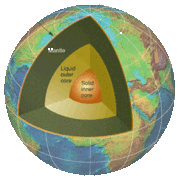
The interior of the Earth, like that of the other terrestrial planets, is chemically divided into layers. The Earth has an outer silicate solid crust, a highly viscous mantle, a liquid outer core that is much less viscous than the mantle, and a solid inner core.
The geologic component layers of the Earth are at the following depths below the surface:
| Depth | Layer | |
|---|---|---|
| Kilometers | Miles | |
| 0–60 | 0–37 | Lithosphere (locally varies between 5 and 200 km) |
| 0–35 | 0–22 | ... Crust (locally varies between 5 and 70 km) |
| 35–60 | 22–37 | ... Uppermost part of mantle |
| 35–2890 | 22–1790 | Mantle |
| 100–700 | 62–435 | ... Asthenosphere |
| 2890–5100 | 1790–3160 | Outer core |
| 5100–6378 | 3160–3954 | Inner core |
Tectonic plates
According to plate tectonics theory currently accepted by the vast majority of scientists working in this area, the outermost part of the Earth's interior is made up of two layers: the lithosphere comprising the crust, and the solidified uppermost part of the mantle. Below the lithosphere lies the asthenosphere, which comprises the inner, viscous part of the mantle. The mantle behaves like a superheated and extremely viscous liquid.
The lithosphere essentially floats on the asthenosphere and is broken up into what are called tectonic plates. These plates move in relation to one another at one of three types of plate boundaries: convergent, divergent, and transform. Earthquakes, volcanic activity, mountain-building, and oceanic trench formation occur along plate boundaries.
The main plates are
- African Plate, covering Africa - Continental plate
- Antarctic Plate, covering Antarctica - Continental plate
- Australian Plate, covering Australia (fused with Indian Plate between 50 and 55 million years ago) - Continental plate
- Eurasian Plate covering Asia and Europe - Continental plate
- North American Plate covering North America and north-east Siberia - Continental plate
- South American Plate covering South America - Continental plate
- Pacific Plate, covering the Pacific Ocean - Oceanic plate
Notable minor plates include the Indian Plate, the Arabian Plate, the Caribbean Plate, the Nazca Plate and the Scotia Plate.
Surface
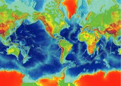
The Earth's terrain varies greatly from place to place. About 70% of the surface is covered by water, with much of the continental shelf below sea level. If all of the land on Earth were spread evenly, water would rise to an altitude of more than 2500 metres (approximately 8000 ft.). The remaining 30% not covered by water consists of mountains, deserts, plains, plateaus, etc.
Currently the total arable land is 13.31% of the land surface, with only 4.71% supporting permanent crops. Close to 40% of the Earth's land surface is presently used for cropland and pasture, or an estimated 3.3 × 10⁹ acres of cropland and 8.4 × 10⁹ acres of pastureland.
Extremes
Elevation extremes: (measured relative to sea level)
- Lowest point on land: Dead Sea −417 m
- Lowest point overall: Challenger Deep of the Mariana Trench in the Pacific Ocean −10,924 m
- Highest point: Mount Everest 8,844 m (2005 est.)
Hydrosphere
The abundance of water on Earth is a unique feature that distinguishes the " Blue Planet" from others in the solar system. Approximately 70.8 percent of the Earth is covered by water and only 29.2 percent is terra firma.
The Earth's hydrosphere consists chiefly of the oceans, but technically includes all water surfaces in the world, including inland seas, lakes, rivers, and underground waters. The average depth of the oceans is 3,794 m (12,447 ft), more than five times the average height of the continents. The mass of the oceans is approximately 1.35 × 10^18 tonnes, or about 1/4400 of the total mass of the Earth.
Atmosphere
The Earth's atmosphere has no definite boundary, slowly becoming thinner and fading into outer space. Three-quarters of the atmosphere's mass is contained within the first 11 km of the planet's surface. This lowest layer is called the troposphere. Further up, the atmosphere is usually divided into the stratosphere, mesosphere, and thermosphere. Beyond these, the exosphere thins out into the magnetosphere (where the Earth's magnetic fields interact with the solar wind). An important part of the atmosphere for life on Earth is the ozone layer.
The atmospheric pressure on the surface of the Earth averages 101.325 kPa, with a scale height of about 6 km. It is 78% nitrogen and 21% oxygen, with trace amounts of other gaseous molecules such as water vapor. The atmosphere protects the Earth's life forms by absorbing ultraviolet solar radiation, moderating temperature, transporting water vapor, and providing useful gases. The atmosphere is one of the principal components in determining weather and climate.
Because hydrogen gas is light and based on Earth's mean temperature, achieves escape velocity, unfixed hydrogen leaves the Earth. For this reason, the Earth's environment is oxidizing, with consequences for the chemical nature of life which developed on the planet.
Climate
The most prominent features of the Earth's climate are its two large polar regions, two narrow temperate zones, and a wide equatorial tropical region. Precipitation patterns vary widely, ranging from several metres of water per year to less than a millimetre.
Ocean currents are important factors in determining climate, particularly the spectacular thermohaline circulation which distributes heat energy from the equatorial oceans to the polar regions.
Pedosphere
The pedosphere is the outermost layer of the Earth that is composed of soil and subject to soil formation processes. It exists at the interface of the lithosphere, atmosphere, hydrosphere and biosphere.
Biosphere
The planet's lifeforms are sometimes said to form a "biosphere". This biosphere is generally believed to have begun evolving about 3.5 billion (3.5×10⁹) years ago. Earth is the only place in the universe officially recognized by the communities of Earth where life is absolutely known to exist, and some scientists believe that biospheres might be rare.
The biosphere is divided into a number of biomes, inhabited by broadly similar flora and fauna. On land primarily latitude and height above the sea level separates biomes. Terrestrial biomes lying within the Arctic, Antarctic Circle or in high altitudes are relatively barren of plant and animal life, while most of the more populous biomes lie near the Equator.
Land use
Humans use the Earth's land to support themselves through the production of food, energy, and building material. They also live on the land by building shelters. Human use of land is approximately:
- Arable land: 13.13%
- Permanent crops: 4.71%
- Permanent pastures: 26%
- Forests and woodland: 32%
- Urban areas: 1.5%
- Other: 30% (1993 est.)
Irrigated land: 2,481,250 km² (1993 est.)
Natural and environmental hazards
Large areas are subject to extreme weather such as (tropical cyclones), hurricanes, or typhoons that dominate life in those areas. Many places are subject to earthquakes, landslides, tsunamis, volcanic eruptions, tornadoes, sinkholes, blizzards, floods, droughts, and other calamities and disasters.
Many localize areas are subject to human-made pollution of the air and water, acid rain and toxic substances, loss of vegetation ( overgrazing, deforestation, desertification), loss of wildlife, species extinction, soil degradation, soil depletion, erosion, and introduction of invasive species.
Long-term climate alteration from enhancement of the greenhouse effect caused by the earth itself and human industrial carbon dioxide emissions is an increasing concern, the focus of intense study and debate.
Human geography
Asia
Asia
Asia
Asia
America
America
Africa
Africa
Europe
Europe
Europe
Europe
Europe
Earth has approximately 6,500,000,000 human inhabitants ( February 24, 2006 estimate). Projections indicate that the world's human population will reach seven billion in 2013 and 9.1 billion in 2050 (2005 UN estimates). Most of the growth is expected to take place in developing nations. Human population density varies widely around the world.
It is estimated that only one eighth of the surface of the Earth is suitable for humans to live on — three-quarters is covered by oceans, and half of the land area is desert, high mountains or other unsuitable terrain.
The northernmost permanent settlement in the world is Alert, on Ellesmere Island in Nunavut, Canada. The southernmost is the Amundsen-Scott South Pole Station, in Antarctica, almost exactly at the South Pole.
There are 267 administrative divisions, including nations, dependent areas, other, and miscellaneous entries. Earth does not have a sovereign government with planet-wide authority. Independent sovereign nations claim all of the land surface except for some segments of Antarctica. There is a worldwide general international organization, the United Nations. The United Nations is primarily an international discussion forum with only limited ability to pass and enforce laws.
In total, about 400 people have been outside the Earth's atmosphere as of 2004, and of these, twelve have walked on the Moon. Most of the time the only humans in space are those on the International Space Station, currently three people who are usually replaced every 6 months. See human spaceflight.
Solar system
It takes the Earth, on average, 23 hours, 56 minutes and 4.091 seconds ( one sidereal day) to rotate around the axis that connects the north and the south poles. From Earth, the main apparent motion of celestial bodies in the sky (except that of meteors within the atmosphere and low-orbiting satellites) is to the west at a rate of 15 °/h = 15'/min, i.e., an apparent Sun or Moon diameter every two minutes.
Earth orbits the Sun every 365.2564 mean solar days ( 1 sidereal year). From Earth, this gives an apparent movement of the Sun with respect to the stars at a rate of about 1 °/day, i.e., a Sun or Moon diameter every 12 hours, eastward. The orbital speed of the Earth averages about 30 km/s (108,000 km/h), which is enough to cover the planet's diameter (~12,600 km) in seven minutes, and the distance to the Moon (384,000 km) in four hours.
The Moon revolves with the Earth around a common barycenter, from fixed star to fixed star, every 27.32 days. When combined with the Earth–Moon system's common revolution around the Sun, the period of the synodic month, from new moon to new moon, is 29.53 days. The Hill sphere (gravitational sphere of influence) of the Earth is about 1.5 Gm (930,000 miles) in radius. Viewed from Earth's north pole, the motion of Earth, its moon and their axial rotations are all counterclockwise. The orbital and axial planes are not precisely aligned: Earth's axis is tilted some 23.5 degrees against the Earth–Sun plane (which causes the seasons); and the Earth–Moon plane is tilted about 5 degrees against the Earth-Sun plane (without a tilt, there would be an eclipse every two weeks, alternating between lunar eclipses and solar eclipses).
In an inertial reference frame, the Earth's axis undergoes a slow precessional motion with a period of some 25,800 years, as well as a nutation with a main period of 18.6 years. These motions are caused by the differential attraction of Sun and Moon on the Earth's equatorial bulge because of its oblateness. In a reference frame attached to the solid body of the Earth, its rotation is also slightly irregular from polar motion. The polar motion is quasi-periodic, containing an annual component and a component with a 14-month period called the Chandler wobble. In addition, the rotational velocity varies, in a phenomenon known as length of day variation.
In modern times, Earth's perihelion occurs around January 3, and the aphelion around July 4 (near the solstices, which are on about December 21 and June 21). For other eras, see precession and Milankovitch cycles.
Phases
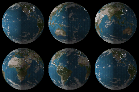
From space, the Earth can be seen to go through phases similar to the phases of the Moon and Venus. This appearance is caused by light that reflects off the Earth as it moves around the Sun. The phases seen depend upon the observer's location in space. The phases of the Earth can be simulated by shining light on a globe of the Earth.
From orbit around the Earth, one can see all of the phases of the Earth in progression from New Earth to New Earth. The speed at which one sees these phases is related to the orbit of the observer and the speed of the observer around the Earth.
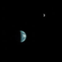
A Martian observer can see the Earth go through phases similar to those that an Earth-bound observer sees the phases of Venus (as discovered be Galileo), going for the Martian's perspective from New Earth to Fat Crescent to wane to New Earth. It is can be shown that an imaginary observer on the Sun would not see the Earth going through phases. The sun observer would only be able to see the lit side of the earth.
Magnetic field
The Earth's magnetic field is shaped roughly as a magnetic dipole, with the poles currently located proximate to the planet's geographic poles. The field forms the magnetosphere, which deflects particles in the solar wind. The bow shock is located about at 13.5 RE. The collision between the magnetic field and the solar wind forms the Van Allen radiation belts, a pair of concentric, torus-shaped regions of energetic charged particles. When the plasma enters the Earth's atmosphere at the magnetic poles, it forms the aurora.
Moon
| Name | Diameter (km) | Mass (kg) | Semi-major axis (km) | Orbital period |
|---|---|---|---|---|
| Moon | 3,474.8 | 7.349×10²² | 384,400 | 27 days, 7 hours, 43.7 minutes |
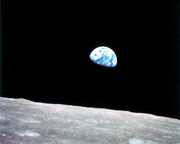
The Moon, sometimes called 'Luna', is a relatively large, terrestrial, planet-like satellite, with a diameter about one-quarter of the Earth's. It is the largest moon in the solar system relative to the size of its planet. ( Charon is larger relative to dwarf planet Pluto.) The natural satellites orbiting other planets are called "moons", after Earth's Moon.
The gravitational attraction between the Earth and Moon cause tides on Earth. The same effect on the Moon has led to its tidal locking: its rotation period is the same as the time it takes to orbit the Earth. As a result, it always presents the same face to the planet. As the Moon orbits Earth, different parts of its face are illuminated by the Sun, leading to the lunar phases: The dark part of the face is separated from the light part by the solar terminator.
Because of their tidal interaction, the Moon recedes from Earth at the rate of approximately 38 mm a year. Over millions of years, these tiny modifications—and the lengthening of Earth's day by about 17 µs a year—add up to significant changes. During the Devonian period, there were 400 days in a year, with each day lasting 21.8 hours.
The Moon may dramatically affect the development of life by taming the weather. Paleontological evidence and computer simulations show that Earth's axial tilt is stabilized by tidal interactions with the Moon. Some theorists believe that without this stabilization against the torques applied by the Sun and planets to the Earth's equatorial bulge, the rotational axis might be chaotically unstable, as it appears to be for Mars. If Earth's axis of rotation were to approach the plane of the ecliptic, extremely severe weather could result from the resulting extreme seasonal differences. One pole would be pointed directly toward the Sun during summer and directly away during winter. Planetary scientists who have studied the effect claim that this might kill all large animal and higher plant life. However, this is a controversial subject, and further studies of Mars—which shares Earth's rotation period and axial tilt, but not its large moon or liquid core—may settle the matter.
Viewed from Earth, the Moon is just far enough away to have very nearly the same apparent angular size as the Sun (the Sun is 400 times larger, and the Moon is 400 times closer). This allows total eclipses and annular eclipses to occur on Earth.
The most widely accepted theory of the Moon's origin, the giant impact theory, states that it was formed from the collision of a Mars-size protoplanet with the early Earth. This hypothesis explains (among other things) the Moon's relative lack of iron and volatile elements, and the fact that its composition is nearly identical to that of the Earth's crust.
Earth has at least two co-orbital satellites, the asteroids 3753 Cruithne and 2002 AA29.
Descriptions
Earth has often been personified as a deity, in particular a goddess (see Gaia and Mother Earth). The Chinese Earth goddess Hou-Tu is similar to Gaia, the deification of the Earth. As the patroness of fertility, her element is Earth. In Norse mythology, the Earth goddess Jord was the mother of Thor and the daughter of Annar. Ancient Egyptian mythology is different from that of other cultures because Earth is male, Geb, and sky is female, Nut (goddess).
Although commonly thought to be a sphere, the Earth is actually an oblate spheroid. It bulges slightly at the equator and is slightly flattened at the poles. In the past there were varying levels of belief in a flat Earth, but ancient Greek philosophers and, in the Middle Ages, thinkers such as Thomas Aquinas believed that it was spherical. A 19th-century organization called the Flat Earth Society advocated the even-then discredited idea that the Earth was actually disc-shaped, with the North Pole at its centre and a 150 foot (50 m) high wall of ice at the outer edge. It and similar organizations continued to promote this idea, based on religious beliefs and conspiracy theories, through the 1970s. Today, the subject is more frequently treated tongue-in-cheek or with mockery.
Prior to the introduction of space flight, these inaccurate beliefs were countered with deductions based on observations of the secondary effects of the Earth's shape and parallels drawn with the shape of other planets. Cartography, the study and practice of map making, and vicariously geography, have historically been the disciplines devoted to depicting the Earth. Surveying, the determination of locations and distances, to an lesser extent navigation, the determination of position and direction, have developed alongside cartography and geography, providing and suitably quantifying the requisite information.
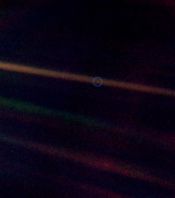
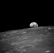
The technological developments of the latter half of the 20th century are widely considered to have altered the public's perception of the Earth. Before space flight, the popular image of Earth was of a green world. Science fiction artist Frank R. Paul provided perhaps the first image of a cloudless blue planet (with sharply defined land masses) on the back cover of the July 1940 issue of Amazing Stories, a common depiction for several decades thereafter. Apollo 17's 1972 " Blue Marble" photograph of Earth from cislunar space became the current iconic image of the planet as a marble of cloud-swirled blue ocean broken by green-brown continents. A photo taken of a distant Earth by Voyager 1 in 1990 inspired Carl Sagan to describe the planet as a " Pale Blue Dot." Earth has also been described as a massive spaceship, with a life support system that requires maintenance, or as having a biosphere that forms one large organism. See Spaceship Earth and Gaia theory.
Future
The future of the planet is closely tied to that of the Sun. The luminosity of the Sun will continue to steadily increase, growing from the current luminosity by 10% in 1.1 billion years (1.1 Gyr) and up to 40% in 3.5 Gyr. Climate models indicate that the increase in radiation reaching the Earth is likely to have dire consequences, including possible loss of the oceans.
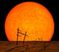
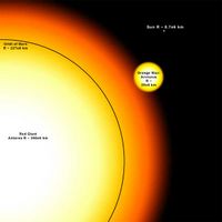
The Sun, as part of its solar lifespan, will expand to a red giant in 5 Gyr. Models predict that the Sun will expand out to about 99% of the distance to the Earth's present orbit (1 astronomical unit, or AU). However, by that time, the orbit of the Earth may have expanded to about 1.7 AUs because of the diminished mass of the Sun. The planet might thus escape envelopment.
The increased heat will accelerate the inorganic CO2 cycle,reducing its concentration to the lethal dose for plants (10 ppm for C4 photosynthesis) in 900 million years. But even if the Sun were eternal and stable, the continued internal cooling of the Earth would have resulted in a loss of much of its atmosphere and oceans (due to lower volcanism). More specifically, for Earth's oceans, the lower temperatures in the crust will permit their water to leak more deeply than today(at certain debt the water is evaporating) resulting in their total disappearance in 1 billion years.
