Minneapolis, Minnesota
2007 Schools Wikipedia Selection. Related subjects: North American Geography
| Minneapolis, Minnesota | |||
|
|||
| Nickname: "City of Lakes" | |||
| Motto: En Avant | |||
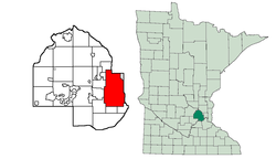
| Location in Hennepin County and the state of Minnesota. | |||
| Coordinates: | |||
|---|---|---|---|
| Country | United States | ||
| State | Minnesota | ||
| Counties | Hennepin | ||
| Mayor | R.T. Rybak ( DFL) | ||
| Area | |||
| - City | 58.4 mi² - 151.3 km² | ||
| - Land | 54.9 mi² - 142.2 km² | ||
| - Water | 3.5 mi² - 9.1 km² | ||
| Elevation | 264 m | ||
| Population | |||
| - City (2000) | 382,618 | ||
| - Density | 2,691.4/km² (6,969/sq mi) | ||
| - Metro | 2,968,805 | ||
| Time zone | CST ( UTC-6) | ||
| - Summer ( DST) | CDT ( UTC-5) | ||
| Website: http://www.ci.minneapolis.mn.us/ | |||
Minneapolis (pronounced [ˌmɪniˈæpəlɪs]) is the largest city in Minnesota, United States, and the county seat of Hennepin County. It adjoins Saint Paul, the state's capital and second-largest city. Together they form the core of the Twin Cities metropolitan area, the 16th-largest agglomeration in the country (and roughly 65th-largest in the world), with about 3,500,000 residents. In the 2000 census, the city itself had a total population of 382,618.
Minneapolis is recognized by the Globalization and World Cities Study Group & Network as a world-class city.
History
Called in the Ojibwe language Gakaabikaang (at the falls), the city grew up around the Saint Anthony Falls, the only waterfall on the Mississippi River and the end of the commercially navigable section of the river until locks were installed in the 1960s. Father Louis Hennepin was the first European to explore the area, giving the falls their name, as well as lending his name to the county in which Minneapolis is located. The nearby Fort Snelling spurred the growth of villages and towns in the area. A lumber mill was built on the falls in 1822 to supply the fort. In the 1840s, settlers were not allowed to stay on land controlled by the military without special permission, so the first settlement near the falls, St. Anthony, grew on the northeast side of the river, just outside of the fort's jurisdiction.
The first person authorized to live on the river's west bank was Colonel John H. Stevens, who operated a ferry service starting around 1850. A few years later, the amount of land controlled by the fort was reduced with an order from U.S. President Millard Fillmore, and free settlement followed. The village of Minneapolis soon sprung up on the southwest bank of the river. The village of St. Anthony was incorporated by the Minnesota Territorial Legislature in 1855, and Minneapolis soon followed in 1856.
The original campus of the University of Minnesota system first appeared near the falls at this time. Today it is a Big Ten university with more than 50,000 undergraduate and graduate students enrolled in the Twin Cities alone, making it one of the largest campuses in the country.
Minneapolis grew quickly during and after the Civil War and became a city in 1867. Outstripping the growth of its neighbour, the city merged with St. Anthony five years later in 1872. The early growth of the city was directed by the river, which ran to the southeast, and most early streets ran parallel to it to maximize the amount of land that could be used. Later growth of Minneapolis eventually turned to using north-south/east-west streets, so many unique intersections were formed to translate between the two layouts (probably the most famous of these is a site known as Seven Corners, on the eastern periphery of downtown). Some streets, especially many of the older and more traditionally important ones of the city, like Hennepin Avenue and Nicollet Avenue, have both orientations at different points along their roadways.
Following an initial burst of activity in the lumber industry, the city's economy developed around the processing of grain from the Great Plains, which is reflected by the presence of companies such as General Mills, Pillsbury and Cargill in the city. In its heyday, it was known as the "milling capital of the world." It was the leading producer of grain in the world until 1932. Today, it is still referred to as the mill city. More recently the city has become notable for its medical and financial industries, as well as the largest shopping mall in terms of indoor space in the United States, the Mall of America (actually in Bloomington, a suburb south of Minneapolis). Minneapolis was the headquarters of Honeywell International Inc.
The 1920s and 1930s were a rather dark period in the city's history, as organized crime and corruption took hold of the region. The most notorious gangster from this time was Kid Cann (real name Isadore Blumenfeld) who ran much of his operation from the city's West Hotel and engaged in bootlegging, racketeering, and prostitution.
In the 1950s and 1960s, the downtown area of Minneapolis went through a major phase of urban renewal, which involved the razing of about 200 buildings across 25 city blocks—roughly 40% of the area. This included the destruction of a slum area known as "Skid Row," but also the destruction of many buildings with notable architecture. One of the most lamented buildings was the Metropolitan Building, known simply as "the Met". Efforts to save the building (which ultimately failed) are credited with jumpstarting a much greater interest in historic preservation in the state of Minnesota.
While it was never official policy, segregation occurred between whites and blacks in the city, and racial issues still fuel conflicts in the city today. A desegregation program of forced busing to balance the number of black and white schoolchildren in city schools began in 1972. While ethnic diversity continues to grow in the area (both in quantity and variety), some advocacy groups, in particular those representing African Americans and Native Americans, complain that their members are excessively targeted by the police. Minneapolis has a higher rate of black poverty than many other American cities.
Another relatively troubled period for parts of Minneapolis was the 1990s, when the murder rate and incidence of gang violence climbed, almost entirely in poorer neighborhoods of the city. The Phillips neighbourhood (now referred to as Phillips Community) was particularly hard-hit. After reaching a record 97 homicides in 1995, the city gained an unpleasant nickname because of the violence: "Murderapolis." Supposedly coined by local gun shop owner Mark Koscielski, the term gained widespread use after The New York Times used it when reporting that Minneapolis had surpassed the per capita homicide rate of New York City. The murder rate retreated in the following years, but area residents often grow concerned that the nickname may make a comeback whenever there is an uptick in violence in the city.
Health and environmental issues have gained importance over the years. Many cleanup projects have taken place, and industrial activities have been scaled back or modified within the city. In 2005, the City amended its Comprehensive Plan and adopted various indicators that strengthen its commitment to sustainability. On the scale of individuals, a ban on smoking in all bars, bowling alleys and restaurants went into effect in March 2005.
Minneapolis has a long history of prominence as a centre for the arts. The Walker Art Centre (opened in 1927) an early proponent of pop and postmodern art movements. The Guthrie Theatre (founded in 1963) is a repertory company whose stage also showcases local and international performances theatrical and otherwise, and features workshops headlined by Emmy and Oscar-winning celebrities. The new three-stage Guthrie complex opened in the old Mill District in 2006. In the 1980s, a diverse range of musicians, including Prince, Hüsker Dü, the Replacements, the Suburbs, and Soul Asylum set the pace for the nation in pop musical innovation, and local producers Jimmy Jam and Terry Lewis's studios became a destination for some of the 1980s and 1990s biggest acts. Prince's music and that of groups/artists in his artistic influence gave rise to the term "the Minneapolis sound".
Geography
According to the United States Census Bureau, the city has a total area of 151.3 km² (58.4 mi²). 142.2 km² (54.9 mi²) of it is land and 9.1 km² (3.5 mi²) of it (6.01%) is water.
The city centre is located just south of 45 degrees north latitude. On the south side of Golden Valley Road just east of Wirth Parkway, there is a stone containing a weathered plaque, marking a point on 45th parallel.
Climate
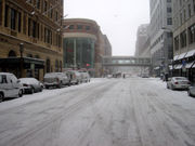
The climate of Minneapolis is typical of cities located in the Midwestern United States. However, due to the city's northerly location, it generally runs on the cold side. Winters are particularly punishing with bitter cold arctic air masses pushing their way south from Canada. Of all the major metropolitan areas in the U.S., the Minneapolis-St.Paul metropolitan area has the coldest annual mean temperature of only 7.5 °C (45.5 °F). There are four distinct seasons, with characteristic large changes in temperatures over a short period of time. Winters are bitterly cold and dry, and summers are warm, sometimes hot, and frequently humid. The city experiences a full range of precipitation and related weather events, including snow, sleet, ice, rain, thunderstorms, and fog.
The highest temperature ever recorded in Minneapolis was 108 °F (42 °C) on July 14, 1936. The coldest temperature ever recorded at the city was -41 °F (-40.6 °C), on January 21, 1888. The snowiest winter of record was the winter of 1983-84, when 98.4 in (2.50 m) of snow fell.
Demographics
Minnesota has historically been a home to Scandinavian and German immigrants. Scandinavians (mostly Norwegians and Swedes) tended to settle in the colder, forested north, and Germans often resided in the relatively warmer rolling hills of the south. Minneapolis sits between these two regions and thus has large populations of people of German and Scandinavian descent. Much of the business and merchant class of early Minneapolis was neither German nor Scandinavian, but British by way of New England Yankee descent.
During the great wave of Eastern European immigration in the 1870s through the early 20th Century, many immigrants from Poland, the Baltic States, and Russia, as well as other people from the region settled in the Northeast neighbourhood. "Nordeast" was until recently very strongly identified with these populations.
Minneapolis also has a large Native American population, one of the largest in the United States. After the Vietnam War, Minneapolis became a destination city for Hmong and Vietnamese refugees. More recently, a large influx of Somali refugees has modified Minneapolis's ethnic makeup. Smaller populations of Laotians, Cambodians, Ethiopians, Mexicans, and others can also be found in the city. One of the largest Tibetan immigrant populations in the United States resides there as well.

The population residing within the city's limits has decreased significantly since its peak of 521,718 in 1950, although the number of people residing in the city has seen a rebound in recent years. The 1990 census recorded a low of 368,383, and the next census saw a small increase from that level. The rebounding growth has largely been due to an increase in the number of non-white residents, as the number of white residents has continued to decline and is now at its lowest level since the very early 20th century when the city had a much smaller total population. Jews, for example, were once a significant presence in the northern part of the city, but they have largely moved out into suburbs such as St. Louis Park, Golden Valley, and Minnetonka. In general, the Twin Cities suburbs have seen massive growth, and the Minneapolis-St. Paul metropolitan area has roughly doubled since 1950 and now has about three million residents.
The downtown region also saw a major decline in population, but managed to retain residents better than many similar cities. The downtown population has been booming in the last decade as new condominiums are completed and warehouses are converted to loft-style housing. The U.S. census recorded 20,201 residents in the city centre in 2000, but an estimate by Maxfield Research just five years later in January 2005 put the number at 29,350, fully recovering from losses in the 1960s and 1970s. Considering the number of new condos in development, the downtown district could reach 40,000 by 2010. Still, the people living downtown are greatly outnumbered by commuters, who bring the daytime population up to about 165,000 each weekday.
While the overall population has declined, the number of inhabited houses has remained comparatively steady (as compared to other rust-belt inner cities where large numbers of houses have been razed). Presumably some of the population loss is due to decreased average density per housing unit.
As of the census ² of 2000, there were 382,618 people, 162,352 households, and 73,870 families residing in the city. The population density was 2,691.4/km² (6,970.3/mi²). There were 168,606 housing units at an average density of 1,186.0/km² (3,071.6/mi²).
| Racial makeup | |
|---|---|
| Ethnicity | Percentage of Minneapolis population |
| White | 65.1% |
| African American | 18.0% |
| Hispanic or Latino of any race | 7.6% |
| Asian | 6.1% |
| from two or more races | 4.4% |
| Native American | 2.29% |
| Pacific Islander | 0.1% |
There were 162,352 households out of which 22.6% had children under the age of 18 living with them, 29.0% were married couples living together, 12.3% had a female householder with no husband present, and 54.5% were non-families. 40.3% of all households were made up of individuals and 8.0% had someone living alone who was 65 years of age or older. The average household size was 2.25 and the average family size was 3.15.
In the city the population was spread out with 22.0% under the age of 18, 14.4% from 18 to 24, 36.6% from 25 to 44, 17.9% from 45 to 64, and 9.1% who were 65 years of age or older. The median age was 31 years. For every 100 females there were 101.0 males. For every 100 females age 18 and over, there were 100.1 males.
The median income for a household in the city was $37,974, and the median income for a family was $48,602. Males had a median income of $35,216 versus $30,663 for females. The per capita income for the city was $22,685. About 11.9% of families and 16.9% of the population were below the poverty line, including 24.5% of those under age 18 and 10.9% of those age 65 or over.
| Population history | ||||||||||||||
|---|---|---|---|---|---|---|---|---|---|---|---|---|---|---|
| 1860 | 1870 | 1880 | 1890 | 1900 | 1910 | 1920 | 1930 | 1940 | 1950 | 1960 | 1970 | 1980 | 1990 | 2000 |
| 3,000 | 13,000 | 46,887 | 164,738 | 202,718 | 301,408 | 380,582 | 464,356 | 492,370 | 521,718 | 482,872 | 434,400 | 370,951 | 368,383 | 382,618 |
Minneapolis neighborhoods
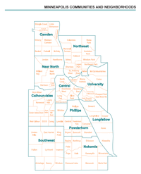
The city is officially divided into several communities, each containing multiple neighborhoods. For example, the area typically referred to by locals as "North Minneapolis" is actually the Near North community, which is composed of the Hawthorne, Jordan, Near-North, and Willard-Hay neighborhoods. The north side has been continually plagued with poverty, crime, and violence. The city government has repeatedly tried to improve this area, but has failed many times.
Most of the neighborhoods in Minneapolis coordinate certain activities under the Neighbourhood Revitalization Program. In some cases, two to four neighborhoods act together under a single neighbourhood organization.
Some areas of the city are more commonly known by locally established nicknames, many of which are predominantly business districts. One such place is Dinkytown (several square blocks of small businesses in the Marcy Holmes neighborhood, although the name is sometimes used informally to refer to the whole Marcy Holmes neighbourhood), near the University. To the southwest of Downtown is Uptown, which is loosely defined as the area around the Uptown Theatre near the intersection of Hennepin Avenue and Lake Street, and features a large number of restaurants, bars, and independently owned businesses. The North Loop is a primarily residential section of the warehouse district extending to the west bank of the Mississippi river that is primarily made up of $1,250 a month apartments and $500,000 lofts.
Crime
The FBI released data as of Tuesday June 13, 2006, Minneapolis had experienced a 15 percent jump from 2004. This increase is six times the 2.5 percent national rise in murders, rapes, robberies and aggravated assaults in 2005, figures disclosed in preliminary data from the FBI's Uniform Crime Report. Violent crime in Minneapolis has increased in every year since 2001.
The 15 percent jump helped Minneapolis be recently ranked by the Morgan Quitno research group as the 23rd most violent city based on 2005 FBI statistics of murders, forcible rapes, robberies, and aggravated assaults. When burglary and motor vehicle theft are included, it is ranked at 27th.
Economy
Minneapolis's economy has been historically based on the adjoining agricultural area, though that has changed as can be seen from the list of Fortune 1000 companies headquarted in the city:
- Target Corp.
- Ameriprise Financial
- U.S. Bancorp
- Xcel Energy
- Thrivent Financial for Lutherans
- PepsiAmericas Inc.
- Bemis Co. Inc.
- The Valspar Corp
Many other major corporations, some with deep roots in the city of Minneapolis (for example General Mills, founded in the Historic Mill District), are based in the suburbs.
Law and government
Minneapolis is a city that is well known for its liberal politics and to this day remains a stronghold for the Democratic Party. For example in 2004 John Kerry won the city by a rather large margin. Minneapolis has an arguably convoluted set of different government entities that oversee actions in the city. The most prominent is the Minneapolis City Council, which holds the most power. The mayor has some power to appoint certain individuals, such as the chief of police, but is otherwise relatively weak and must coordinate with the city council for most other activities. Other groups in the city include the Minneapolis Park and Recreation Board, Minneapolis Public Library's Board of Trustees, the Neighbourhood Revitalization Program, the Public Housing Authority, and the Board of Estimate and Taxation. These councils tend to be semi-independent, and some can levy their own taxes and fees.
There are some efforts currently underway to examine how the city government can be streamlined, though it is hard to say how quickly any changes might come about. A number of the city boards were created by the Minnesota Legislature between the time of the city's founding and 1920 when the city finally gained home rule by passing a new charter (simply an agglomeration of the various laws that had been specifically written for the city at the time).
Mayor
The current mayor of Minneapolis is R.T. Rybak. There have been a number of notable individuals who have held the office. Most are known for their positive influences on the city. Hubert H. Humphrey, who became mayor in 1945, started what may be the first equal employment commission while he was in office. He later went on to serve as US vice president and ran for president in 1968. Arthur Naftalin was the first Jewish mayor, while Sharon Sayles Belton became the first woman and the first African-American to hold the office. The city government has not been immune to corruption, however, and the man who exemplified that was "Doc" Ames. He essentially turned the police force into a group of organized criminals before an investigation forced him out of office more than a century ago.
City council
The Minneapolis City Council is composed of 13 single member districts, called wards. The Democratic-Farmer-Labor Party (DFL) dominates the council, with twelve members, and Barbara Johnson is council president. The Green Party has one member as of 2006.
Minneapolis Public Schools
The school board exists as a separate legal entity from the city as Special School District Number 1, commonly called the Minneapolis Public Schools.
2008 Republican National Convention
Minneapolis, along with St. Paul, will be co-hosts of the 2008 Republican National Convention, to be held from September 1 to September 4, 2008. The main convention activities will be held at the St. Paul Xcel Energy Centre; convention attendees are expected to use up to 25,000 hotel rooms in the Twin Cities Metropolitan Area out of 30,000 total hotel rooms in the area.
Culture
Nomenclature
The city sits along the Mississippi River and also has 24 small lakes in city limits. The abundance of lakes led Charles Hoag, an early settler and Minneapolis's first schoolmaster, to suggest a name derived from minne, the Dakota word for water, and polis, the Greek word for city. Other names considered at the time were Brooklyn and Albion. The early use of "Brooklyn" for the then-village lives on into the 21st century in the names of two suburbs north of Minneapolis, Brooklyn Park and Brooklyn Centre. The city is also known as the "City of Lakes," a phrase that appears on many municipal vehicles and properties. The traditional postal abbreviation for the city's name is Mpls., and much old correspondence can still be found dated from "Mpls., Minn." Once the global centre of the timber milling industry and then later the grain milling industry, Minneapolis is still often known by the appellation Mill City.
Technology
In a 2005 issue of Popular Science the publication determined Minneapolis, MN to be the "Top Tech City" in the United States . Among many factors that determined this ranking, Minneapolis ranked first among U.S. cities in innovative transportation solutions and fourth in energy technology.
| Category | National Average | Minneapolis |
|---|---|---|
| Number of High Tech Companies | 1,260 | 3,939 |
| Percent of Work Force with Advanced Degrees | 9 | 10 |
| Number of Wi-Fi Hotspots | 61 | 110 |
| Percent Deployment of "Intelligent Transportation Solutions" | 34 | 61 |
| Percent of Transit System Accepting Electronic Payment | 44 | 100 |
| Annual Number of Clinical Medical Trials | 206 | 333 |
| Annual University R&D Expenditures | $200M | $462M |
| EPA-Lauded Energy Star Buildings | 4 | 8 |
Arts
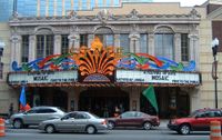
Minneapolis claims to have the highest per capita attendance at theatre and arts events outside of New York City and Chicago. The region is reportedly the third-largest theatre market in the country, attracting major performances. The Guthrie Theatre is the most famous theater in the city. Minneapolis also supports two Tony Award winning theater companies: the Children's Theatre Company and Theatre de la Jeune Lune. In order to help revitalize the downtown and warehouse district areas of Minneapolis, which had declined in the mid to late 20th century, the city purchased and renovated a few theaters on Hennepin Avenue to create the Hennepin Theatre District, including the State, Orpheum, and Pantages venues.
In 2004 with an attendance of 50,197, Minneapolis's Minnesota Fringe Festival was the largest non-juried performing arts festival in the United States and the third largest Fringe festival in North America. In 2005, the Minnesota Fringe ran 11 days, August 4-14 with 44,630 paid tickets. In 2004, 1,100 artists produced over 800 individual performances and events.
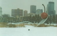
The most extensive museum in the city is the Minneapolis Institute of Arts. Modern art is displayed in the Walker Art Centre. The Walker includes an outdoor sculpture garden with " Spoonbridge and Cherry," which has become a symbol of the city.
The Warehouse District adjoining downtown was a hub of studio and gallery activity in the 1980s, but most artists have been driven out by high rents. Today the Northeast Minneapolis Arts District is the most vibrant visual arts community in the city, though the largest art event (one of the largest in the nation) is the annual Uptown Art Fair.
Numerous festivals are held across the city during the year. Many are small, although others can attract visitors from across the region. Fireworks displays occur several times a year, although the largest is not on July 4th as in most American cities—that is reserved for one night during the official city celebration, the Aquatennial, held in mid-July. The Aquatennial display is reportedly the fourth-largest annual fireworks show in the nation.
Arts education is also strong in the Minneapolis area with schools like the Perpich Centre for Arts Education, an arts-oriented charter high school, in Golden Valley, the Minneapolis College of Art and Design, an arts college adjacent to the Minneapolis Institute of Arts, playing a central role in the city's visual, music and literary scenes, and the Art Institutes International Minnesota, located in downtown Minneapolis on the corner of Hennepin Ave. and 9th Street, is an arts college which focuses more on computer arts, such as graphic design, animation and media graphics, photography, and interactive media design.
Throughout the city are scattered various sculptures and murals.
Minneapolis was home to the " Minneapolis Sound" in pop music in the 1980s. Prince is Minneapolis's most famous musical progeny. Several of his songs include references to the city.
Alternative rock groups such as Hüsker Dü and The Replacements were a force in the 1980s, and Paul Westerberg (of the Replacements) still lives and works in Minneapolis. Popular acts from the 1990s include The Jayhawks, Semisonic and pop group Information Society. In recent years Minneapolis has garnered a significant hip hop community with labels such as Rhymesayers Entertainment and Doomtree. It has also developed a vibrant spoken word community, led by organizations such as the MN Spoken Word Association ( MNSWA), Slam MN, Trú Rúts Endeavors, SASE: The Write Place and others.
It is also interesting to note that one of the most replayed songs of the past fifty years, Funkytown, came out of the Minneapolis scene. It was recorded by the disco group Lipps, Inc. and former Miss Minnesota finalist Cynthia Johnson.
Parks
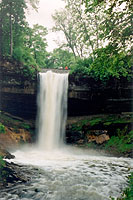
Minneapolis has a large park system consisting of ten square miles (26 km²) of land and water that is interlinked in many places. The Grand Rounds Scenic Byway circles through the city and brings together many of the bigger park areas including land along the Mississippi River, many of the city's lakes, and other scenic areas of the city. The route has a parkway for cars (not a freeway—literally just a roadway through park land, though the number of stops is reduced), a bikeway for riders, and a walkway for pedestrians all running in roughly parallel paths along the 50-mile route. It is the first natural scenic byway totally located in a major urban area . Additional routes in the Minneapolis park system crisscross the city, and the number of bikeways and walkways continues to grow. They also interconnect with neighboring cities. One of the most famous parks in Minneapolis is Minnehaha Park, where Minnehaha Falls is located. A number of cultural heritage events take place there every year. Prospect Park is the home of the 1913 water tower, a Minneapolis icon.
There are several freshwater lakes across the southern part of the city. The most significant grouping is the western " Chain of Lakes" consisting of Lake Harriet, Lake Calhoun, Lake of the Isles, and Cedar Lake. Lake Nokomis and Lake Hiawatha lie farther to the east.
Sports
Professional sports are well-established in Minneapolis, and although the city's teams have not been particularly successful in acquiring championships, all have been lauded at one time or another for their high-caliber play. The city is the origin of one of the most famous basketball teams of all time, the Los Angeles Lakers (formerly the Minneapolis Lakers). It is also the original home of the Minnesota North Stars (now the Dallas Stars).
| Club | Sport | League | Venue | Championships |
|---|---|---|---|---|
| Minnesota Twins | Baseball | Major League Baseball; AL | Metrodome | World Series: 1987, 1991 |
| Minnesota Vikings | American football | National Football League; NFC | Metrodome | |
| Minnesota Timberwolves | Basketball | National Basketball Association; Western Conference | Target Centre | |
| Minnesota Lynx | Basketball | Women's National Basketball Association; Western Conference | Target Centre | |
| Minnesota Wild | Hockey | National Hockey League; Western Conference | Xcel Energy Centre |
The Hennepin County board on May 3, 2006 approved a new ballpark for the Twins in the Warehouse District, across the street from the Target Centre. The NHL team Minnesota Wild plays in Saint Paul. Minneapolis also has a slight bit of infamy in the WWE world as it was the location of the death and subsequent tribute shows of superstar Eddie Guerrero. A number of popular professional wrestlers also hail from Minneapolis.
Transportation
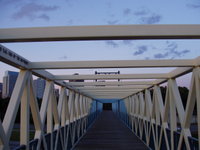
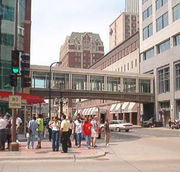
A system of " skyways" (small, fully enclosed pedestrian bridges) link the buildings across more than 60 city blocks of the downtown region, providing a way to travel around the city without being exposed to the wide temperature extremes of the climate. The system is widely used by the daytime worker population and downtown residents, who are able to move around without their coats and other outdoor gear all day long. The street-level foot traffic is greatly reduced (especially as the outdoor temperature dips) and many businesses that would normally be located at ground level in other cities are instead brought up to the second floor. In fact, the interconnected passageways that include restaurants and retailers are sometimes considered as one of the largest shopping centers in the Twin Cities (though most businesses in the skyways close down at night and on the weekend).
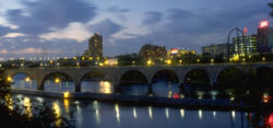
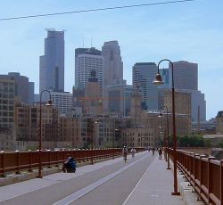
Historically, Minneapolis and St. Paul provided some of the earliest rail passages across the Mississippi River, which widens downriver where the St. Croix River joins the Mississippi. Today, rail traffic through the city is diminished, and some of the old bridges such as the Stone Arch Bridge have been converted for bicycle and pedestrian use. These link into the extensive park and trail system of the city.
Most residents of Minneapolis get around the region by car, and a number of highways snake through the city. Minneapolis and St. Paul are the junction points between Interstate 94 and Interstate 35. I-35 splits into two parts when entering the metro area. The western half, I-35W, goes through downtown Minneapolis. The I-394 spur connects the downtown region to western suburbs. Two spurs from I-94, I-494 and I-694, make a loop around the metro area, but do not pass through the cities of Minneapolis or St. Paul.
Only two U.S. highways pass through the city, but they are unmarked. Interstate 394 is largely an upgraded segment of U.S. Highway 12 which comes into the city from the western and then joins I-94 to follow that road around downtown and into St. Paul. U.S. Highway 52 follows Interstate 94 north of the metro area, so it is considered to follow that all of the way through the city today, though it had originally been routed along surface streets and along University Avenue between Minneapolis and St. Paul.
Minnesota state highways include:
- Minnesota State Highway 47 (Minneapolis to Aitkin) enters the city from the North as University Avenue
- Minnesota State Highway 55 (Tenney to Hastings) passes through outer Minneapolis as Olson Memorial Highway and Hiawatha Avenue (though, since June 2005, it now follows I-94 around downtown).
- Minnesota State Highway 62 (Eden Prairie to Fort Snelling - known as the "Crosstown") runs along the southeastern edge of the city as the Crosstown Highway (west of Chicago Ave and east of Xerxes Ave, the highway is considered as part of Richfield), however, the Richfield-Minneapolis line lies right at the northern edge of the Highway 62 right-of-way during that 3-mile stretch).
- Minnesota State Highway 65 (Minneapolis to Littlefork) follows Central Avenue through Northeast Minneapolis, and until June 2005, it also followed Washington, 4th, and 5th Avenues though downtown Minneapolis. A freeway stub running from I-35W to 10th Avenue is still considered part of Highway 65, creating a gap in the official routing.
- Minnesota State Highway 77 (Apple Valley to Minneapolis) ends as it enters the city from the south as Cedar Avenue.
- Minnesota State Highway 121 (Richfield to Minneapolis) is a spur that connects Interstate 35W with Lyndale Avenue in South Minneapolis.
The city is served by air with the Minneapolis-Saint Paul International Airport, which is at the southeast corner of the city off of Minnesota State Highway 5. The airport is also bordered by Saint Paul, Bloomington, and Richfield. It is a hub and home base for Northwest Airlines as well as for Mesaba Airlines, Sun Country Airlines, and Champion Airlines.
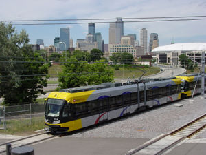
Metro Transit runs most of the area's buses and has begun operation of a light rail system, the Hiawatha Line, which has a daily ridership of 28,800, making it the 14th busiest light rail system in the country. The line opened its first and second phases to the public in 2004, connecting the airport and Bloomington's Mall of America into downtown. A number of other rail projects including new commuter rail lines linking the city to the suburbs are in the planning stages, and the city council has officially begun "explor[ing] the feasibility of bringing back a streetcar system." Some bus rapid transit lines are also likely to be built in the coming years.
Proposed commuter and light rail lines head in several directions from Minneapolis and St. Paul.
- Hiawatha_Line, Minneapolis to the Mall of America
- Northstar Corridor Commuter Line, Minneapolis north to Big Lake, MN.
- Central Corridor, Downtown Minneapolis to St. Paul
- SouthWest Transitway, Minneapolis to St Louis Park, Hopkins, Minnetonka, and Eden Prairie
- Red Rock Corridor, Commuter Rail from Minneapolis southeast to Hastings, through St Paul.
Over the last twenty years, the system of bicycle trails has expanded from a long-standing system of recreational trails, the Grand Rounds, to include a network of on-street bike lanes and an increasing number of commuter trails. Trails include:
- The Midtown Greenway
- The Kenilworth Trail
- The Cedar Lake Trail
- The West River Parkway along the Mississippi.
Free online bicycle maps are provided by the city here.
Minneapolis is one of the most heavily-biked cities in the country, with an average level of 10,000 people riding daily for commuting and recreation (there are significant seasonal variations, but many people bike year-round).
Famous Minneapolitans
|
|
Famous people from the Twin Cities area (near Minneapolis), or in Minneapolis for a brief time
|
Famous music groups from Minneapolis
|
Diplomacy
Canada, Norway, and Ecuador maintain consulates in Minneapolis.
- Consulate General of Canada in Minneapolis
- Royal Norwegian Consulate General in Minneapolis
Sister cities
Minneapolis has eight sister cities:
The city also maintains informal connections with the cities of Hiroshima, Japan and Kampala, Uganda.
