West Virginia
2007 Schools Wikipedia Selection. Related subjects: North American Geography
|
|||||||||||
| Official language(s) | English | ||||||||||
| Capital | Charleston | ||||||||||
| Largest city | Charleston | ||||||||||
| Area | Ranked 41st | ||||||||||
| - Total | 24,244 sq mi (62,809 km²) |
||||||||||
| - Width | 130 miles (210 km) | ||||||||||
| - Length | 240 miles (385 km) | ||||||||||
| - % water | 0.6 | ||||||||||
| - Latitude | 37°10'N to 40°40'N | ||||||||||
| - Longitude | 77°40'W to 82°40'W | ||||||||||
| Population | Ranked 37th | ||||||||||
| - Total ( 2000) | 1,808,344 | ||||||||||
| - Density | 75.1/sq mi 29.0/km² (27th) |
||||||||||
| - Median income | $32,589 (50th) | ||||||||||
| Elevation | |||||||||||
| - Highest point | Spruce Knob 4,863 ft (1,427 m) |
||||||||||
| - Mean | 1,500 ft (460 m) | ||||||||||
| - Lowest point | Potomac River 240 ft (73 m) |
||||||||||
| Admission to Union | June 20, 1863 (35th) | ||||||||||
| Governor | Joe Manchin (D) | ||||||||||
| U.S. Senators | Robert C. Byrd (D) Jay Rockefeller (D) |
||||||||||
| Time zone | Eastern: UTC-5/ -4 | ||||||||||
| Abbreviations | WV US-WV | ||||||||||
| Web site | www.wv.gov | ||||||||||
West Virginia is a state of the United States in the region of Appalachia, also known as The Mountain State. West Virginia broke away from the Commonwealth of Virginia during the American Civil War and was admitted to the Union as a separate state on June 20, 1863 (an anniversary now celebrated as West Virginia Day in the state). It is the only state formed as a direct result of the American Civil War.
The Census Bureau considers West Virginia part of the South because much of the state is below the Mason-Dixon Line, despite its northern panhandle extending as far north as Staten Island, New York. Many citizens of West Virginia claim they are part of Appalachia, rather than the Mid-Atlantic or the South, while the state's Northern Panhandle, and North-Central region, feel an affinity for Pittsburgh, Pennsylvania. Also, those in the Eastern Panhandle feel a connection with the Washington, D.C. suburbs in Maryland and Virginia, and southern West Virginians often consider themselves Southerners. Finally, the towns and farms along the mid- Ohio River have an appearance and culture somewhat resembling the Midwest.
The state is noted for its great natural beauty, its timber and coal mining heritage and labor union organizing, mine wars in particular. It is also well known as a tourist destination for those people interested in outdoor activities such as skiing, whitewater rafting, rock climbing, fishing and hunting.
Geography
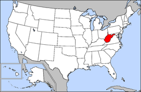
West Virginia is bordered by Pennsylvania to the north; by Ohio to the north and west; by Kentucky to the west; by Maryland to the north and east; and by Virginia to the east and south. The Ohio and Potomac rivers form parts of the boundaries.
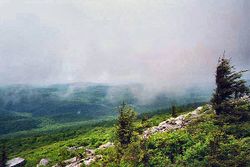
West Virginia is the only state in the nation located entirely within the Appalachian Mountain range, and in which all areas are mountainous; for this reason it is nicknamed The Mountain State. About 75% of the state is within the Cumberland Plateau and Allegheny Plateau regions. Though the relief is not high, the plateau region is extremely rugged in most areas.
On the southeastern state line with Virginia, high peaks in the Monongahela National Forest region give rise to an island of colder climate and ecosystems similar to those of northern New England and eastern Canada. The highest point in the state is atop Spruce Knob, which at 4,863 feet (1,482 m) is covered in a boreal forest of dense spruce trees at altitudes above 4,000 feet (1,220 m). Spruce Knob lies within the Monongahela National Forest and is a part of the Spruce Knob-Seneca Rocks National Recreation Area. A total of six wilderness areas can also be found within the forest. Outside the forest to the south, the New River Gorge is a 1,000 foot (304 m) deep canyon carved by the New River. The National Park Service manages a portion of the gorge and river which has been designated as the New River Gorge National River, one of only 15 rivers in the U.S. with this level of protection. Magic Island is an island (now connected to the mainland) in the Kanawha River near its confluence with the Elk River in Charleston.
Other areas under protection and management include:
|
|
The native vegetation for most of the state was originally mixed hardwood forest of oak, chestnut, maple, beech, and white pine, with willow and American sycamore along the state's waterways. Many of the areas are rich in biodiversity and scenic beauty, a fact that is appreciated by native West Virginians, who refer to their home as Almost Heaven. Ecologically, most of West Virginia falls into the Appalachian mixed mesophytic forests ecoregion.
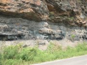
The underlying rock strata are sandstones, shales, bituminous coal beds, and limestones laid down in a near shore environment from sediments derived from mountains to the east, in a shallow inland sea on the west. Some beds illustrate a coastal swamp environment, some river delta, some shallow water. Sea level rose and fell many times during the Mississippian and Pennsylvanian eras, giving a variety of rock strata. The Appalachian Mountains are some of the oldest on earth, having formed over 300 million years ago.
History
Prehistory
The area now known as West Virginia was a favorite hunting ground of numerous Native American peoples before the arrival of European settlers. Many ancient man-made earthen mounds from various mound builder cultures survive, especially in the areas of Moundsville, South Charleston, and Romney. Although little is known about these civilizations, the artifacts uncovered give evidence of a complex, stratified culture that practiced metallurgy.
European exploration and settlement
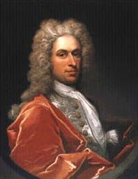
In 1671, General Abram Wood, at the direction of Royal Governor William Berkeley of the Virginia Colony, sent a party which discovered Kanawha Falls. In 1716, Governor Alexander Spotswood with about thirty horsemen made an excursion into what is now Pendleton County. John Van Metre, an Indian trader, penetrated into the northern portion in 1725. The same year, German settlers from Pennsylvania founded New Mecklenburg, the present Shepherdstown, on the Potomac River, and others followed.
King Charles II of England, in 1661, granted to a company of gentlemen the land between the Potomac and Rappahannock rivers, known as the Northern Neck. The grant finally came into the possession of Thomas Fairfax, 6th Lord Fairfax of Cameron, and in 1746, a stone was erected at the source of the North Branch Potomac River to mark the western limit of the grant. A considerable part of this land was surveyed by George Washington between 1748 and 1751. The diary kept by the surveyor indicates that there were already many squatters, largely of German origin, along the South Branch Potomac River. Christopher Gist, a surveyor in the employ of the first Ohio Company, which was composed chiefly of Virginians, explored the country along the Ohio River north of the mouth of the Kanawha River between 1751 and 1752. The company sought to have a fourteenth colony established with the name Vandalia. Many settlers crossed the mountains after 1750, though they were hindered by Native American depredations. Presumably, few Native Americans lived within the present limits of the state, but the region was a common hunting ground, crossed also by many war trails. During the French and Indian War the scattered settlements were almost destroyed.
In 1774, the Crown Governor of Virginia John Murray, 4th Earl of Dunmore, led a force over the mountains, and a body of militia under General Andrew Lewis dealt the Shawnee Indians, under Cornstalk, a crushing blow during the Battle of Point Pleasant at the junction of the Kanawha and the Ohio rivers. Native American attacks continued until after the American Revolutionary War. During the war, the settlers in Western Virginia were generally active Whigs and many served in the Continental Army.
Trans-Allegheny Virginia, 1776-1861
Social conditions in western Virginia were entirely unlike those in the eastern portion of the state. The population was not homogeneous, as a considerable part of the immigration came by way of Pennsylvania and included Germans, Protestant Ulster-Scots, and settlers from the states farther north. During the American Revolution, the movement to create a state beyond the Alleghanies was revived and a petition for the establishment of "Westsylvania" was presented to Congress, on the grounds that the mountains made an almost impassable barrier on the east. The rugged nature of the country made slavery unprofitable, and time only increased the social, political and economic differences between the two sections of Virginia.
The convention which met in 1829 to form a new constitution for Virginia, against the protest of the counties beyond the mountains, required a property qualification for suffrage and gave the slave-holding counties the benefit of three-fifths of their slave population in apportioning the state's representation in the U.S. House of Representatives. As a result, every county beyond the Alleghenies except one voted to reject the constitution, which nevertheless passed because of eastern support. Though the Virginia constitution of 1850 provided for white male suffrage, the distribution of representation among the counties continued to give control to the section east of the Blue Ridge Mountains. Another grievance of the west was the large expenditure for internal improvements at state expense by the Virginia Board of Public Works in the East compared with the scanty proportion allotted to the West.
Separation from Virginia
In 1861, only nine of the forty-six delegates from the area located in present state of West Virginia voted to secede. Almost immediately after the vote to proceed with secession prevailed in the Virginia General Assembly, a mass meeting at Clarksburg recommended that each county in northwestern Virginia send delegates to a convention to meet in Wheeling on May 13, 1861. When this First Wheeling Convention met, 425 delegates from 25 counties were present, but soon there was a division of sentiment. Some delegates favored the immediate formation of a new state, while others argued that, as Virginia's secession had not yet been passed by the required referendum, such action would constitute revolution against the United States. It was decided that if the ordinance was adopted (of which there was little doubt), another convention including the members-elect of the legislature should meet at Wheeling in June. At the election on May 23, 1861, secession was ratified by a large majority in the state as a whole, but in the western counties 40,000 votes out of 44,000 were cast against it. Thus, the Restored Government of Virginia was formed with its capital in Wheeling.
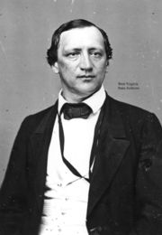
The Second Wheeling Convention met as agreed on June 11 and declared that, since the Secession Convention had been called without the consent of the people, all its acts were void, and that all who adhered to it had vacated their offices. An act for the reorganization of the government was passed on June 19. The next day Francis H. Pierpont was chosen governor of Virginia, other officers were elected and the convention adjourned. The legislature, composed of the members from the western counties who had been elected on May 23 and some of the holdover senators who had been elected in 1859, met at Wheeling on July 1, filled the remainder of the state offices, organized a state government and elected two United States senators who were recognized at Washington, D.C. At that point, therefore, there were two state governments in Virginia, one pledging allegiance to the United States and one to the Confederacy.
The Wheeling Convention, which had taken a recess until August 6, then reassembled on August 20, and called for a popular vote on the formation of a new state and for a convention to frame a constitution if the vote should be favorable. At the election on October 24, 1861, 18,489 votes were cast for the new state and only 781 against. The convention began on November 26, 1861, and finished its work on February 18, 1862, and the instrument was ratified (18,162 for and 514 against) on April 11, 1862.
On May 13, the state legislature of the reorganized government approved the formation of the new state. An application for admission to the Union was made to Congress, and on December 31 1862, an enabling act was approved by President Abraham Lincoln admitting West Virginia, on the condition that a provision for the gradual abolition of slavery be inserted in the Constitution. The Convention was reconvened on February 12, 1863, and the demand was met. The revised constitution was adopted on March 26 1863, and on April 20, 1863, President Lincoln issued a proclamation admitting the state at the end of sixty days ( June 20, 1863). Meanwhile officers for the new state were chosen and Governor Pierpont moved his capital to Alexandria where he asserted jurisdiction over the counties of Virginia within the Federal lines.
The question of the constitutionality of the formation of the new state was brought before the Supreme Court of the United States in the following manner: Berkeley and Jefferson counties lying on the Potomac east of the mountains, in 1863, with the consent of the reorganized government of Virginia voted in favour of annexation to West Virginia. Many voters absent in the Confederate Army when the vote was taken refused to acknowledge the transfer upon their return. The Virginia General Assembly repealed the act of secession and in 1866 brought suit against West Virginia asking the court to declare the counties a part of Virginia. Meanwhile, Congress, on March 10, 1866, passed a joint resolution recognizing the transfer. The Supreme Court, in 1871, decided in favour of West Virginia.
During the American Civil War, West Virginia suffered comparatively little. George B. McClellan's forces gained possession of the greater part of the territory in the summer of 1861, and Union control was never seriously threatened, in spite of the attempt by Robert E. Lee in the same year. In 1863, General John D. Imboden, with 5,000 Confederates, overran a considerable portion of the state. Bands of guerrillas burned and plundered in some sections, and were not entirely suppressed until after the war ended.
The area which became West Virginia furnished about 36,000 soldiers to the Federal armies and somewhat less than 10,000 to the Confederate. The absence in the army of the Confederate sympathizers helps to explain the small vote against the formation of the new state. During the war and for years afterwards partisan feelings ran high. The property of Confederates might be confiscated, and in 1866 a constitutional amendment disfranchising all who had given aid and comfort to the Confederacy was adopted. The addition of the Fourteenth and Fifteenth Amendments to the United States Constitution caused a reaction, the Democratic party secured control in 1870, and in 1871, the constitutional amendment of 1866 was abrogated. The first steps toward this change had been taken, however, by the Republicans in 1870. On August 22, 1872, an entirely new constitution was adopted.
Beginning in Reconstruction, and for several decades thereafter, the two states disputed the new state's share of the pre-war Virginia government's debt, which had mostly been incurred to finance public infrastructure improvements, such as canals, roads, and railroads under the Virginia Board of Public Works. Virginians, led by former Confederate General William Mahone, formed a political coalition which was based upon this theory, the Readjuster Party. Although West Virginia's first constitution provided for the assumption of a part of the Virginia debt, negotiations opened by Virginia in 1870 were fruitless, and in 1871, that state funded two-thirds of the debt and arbitrarily assigned the remainder to West Virginia. The issue was finally settled in 1915, when the United States Supreme Court ruled that West Virginia owed Virginia $12,393,929.50. The final installment of this sum was paid off in 1939.
Demographics
|
|
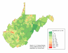
The centre of population of West Virginia is located in Braxton County, in the town of Gassaway .
As of 2005, West Virginia has an estimated population of 1,816,856, which is an increase of 4,308, or 0.2%, from the prior year and an increase of 8,506, or 0.5%, since the year 2000. This includes a natural decrease since the last census of 3,296 people (that is 108,292 births minus 111,588 deaths) and an increase from net migration of 14,209 people into the state. Immigration from outside the United States resulted in a net increase of 3,691 people, and migration within the country produced a net increase of 10,518 people.
| Demographics of West Virginia (csv) | |||||
|---|---|---|---|---|---|
| By race | White | Black | AIAN | Asian | NHPI |
| AIAN is American Indian or Alaskan Native - NHPI is Native Hawaiian or Pacific Islander | |||||
| 2000 (total population) | 96.01% | 3.49% | 0.59% | 0.66% | 0.05% |
| 2000 (Hispanic only) | 0.63% | 0.04% | 0.02% | 0.01% | 0.01% |
| 2005 (total population) | 95.99% | 3.56% | 0.56% | 0.69% | 0.05% |
| 2005 (Hispanic only) | 0.80% | 0.04% | 0.02% | 0.01% | 0.01% |
| Growth 2000-2005 (total population) | 0.46% | 2.49% | -3.96% | 5.57% | -2.80% |
| Growth 2000-2005 (non-Hispanic only) | 0.28% | 2.30% | -4.24% | 5.96% | -0.52% |
| Growth 2000-2005 (Hispanic only) | 27.74% | 21.51% | 5.56% | -20.22% | -16.67% |
Only 1.1% of the state's residents were foreign-born, placing West Virginia last among the 50 states in that statistic. It has the lowest percentage of residents that speak a language other than English in the home (2.7%).
The five largest ancestry groups in West Virginia are: American (23.2%), German (17.2%), Irish (13.5%), English (12%), Italian (4.8%).
Many West Virginians identify their ancestry as "American." It is the largest reported ancestry in most counties in the state, and the state has the highest percentage of residents of "American ancestry" in the nation. This choice often corresponds to Scots-Irish American heritage.
Large numbers of people of German ancestry are present in the northeastern counties of the state.
5.6% of West Virginia's population were reported as under 5, 22.3% under 18, and 15.3% were 65 or older. Females made up approximately 51.4% of the population.
Economy
The economy of West Virginia is one of the most fragile of any U.S. state. According to U.S. Census Bureau data, West Virginia is the third lowest in per capita income , ahead of only Arkansas and Mississippi. It also ranks last in median household income. The proportion of West Virginia's adult population with a bachelor's degree is the lowest in the U.S. at 15.3%.
One of the major resources in West Virginia's economy is coal. West Virginia also engaged in oil drilling, but currently only has a few small to medium sized oil and natural gas fields. Farming is also practiced in West Virginia, but on a limited basis because of the mountainous terrain over much of the state.
West Virginia personal income tax is based on federal adjusted gross income (not taxable income), as modified by specific items in West Virginia law. Citizens are taxed within 5 income brackets, which range from 3.0% to 6.5%. Although the state's consumers' sales tax is levied at 6 cents for $1, 12 cents for $2, 18 cents for $3, and so on, this tax is not a flat 6% applied against the purchase price. Rather, the consumer sales tax is computed on a bracket system.
West Virginia counties administer and collect property taxes, although property tax rates reflect levies for state government, county governments, county boards of education and municipalities. Counties may also impose a hotel occupancy tax on lodging places not located within the city limits of any municipality that levies such a tax. Municipalities may levy license and gross receipts taxes on businesses located within the city limits and a hotel occupancy tax on lodging places in the city. Although the Department of Tax and Revenue plays a major role in the administration of this tax, less than one-half of one percent of the property tax collected goes to state government. The primary beneficiaries of the property tax are county boards of education. Property taxes are paid to the sheriff of each of the state's 55 counties. Each county and municipality can impose its own rates of property taxation within the limits set by the West Virginia Constitution. The West Virginia legislature sets the rate of tax of county boards of education. This rate is used by all county boards of education statewide. However, the total tax rate for county boards of education may differ from county to county because of excess levies. The Department of Tax and Revenue supervises and otherwise assists counties and municipalities in their work of assessment and tax rate determination. The total tax rate is a combination of the tax levies from four state taxing authorities: state, county, schools, and municipal. This total tax rate varies for each of the four classes of property, which consists of personal, real, and intangible properties. Property is assessed according to its use, location, and value as of July 1. All property is reappraised every three years; annual adjustments are made to assessments for property with a change of value. West Virginia does not impose an inheritance tax. Because of the phase-out of the federal estate tax credit, West Virginia's estate tax is not imposed on estates of persons who died in 2005.
Transportation
Highways form the backbone of transportation systems in West Virginia, with over 37,300 miles of public roads in the state. Airports, railroads, and rivers complete the commercial transportation modes for West Virginia. Commercial air travel is facilitated by airports in Charleston, Huntington, Beckley, Lewisburg, Clarksburg, Martinsburg, Morgantown, Wheeling, and Parkersburg. Cities like Charleston, Huntington, Clarksburg, Fairmont, and Logan have bus-based public transit systems. Charleston also has a limited number of trolley cars that run primarily through the downtown area. West Virginia University in Morgantown boasts a PRT (personal rapid transit) system, the state's only single rail public transit system. Developed by Boeing, the WVU School of Engineering and the Department of Transportation, it was a model for low-capacity light transport designed for smaller cities. Recreational transportation opportunities abound in West Virginia, including hiking trails, rail trails, ATV off road trails, white water rafting rivers, and two tourist railroads ( Cass Scenic Railroad, and the Potomac Eagle Scenic Railroad.
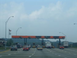
West Virginia is crossed by several interstate highways. I-64 enters the state near White Sulphur Springs in the mountainous east, and exits for Kentucky in the west, near Huntington. I-77 enters from Virginia in the south, near Bluefield. It runs north past Parkersburg before it crosses into Ohio. I-64 and I-77 are merged in a stretch of toll road known as the West Virginia Turnpike, on which construction began in 1952. It runs from just east of Charleston south to the exit for Princeton. I-68's western terminus is in Morgantown. From there it runs east into Maryland. I-79 enters from Pennsylvania and runs through the state to its southern terminus in Charleston. I-70 briefly runs through West Virginia, crossing the northern panhandle through Wheeling. I-81 also briefly runs through the eastern panhandle where it goes through Martinsburg.
Rail lines in the state used to be more prevalent, but many lines have been discontinued because of increased automobile traffic. Many old tracks have been converted to rail trails for recreational use, and the state is still served by a few commercial lines for hauling coal and by Amtrak.
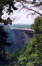
Because of the mountainous nature of the entire state, West Virginia has several notable tunnels and bridges. The most famous of these is the New River Gorge Bridge, which was at a time the longest steel-arch bridge in the world with a 3,031 foot (924 m) span. The bridge is also pictured on the West Virginia state quarter.
Law and government
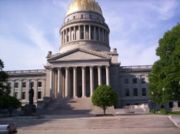
West Virginia's capital and seat of government is the city of Charleston, located in the southwest area of the state.
Legislative Branch
The West Virginia Legislature is bicameral, consisting of the House of Delegates and the Senate. It is a citizen's legislature, meaning that legislative office is not a full-time occupation, but rather a part-time position. Consequently, the legislators often hold a full-time job in their community of residence.
Typically, the legislature is in session for 60 days between January and early April. The final day of the regular session ends in a bewildering fury of last-minute legislation in order to meet a constitutionally imposed deadline of midnight. During the remainder of the year, legislators gather periodically for 'special' sessions when called by the governor.
Executive Branch
The governor, elected every four years on the same day as the U.S. Presidential election, is sworn in during the following January.
Governors of West Virginia can serve two consecutive terms but must sit out a term before serving a third term in office.
Judicial Branch
West Virginia is one of twelve states that does not have a death penalty.
For the purpose of courts of general jurisdiction, the state is divided into 31 judicial circuits. Each circuit is made up of one or more counties. Circuit judges are elected in partisan elections to serve eight-year terms.
West Virginia’s highest court is the Supreme Court of Appeals. The Supreme Court of Appeals of West Virginia is the busiest appellate court of its type in the United States. West Virginia is one of 11 states with a single appellate court. The state constitution allows for the creation of an intermediate court of appeals, but the Legislature has never created one. The Supreme Court is made up of five justices, elected in partisan elections to 12-year terms.
West Virginia is an alcoholic beverage control state. However, unlike most such states, it does not operate retail outlets, having exited that business in 1990. It retains a monopoly on wholesaling of distilled spirits only.
Politics
West Virginia's politics are largely dominated by the Democratic Party, Democrats dominate most local and state offices. West Virginia also has a very strong tradition of union membership. While the state continued its Democratic tradition by supporting Bill Clinton by large margins in 1992 and 1996, a majority of West Virginia voters supported George W. Bush in 2000 and 2004. Bush easily won the state's five electoral votes in 2004 by a margin of 13 percentage points with 56.1% of the vote.
The most consistent support for Democrats is found in the coal fields of southern West Virginia (especially McDowell, Mingo, Logan, Wyoming, and Boone Counties), while Republicans are most numerous to the east of the Allegheny Mountains, especially in the state's Eastern Panhandle and Potomac Highlands.
Important cities and towns
Large cities (+ 10,000 population)
|
|
Towns and small cities
|
|
|
|
|
Metropolitan Statistical Areas
|
|
Micropolitan Statistical Areas
|
|
Education
Colleges and universities
|
|
Professional sports teams
| Club | Sport | League |
|---|---|---|
| Bluefield Orioles | Baseball | Appalachian League |
| Princeton Devil Rays | Baseball | Appalachian League |
| West Virginia Power | Baseball | South Atlantic League |
| Wheeling Nailers | Ice hockey | ECHL |
| West Virginia Wild | Basketball | International Basketball League |
| Huntington Heroes | Indoor football | World Indoor Football League |
| Ohio Valley Greyhounds | Indoor football | United Indoor Football |
| West Virginia Chaos | Soccer | USL Premier Development League |


