Issyk Kul
2007 Schools Wikipedia Selection. Related subjects: General Geography
| Lake Issyk-Kul, Kyrgyzstan | |
|---|---|
|
|
|
| Coordinates | |
| Lake type | Endorheic Mountain lake Monomitic |
| Primary sources | Glaciers Ču River |
| Primary outflows | Evaporation |
| Catchment area | 15,844 km² |
| Basin countries | Kyrgyzstan |
| Max-length | 182 km |
| Max-width | 60 km |
| Surface area | 6,236 km² |
| Average depth | 270 m |
| Max-depth | 668 m |
| Water volume | 1,738 km³ |
| Shore length1 | 688 km |
| Surface elevation | 1,606 m |
| Settlements | Cholpon-Ata |
| 1 Shore length is an imprecise measure which may not be standardized for this article. | |
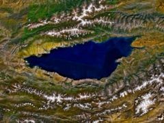
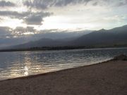
Issyk Kul (also Ysyk Köl, Issyk-kol) is an endorheic lake in the northern Tian Shan mountains in eastern Kyrgyzstan. Although it is surrounded by snow-capped peaks, it never freezes, hence its name, which means "warm lake" in the Kyrgyz language. It has a length of 182 km, a width of up to 60 km, and covers an area of 6,236 km². This makes it the second largest mountain lake in the world behind Lake Titicaca. Located at an altitude of 1,606 m, it reaches 668 m in depth. It is fed by springs, including many hot springs, and snow melt-off, and it has no current outlet. Its southern shore is dominated by the ruggedly beautiful Tian Shan mountain range. The lake is slightly saline and its level drops by approximately 5 cm per year.
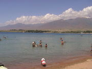
During the Soviet era, the lake became a popular vacation resort, with numerous sanatoria, boarding houses and vacation homes along its northern shore, many concentrated in and around the town of Cholpon-Ata. These fell on hard times after the break-up of the USSR, but now hotel complexes are being refurbished and simple private bed-and-breakfast pensions are being established for a new generation of health and leisure visitors.
The city of Karakol (formerly Przhevalsk, after the Russian explorer Przhevalsky who died there) is the administrative seat of Issyk-Kul oblast or province. It is located near the eastern tip of the lake and is a good base for excursions into the surrounding area. Its small old core contains an impressive wooden mosque, built witout metal nails by the Uighur people, and a wooden Orthodox church that was used as a stable during Soviet times.
A 14th century Armenian monastery was found on the northeastern shores of the lake by retracing the steps of a medieval map used by Venetian merchants on the Silk Road.
Sevan trout, a fish endemic to Lake Sevan in Armenia, was introduced into Issyk-Kul in the 1970s. While this fish is an endangered species in its "home" lake, it has a much better chance to survive in Lake Issyk-Kul where it has ravaged the indigenous species.
The Legend of its Creation
In Islamic legend, the king of the Ossounes had ass's ears. He would hide them, and order each of his barbers killed to hide his secret. One barber yelled the secret into a well, but he didn't cover the well after. The well water rose and flooded the kingdom. The kingdom is today under the waters of Issyk-Kul. This is how the lake was formed, so legend says. Other legends say that four drowned cities lie at the bottom of the lake; in fact, substantial archaeological finds have been made in shallow waters of the lake.
Russian Navy test site
There is a long-established Soviet, now Russian, test site located at the lake, where submarine and torpedo technology was evaluated.


