Benin
2007 Schools Wikipedia Selection. Related subjects: African Countries; Countries
| République du Bémmin Republic of Benin |
|||||
|
|||||
| Motto: Fraternité, Justice, Travail (French) "Fellowship, Justice, Labour" |
|||||
| Anthem: L'Aube Nouvelle (French) "The Dawn of a New Day" |
|||||
| Capital | Porto Novo1 |
||||
|---|---|---|---|---|---|
| Largest city | Cotonou | ||||
| Official languages | French | ||||
| Government | Multiparty democracy | ||||
| - President | Yayi Boni | ||||
| Independence | from France | ||||
| - Date | August 1, 1960 | ||||
| Area | |||||
| - Total | 112,622 km² ( 101st) 43,483 sq mi |
||||
| - Water (%) | 1.8 | ||||
| Population | |||||
| - July 2005 estimate | 8,439,0002 ( 89th) | ||||
| - 2002 census | 6,769,914 | ||||
| - Density | 75/km² ( 118th3) 194/sq mi |
||||
| GDP ( PPP) | 2005 estimate | ||||
| - Total | $8.75 billion ( 140th) | ||||
| - Per capita | $1,176 ( 165th) | ||||
| HDI (2004) | |||||
| Currency | CFA franc ( XOF) |
||||
| Time zone | WAT ( UTC+1) | ||||
| - Summer ( DST) | not observed ( UTC+1) | ||||
| Internet TLD | .bj | ||||
| Calling code | +229 | ||||
| 1 Cotonou is the seat of government. 2 Estimates for this country explicitly take into account the effects of excess mortality due to AIDS; this can result in lower life expectancy, higher infant mortality and death rates, lower population and growth rates, and changes in the distribution of population by age and sex than would otherwise be expected. 3 Rank based on 2005 estimate. |
|||||
- Not to be confused with the Kingdom of Benin, now the Benin region of Nigeria, or Benin City in that region.
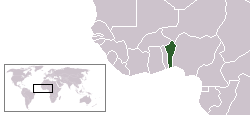
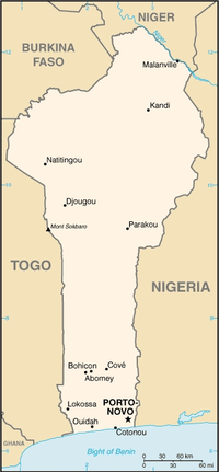
Benin, officially the Republic of Benin, is a country in Western Africa, formerly known as Dahomey (until 1975) or Dahomania. It borders Togo to the west, Nigeria to the east and Burkina Faso and Niger to the north; its short coastline to the south leads to the Bight of Benin. Its capital is Porto Novo, but the seat of government is Cotonou.
Name
The name Benin has no proper connection to Kingdom of Benin (or Benin City). The name Dahomey was changed in 1975 to The Republic of Benin, named after the body of water on which the country lies, the Bight of Benin. This name was picked due to its neutrality, since the current political boundries of Benin encompass over 50 distinct linguistic groups and nearly as many individual ethnic groups. The name Dahomey was the name of the ancient Fon Kingdom, and was determined to be an inappropriate name for such a culturally diverse modern country.
History
The African kingdom of Dahomey was formed by a mixture of various local ethnic groups on the Abomey plain. Historian IA Akinjogbin theorized that the insecurity caused by the slave trade may have contributed to mass migrations of different groups, including a segment of the royal family of the city of Allada, to Abomey. These groups coalesced around a strict military culture aimed at securing and eventually expanding the borders of the small kingdom.
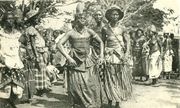
Dahomey was known for its distinct culture and traditions. Boys were often apprenticed to older soldiers at a young age, and learned about the kingdom's military customs until they were old enough to join the army. Dahomey was also famous for instituing an elite female soldier corps, called "Ahosi" or "our mothers" in the Fongbe language, but better known as the Dahomean Amazons in English. This emphasis on military preparation and achievement earned Dahomey the nickname of "little black Sparta" from European observers and commentators like Sir Richard Burton. Human sacrifice was a common practice, according to contemporary sources; on holidays and special occasions, thousands of slaves and prisoners of war were beheaded in public. Some Dahomean religious beliefs maintained that decapitation enhanced the prestige and potency of the Dahomean throne and its warriors.
Though the founders of Dahomey appear to have initially been against it, the slave trade was active in the region of Dahomey for almost three hundred years, leading to the area being named "the Slave Coast". The demands of court procedures, which demanded that a portion of war captives from the kingdom's many battles be decapitated, led to a decrease in the amount of enslaved people exported from the area. The number went from 20,000 at the end of the seventeenth century to 12,000 in the beginning of the 1800's. The decline is partly due to many colonial countries declaring slave trade illegal. This decline continued until 1885, when the last Portuguese trade vessel with slaves departed from the coast of present day Benin.
Along with the powerful Dahomean kingdom, a range of other nations inhabited the area that would become the Republic of Benin. Of note were the Ketu, Icha, Dassa, Anago, and other sub-groups of the Yoruba-speaking people. These groups were in close contact with related sub-groups in present-day Nigeria, and were often enemies of the Dahomeans. However, some were also citizens of Dahomey and in regions like present-day Porto Novo, both groups were intermarried.
North of these people were the Borgu, Mahi, and several other ethnic groups that form the country's present population.
By the middle of the 19th century, Dahomey started to lose its status as the regional power, enabling the French to take over the area in 1892. In 1899, the land became part of the French West Africa colony, still as Dahomey. In 1958, it was granted autonomy as the Republic of Dahomey, and full independence started on August 1, 1960.
For the next 12 years, ethnic strife contributed to a period of turbulence. There were several coups and regime changes, with three main figures dominating - Sourou Apithy, Hubert Maga, and Justin Ahomadegbé - each of them representing a different area of the country. These three agreed to form a presidential council after violence had marred the 1970 elections. In 1972, a military coup led by Mathieu Kérékou overthrew the council. He established a Marxist government under the control of Military Council of the Revolution (CNR), and the country was renamed to the People's Republic of Benin in 1975. In 1979, the CNR was dissolved and elections took place. By the late 1980s, Kérékou abandoned Marxism after an economic crisis and decided to re-establish a parliamentary capitalist system. He was defeated in 1991 elections by Nicéphore Soglo, becoming the first black African president to step down after an election. He returned to power after winning the 1996 vote. In 2001, a closely fought election resulted in Kérékou winning another term. His opponents claimed there were some election irregularities.
President Kérékou and former President Soglo did not run in the 2006 elections, both being barred by the constitution of Benin from running again due to their age and President Kérékou's two recent terms as president. President Kérékou is widely praised for making no effort to change the constitution so that he could remain in office or run again, unlike some African leaders. An election, considered free and fair, was held on March 5, 2006, and resulted in a runoff between Yayi Boni and Adrien Houngbédji. The runoff election was held on March 19 and was won by Yayi Boni, who assumed office on April 6. The success of the fair multiparty elections in Benin won high praise, and Benin is widely considered a model democracy in Africa.
Politics
Politics of Benin takes place in a framework of a presidential representative democratic republic, whereby the President of Benin is both head of state and head of government, and of a pluriform multi-party system. Executive power is exercised by the government. Legislative power is vested in both the government and the legislature. The Judiciary is independent of the executive and the legislature. The current political system is derived from the 1990 Constitution of Benin and the subsequent transition to democracy in 1991.
Administrative divisions
For decades Benin was divided into six departments or provinces, each of which was split in two in 1999. The provinces are divided into 77 communes.
The twelve provinces of Benin are:
- Alibori (from north Borgou)
- Atakora
- Atlantique
- Borgou
- Collines (from north Zou)
- Donga (from south Atakora)
- Kouffo (from north Mono)
- Littoral (the region of Cotonou, split from Atlantique)
- Mono
- Ouémé
- Plateau (from north Ouémé)
- Zou
Geography
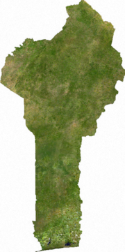
Stretched between the Niger River in the north and the Bight of Benin in the south, Benin's elevation is about the same for the entire country. Most of the population lives in the southern coastal plains, where Benin's largest cities are also located, including Porto Novo and Cotonou. The north of the country consists mostly of savanna and semi-arid highlands.
The climate in Benin is hot and humid with relatively little rain compared to other West African countries, although there are two rainy seasons (April-July and September-November). In the winter the dust winds of the harmattan can make the nights rather cold.
The largest city and commercial capital is Cotonou. The name Cotonou is from the Fon phrase ku tɔ nu 'at the lake of the dead', from the adjacent lagoon. This is a reference to the belief that falling stars represent the souls of those who have just died falling to the underworld. It is said that when Cotonou was founded, the lights of the lacustrine village of Ganvié across the lagoon were reflected in the waters, suggesting fallen stars at the bottom. Ganvié is a fishing village sitting in the water on stilts at the western shore of the lagoon.
The town of Ouidah is the spiritual capital of vodun, and is known locally as glexwe. It was a major slaving port under Portuguese occupation. The town of Abomey is the old capital of the Fon kingdom of Dahomey, and the Fon king continues to reside there.
In Atakora province, Betamaribe settlements straddling the Togolese border are called tata somba 'Somba houses'; they are famous for their fortifications, with livestock housed inside and the people sleeping in huts among the granaries on the roofs.
Economy
The economy of Benin remains underdeveloped and dependent on subsistence agriculture, cotton production, and regional trade. Growth in real output has averaged a stable 5% in the past six years, but rapid population rise has offset much of this increase. Inflation has subsided over the past several years. In order to raise growth still further, Benin plans to attract more foreign investment, place more emphasis on tourism, facilitate the development of new food processing systems and agricultural products, and encourage new information and communication technology. The 2001 privatization policy should continue in telecommunications, water, electricity, and agriculture in spite of initial government reluctance. The Paris Club and bilateral creditors have eased the external debt situation, while pressing for speeded-up structural reforms.
Demographics
There are several dozen ethnolinguistic groups in Benin, representing three of Africa's language families: Niger-Congo, Nilo-Saharan, and Afroasiatic. The later is represented by Hausa living mostly as merchants in the north, while Nilo-Saharan is represented by the Dɛndi, descending from the Songhai Empire. The Dɛndi language predominates along the Niger River in the far north, and is used as a lingua franca in Muslim areas throughout the north, in Alibori, Borgou, and Donga provinces. Of the Niger-Congo family, five branches are represented:
- Mande by the Boko or Busa, now in the far eastern corner (southern Alibori-northern Borgou), but previously more widely spread before being largely absorbed by the Bariba
- West Atlantic by the nomadic Fulbe scattered across the northeast
- Benue-Congo by the Yoruba of Collines and Plateau provinces, such as the old kingdom of Sakete, and the capital city of Porto-Novo, having expanded west from Ɔyɔ and Ifɛ in the 12th to 19th centuries
- Gur (Voltaic) languages predominate in the four northern provinces, with the Batɔmbu (Bariba) of the old Borgou (Bariba) Kingdom occupying most of the countryside in its successor provinces of Borgou and Alibori, as well as the provincial captital of Parakou; the Yom throughout much of Donga province and its capital Djougou; and several groups in the Atakora, including the Bɛtamaribɛ of the Otammari country around the provincial capital of Natitingou, the Biali, the Waama of Tanguiéta, and the Gulmàceba.
- Kwa, especially the Gbe languages spoken by the Tado peoples in the southern and central provinces: the Aja who established themselves in Kouffo province from neighboring Togo and gave rise to the other Tado peoples of Benin, except for the Mina of Mono province, who arrived separately from Togo or Ghana: The Fɔn culture centered in Zou province around the old Fɔn capital of Abomey, but also dominant in Cotonou and southern Atlantique areas such as Ouidah; the Maxi in central Collines, especially around Savalou; the Ayizɔ of central Atlantique ( Allada); the Xwla and Xueda in the lagoons of the coast; the Tɔfin of Ouémé; and the Gun of Porto-Novo. Other Kwa languages are spoken by the Anii in southern Donga in the region of Bassila, and the Fooɖo in western Donga near the town of Ouaké.
Numerically, the most important people are the Fon, with 1.7 million speakers of the Fon language (2001), followed by the various Yoruba groups (1.2 million), the Aja (600,000), the Bariba (460,000), the Ayizo (330,000), the Fulbe (310,000), and the Gun (240,000). Near the ports in the south can be found people of lighter skin who are descended from returned Brazilian slaves. There are also small numbers of Europeans, principly French, and Asians, principly Lebanon and Indians.
Indigenous religions are followed by a majority of the people and include local animistic religions in the Atakora (Atakora and Donga provinces), and Vodun among the Yoruba and Tado peoples of the centre and south of the country. The town of Ouidah on the central coast is the spiritual centre of Beninese vodun.
The Yoruba and Tado pantheons correspond closely:
- The supreme deity Mawu (in the Fon language) or Olodumare (in Yoruba)
- The god of the earth and smallpox, Sakpata or Cankpana
- The god of thunder, Xevioso or Cango
- The god of war and iron, Gu or Ogun
The principal introduced religions are Islam, introduced by the Songhai Empire and Hausa merchants, and now followed throughout Alibori, Borgou, and Donga provinces, as well as among the Yoruba, by 10-15% of the population; and Christianity, followed nominally by another 10-15% throughout the south and centre of Benin and in Otammari country in the Atakora. Most Christians, however, continue to hold Vodun beliefs and have incorporated the Christian pantheon into the Vodun.
Culture
It is believed that Vodun (or "Voodoo", as it is commonly known) originated in Benin and was introduced to Brazil, the Caribbean Islands, and parts of North America by slaves taken from this particular area of the Slave Coast. The indigenous religion of Benin is practiced by about 60% of the population. Since 1992 Vodun has been recognized as one of Benin's official religions, and a National Vodun Holiday is celebrated on January 10.
Many Beninese in the south of the country have Akan-based names indicating the day of the week they were born on. Twins are important in south Beninese culture, and special names for twins are also used.
Local languages are used as the languages of instruction in elementary schools, with French only introduced after several years. Beninese languages are generally transcribed with a separate letter for each speech sound ( phoneme), rather than using diacritics as in French or digraphs as in English. This includes Beninese Yoruba, which in Nigeria is written with both diacritics and digraphs. For instance, the mid vowels written é è, ô, o in French are written e, ɛ, o, ɔ in Beninese languages, whereas the consonants written ng and sh or ch in English are written ŋ and c. However, digraphs are used for nasal vowels and the labial-velar consonants kp and gb, as in the name of the Fon language Fon gbe /fõ ɡ͡be/, and diacritics are used as tone marks. In French-language publications, a mixture of French and Beninese orthographies may be seen.


