Image:Miss R dam 27.jpg
From Wikipedia, the free encyclopedia
- Image
- File history
- File links
No higher resolution available.
Miss_R_dam_27.jpg (771 × 394 pixel, file size: 35 KB, MIME type: image/jpeg)
|
|
This is a file from the Wikimedia Commons. The description on its description page there is shown below. |
|
|
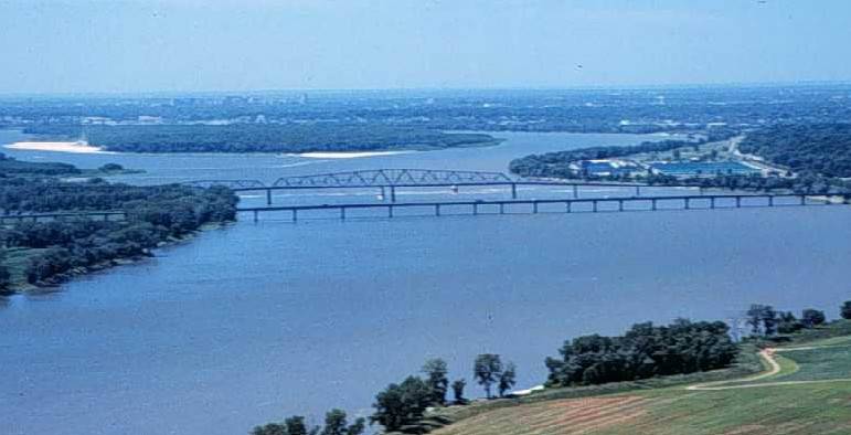
The Mississippi River, looking south toward the city of St. Louis from near the confluence with the Missouri River; showing the Interstate 270 Bridge, the old Chain of Rocks Bridge (which once carried Route 66), city water intake towers, a low water dam (dam 27) and the St. Louis waterworks.
The Chain of Rocks Canal bypasses this section of the river. There are no dams on the river between dam 26 and the Gulf of Mexico.
This photograph was obtained from U.S. Geological Survey's Upper Midwest Environmental Sciences Centre website.
 |
This image is in the public domain because it contains materials that originally came from the United States Geological Survey, an agency of the United States Department of Interior. For more information, see the official USGS copyright policy |
|
File links
The following pages on the English Wikipedia link to this file (pages on other projects are not listed):