Image:GuineaMap.png
From Wikipedia, the free encyclopedia
No higher resolution available.
GuineaMap.png (330 × 355 pixel, file size: 11 KB, MIME type: image/png)
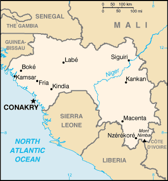
Map of Guinea
Adapted from PCL map collection

This image is a work of a Central Intelligence Agency employee, taken or made during the course of an employee's official duties. As works of the U.S. federal government, all images created or made by the CIA are in the public domain.
Subject to disclaimers.
File history
Legend: (cur) = this is the current file, (del) = delete this old version, (rev) = revert to this old version.
Click on date to download the file or see the image uploaded on that date.
- (del) (cur) 17:14, 20 August 2003 . . Pascal ( Talk | contribs) . . 330×355 (10,858 bytes) (Map Of Guinea from http://www.lib.utexas.edu/maps/cia02/guinea_sm02.gif (replaced old file because of colour))
- (del) (rev) 04:27, 11 July 2003 . . Hephaestos ( Talk | contribs) . . 326×351 (18,895 bytes) (Map of Guinea)
-
Edit this file using an external application
See the setup instructions for more information.
File links
The following pages on the English Wikipedia link to this file (pages on other projects are not listed):
- Guinea
- List of cities in Guinea
Category: Central Intelligence Agency images