Image:Surface analysis.gif
From Wikipedia, the free encyclopedia
- Image
- File history
- File links
No higher resolution available.
Surface_analysis.gif (640 × 480 pixel, file size: 26 KB, MIME type: image/gif)
|
|
This is a file from the Wikimedia Commons. The description on its description page there is shown below. |
|
|
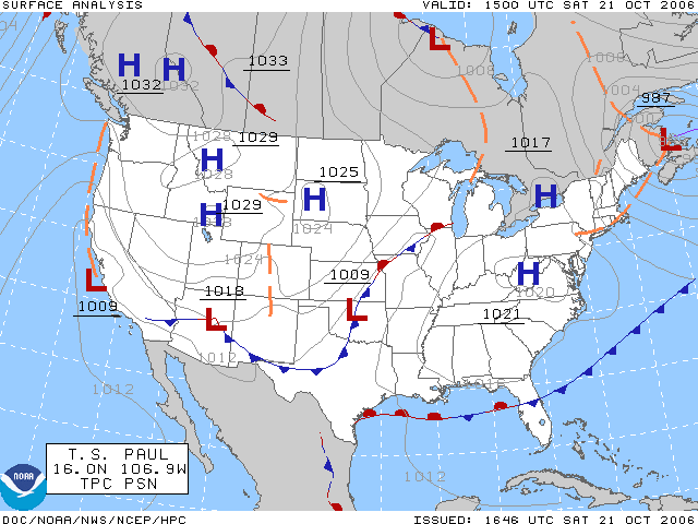
The surface analysis for the United States on October 21, 2006. Plotted by the HPC.
Source Website: Aviation Digital Data Service (ADDS)
Licencing
 |
This image is in the public domain because it contains materials that originally came from the U.S. National Oceanic and Atmospheric Administration. |
 |
File links
The following pages on the English Wikipedia link to this file (pages on other projects are not listed):
- Geography of Bermuda
- Surface weather analysis
- Weather map
- Web mapping