Nathu La
2007 Schools Wikipedia Selection. Related subjects: Geography of Asia
| Nathu La | |
| State - District(s) |
Sikkim - East Sikkim |
| Coordinates | |
| Area - Elevation |
0.1 km² - 4,310 m |
| Time zone | IST ( UTC+5:30) |
| Population ( 2001) - Density |
0† - 0/km² |
| † No permanent native population. Indian and Chinese army personnel at checkposts are the only inhabitants. | |
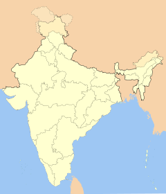
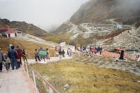
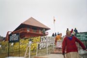
Nathu La Pass listen ( Nepali: नाथू ला, IAST: Nāth Lā; Tibetan: རྣ་ཐོས་ལ་; Wylie: Rna thos la; Chinese: 乃堆拉山口; pinyin: Nǎiduīlā Shānkǒu), also spelled Ntula, Natu La, Nathula, or Natula, is a mountain pass on the Indo-China border connecting the Indian state of Sikkim with Yadong County on the southern border of Tibet. The pass, at 4,310 m (14,200 feet) above mean sea level, forms part of an offshoot of the ancient Silk Road. The name Nathu literally means "listening ears", and La means "Pass" in Tibetan.
Geography
The pass is 56 kilometres (35 mi) east of the Sikkimese capital, Gangtok, and 430 km (270 mi) from the Tibetan capital, Lhasa. Although just 5 km (3 mi) north of the all-weather Jelepla pass, the Nathula pass is blocked by snow in winters as it receives heavy snowfall. Temperatures in Nathula regularly dip below −25 °C (−13 °F) in winters.
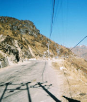
The road leading to Nathula from Gangtok is scenic, with the vegetation graduating from sub-tropical forests to temperate to wet and dry alpine to cold tundra desert devoid of vegetation. Yaks are found in these parts, and in many hamlets they serve as beasts of burden. On the Chinese side the pass leads to the Chumbi Valley of the Tibetan Plateau.
The pass is India's third border post for trade with China after Shipkila in Himachal Pradesh and Lipulekh (or Lipulech) in Uttaranchal.
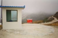
Visitors to the Indian side of Nathula must obtain permits one day in advance in Gangtok. Non-Indian residents are barred from visiting the pass. The pass is open to Indian nationals on Wednesdays, Thursdays, Saturdays and Sundays. On other days it is used for military purposes. The border consists of a simple barbed wire fence without a no man's land. Every Thursday and Sunday, international mail is exchanged between the two nations, a tradition dating back many decades. It is one of the world's highest navigable roads. It is maintained by the Border Roads Organisation, a wing of the Indian Army.
History
Nathula is located on the 563 km long Old Silk Route (an offshoot of the historic Silk Road) since ancient times, connecting Lhasa in Tibet with the Bengal plains to the south. In 1815, trade picked up in volume as the British annexed territories belonging to the Sikkimese, Nepalese and Bhutanese. The potential of Nathula was realised in 1873, after the Darjeeling Deputy Commissioner published a report on the strategic importance of mountain passes between Sikkim and Tibet. In December 1893, the Sikkimese monarchy and Tibetan rulers signed an agreement allowing trade to flourish between the two nations.
In September 1904, a convention signed by the British and Tibetans facilitated the setting up of trading posts at Gyantse and Gartok (in Tibet) and ceded control of the Chumbi Valley to the British. However the treaty took place in the absence of the 13th Dalai Lama, Thubten Gyatso who had fled to Urga in Mongolia after a military expedition led over the Jelepla Pass by British explorer Francis Younghusband to enforce the treaty. Later in November that year, China and Great Britain inked an agreement approving trade between Sikkim and Tibet. During the 2,500th Birth Anniversary celebration of Gautam Buddha in November 1956, Dalai Lama used this pass to travel to India, and returned back to China from it in February 1957.
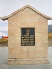
On 1 September 1958, Jawaharlal Nehru, Indira Gandhi (his daughter), and Palden Thondup Namgyal (son and adviser for internal affairs for Tashi Namgyal, the Chogyal of Sikkim) used this pass for going to Bhutan. After the People's Republic of China took control of Tibet in 1950 and suppressed a Tibetan uprising in 1959, the passes into Sikkim became a conduit for refugees from Tibet. During the 1962 Sino-Indian War, the pass witnessed skirmishes between soldiers of the two countries. Though Sikkim was at that time an independent monarchy, it had allowed Indian troops to man its borders. Shortly thereafter the passage was closed and remained closed for more than four decades.
In 1988, India's then Prime Minister Rajiv Gandhi visited Beijing where he recognised China's suzerainty over Tibet. In 1992, Jyoti Basu, then Chief Minister of West Bengal initiated a campaign to reopen the Lhasa- Kalimpong route which ran through Jelepla but nothing constructive materialised. The following year, Prime Minister P. V. Narasimha Rao's visit to China led to further talks on the opening of the pass.
In 2003, with the thawing of Sino-Indian relations, Indian Prime Minister Atal Bihari Vajpayee's visit to China led to the resumption of talks on opening the border. Later in 2004, the Indian Defence Minister's visit to China led to the formal opening of the pass. In the years before the re-opening, the only person permitted to cross the barbed-wire frontier, with an Indian military escort, was a Chinese postman who would hand over the mail to his Indian counterpart in a building at the border. The opening resulted in removing of the barbed wire fence between India and China, which was replaced by a 10-meter wide, stone walled passageway. Though originally scheduled for 2 October 2005, the re-opening was postponed due to last-minute infrastructure problems on the Chinese side. The re-opening, which occurred on July 6, 2006, formally recognises Tibet as part of China by India and Sikkim's accession to India in 1975. The date, incidentally, is the birthday of the reigning Dalai Lama, Tenzin Gyatso, and is widely seen as a snub to the International Tibet Independence Movement. It was also decided to mark the 2006 as the year of Sino-Indian friendship. barbed wire fence that had separated the two neighbors for the past 44 years and in its place is now a 10-meter wide, stone walled passageway waiting for merchants from both sides to go through.
The opening of the pass was marked by a ceremony on the Indian side attended by officials from both sides, including Sikkim Chief Minister Pawan Kumar Chamling (the chief guest), the Chinese ambassador to India, and the Tibetan Autonomous Region Chairman, Champa Phuntsok. Delegation of 100 traders from India and 100 Tibetans crossed the border to the respective trading towns. Despite heavy rain and chilly winds, the ceremony was marked with the attendance of many officials, locals, and international and local media.
Economy
Up to 1962, when the pass was sealed, goods such as pens, watches, cereals, cotton cloth, edible oils, soaps, building materials, and dismantled scooters and four-wheelers were exported to Tibet on mule-back. Two hundred mules, each carrying about 80 kg (175 lb) of load used to ferry goods from Gangtok to Lhasa which used to take 20–25 days. Upon return, silk, raw wool, musk pods, medicinal plants, country liquor, precious stones, gold and silverware were imported to India.
The opening is expected to stimulate the economy of the region, and also bolster Indo-Chinese trade, which amounted to $7 billion in 2004. India hopes that the trade volumes between the two nations will grow to Rs. 206 crore (44.6 million US$) by 2007, and Rs. 12,203 crore (2.6 billion US$) by 2015. Trade marts have been constructed at Sherathang in Sikkim (six kilometres from Nathula) and Rinqingang in Tibet (ten kilometres from Nathula) for the purposes of customs and checking. The trading season starts from 1 June and continues till 30 September, when snowfalls and extreme weather make the pass unusable for civilian purposes. A total of 100 traders and 60 trucks carrying goods are allowed to operate from either side of the border. It is estimated that Indo-China trade would increase by nearly 15~20% over two years of opening of the pass.
Before the pass was closed, nearly 95% of the 200 firms that operated from the Indian side were owned by the Marwari community. For the first five years, permits will only be given to those who were Sikkimese citizens before the kingdom merged with India in 1975. The products to be exported by India are agricultural implements, blankets, copper products, clothes, cycles, coffee, tea, barley, rice, flour, dry fruits, vegetables, vegetable oil, molasses and candy, tobacco, snuff, spices, shoes, kerosene oil, stationery, utensils, wheat, liquor, milk processed product, canned food, cigarettes, local herb, palm oil and hardware. Chinese exports to India will be goat skin, sheep skin, wool, raw silk, yak tail, yak hair, china clay, borax, butter, common salt, horses, goats and sheep. Trading will be open only Mondays through Thursdays from 7:30 a.m. to 3:30 p.m.
India hopes to capitalise on tourism in the region, including Buddhist pilgrims visiting monasteries in Sikkim such as Rumtek, one of the holiest shrines in Buddhism. It also offers the Chinese access to the port of Kolkata (Calcutta), situated about 1,100 km (700 mi) from Lhasa, for transshipments to and from Tibet. The move is also expected to be beneficial to Bangladesh, Bhutan and Nepal. The pass would reduce the journey time to Mansarovar lake from 15 days to two days.
On the Tibetan side, currently most of the foreign trade of Tibet goes through the port of Tianjin more than 4,000 km (2,500 mi) away. With the opening of the Nathula Pass, this distance has been shortened significantly. Two highways, from Kangmar to Yadong and Yadong to Nathula, have been listed in the 2006 construction plans of the Ministry of Transportation and the Development and Reform Commission of the PRC. A plan to start a bus service from Gangtok to Lhasa is also under review. There are also plans to extend the Qinghai-Tibet Railway to Yadong over the next decade.
A major concern of the Indian government is the trafficking of wildlife products such as tiger and leopard skin, bones, bear gall bladders, otter pelts, and shahtoosh wool into India. The government has undertaken a program to sensitise the police and other law enforcement agencies in the area. Most of such illicit trade currently takes place via Nepal.
