Manila
2007 Schools Wikipedia Selection. Related subjects: Geography of Asia
| Location | |
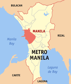
| Map of Metro Manila showing the location of Manila | |
| Government | |
| Region | National Capital Region |
| Province | — |
| District | 1st to 6th districts of Manila |
| Barangays | 897 |
| Income class: | 1st class city; highly urbanized |
| Mayor | Lito L. Atienza, Jr. ( LP) |
| Founded | June 24, 1571 |
| Cityhood | June 10, 1574 |
| Official Website | www.manila.gov.ph |
| Physical characteristics | |
| Area | 38.55 km² |
| Population Total ( 2000) Density |
1,581,082 41,014/ km² |
| Coordinates | 14°35' N 121° E |
The City of Manila ( Filipino: Lungsod ng Maynila), or simply Manila, is the capital of the Philippines. The city is located on the eastern shore of Manila Bay on Luzon, the country's largest island.
Manila is the hub of a thriving metropolitan area home to over 10 million people. The Metro Manila area also known as the National Capital Region (NCR), of which the City of Manila is a part, is a much bigger metropolis consisting of 17 cities and municipalities. This article discusses the city itself; see Metro Manila for the article on the metropolis.
Manila is the second most populous city proper in the Philippines, with more than 1.5 million inhabitants. Only nearby Quezon City, the country's former capital, is more populous. It is currently included in the roster of global cities of the world.
Manila got its name from may nilad, Tagalog for "there is nilad," in reference to the flowering mangrove plant that grew on the marshy shores of the bay. In the 16th century, Manila (then Maynilad) grew from a Muslim settlement on the banks of the Pasig River into the seat of the colonial government of Spain when it controlled the Philippine Islands for over three centuries from 1565 to 1898. Beginning in 1898, the United States occupied and controlled the city and the Philippine archipelago until 1946. During World War II, much of the city was destroyed. The Metropolitan Manila region was enacted as an independent entity in 1975. Today, the city and the metropolis thrive as an important cultural and economic centre. However, overpopulation, traffic congestion, pollution, and crime challenge the city.
Manila has been classified as a "Gamma" global city by the Globalization and World Cities Study Group and Network.
The city
Manila lies at the mouth of the Pasig River on the eastern shores of Manila Bay, which is on the western side of Luzon. It lies about 950 kilometers southeast of Hong Kong and 2,400 kilometers northeast of Singapore. The river bisects the city in the middle. Almost all of the city sits on top of centuries of prehistoric alluvial deposits built by the waters of the Pasig River and on some land reclaimed from Manila Bay. The layout of the city was haphazardly planned during Spanish Era as a set of communities surrounding the original Spanish Era walled city of Manila, called Intramuros. Intramuros is one of the oldest walled cities in the far east. During the American Period, some semblance of city planning using the architectural designs by Daniel Burnham, was done on the portions of the city south of the Pasig River.
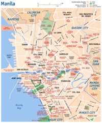
Manila is bordered by several municipalities and cities in Metro Manila: Navotas and Caloocan City to the north, Quezon City to the northeast, San Juan and Mandaluyong City to the east, Makati City to the southeast, and Pasay City to the south.
City seal
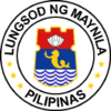
The Seal of Manila depicts the words Lungsod ng Maynila and Pilipinas, Filipino for City of Manila and Philippines, in a circle around a shield. The circle also contains six yellow stars representing the city's six congressional districts. The shield, in the shape of pre-colonial people's shield, depicts the city's nickname Pearl of the Orient on top; a sea lion in the middle, in reference to the city's Spanish influences; and the waves of the Pasig River and Manila Bay in the bottom portion. The colors of the seal mirror that of the Flag of the Philippines.
Districts
The city is divided into sixteen (16) districts. Only one district was not an original town - Port Area. Seven (7) districts are located north of the Pasig River and eight (8) are in the south. San Andres Bukid was previously part of Santa Ana, Paco, and what used to Singalong, while Santa Mesa was once a part of Sampaloc.
|
North of Pasig River
|
South of Pasig River
|
All of these districts, with the exception of Port Area, have their own churches, and several of these districts have achieved recognition in their own right. Intramuros being the old and original enclave of Manila is a historical site. The district of Binondo is the city's Chinatown. Tondo is the densest in terms of population, the largest in land area and also with the highest poverty level. The districts of Ermita and Malate are well-known and popular with tourists, having many bars, restaurants, five-star hotels, and shopping malls while the districts of San Miguel and Pandacan hosts the official residence of the President of the country, Malacañang Palace.
Parks and open areas
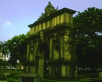
Directly south of Intramuros lies Rizal Park, the country's most significant park. Also known as Luneta (Spanish term for "crescent or moon") and previously as Bagumbayan, the 60 hectare Rizal Park sits on the site where José Rizal, the country's national hero, was executed by the Spaniards on charges of subversion. A monument stands in his honour where Rizal's remains were buried. The big flagpole west of the Rizal Monument is Kilometer Zero for road distances on the island of Luzon and the rest of the country.
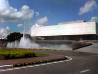
Other attractions in Rizal Park include the Chinese and Japanese Gardens, the Department of Tourism building, the National Museum of the Filipino People, The National Library of the Philippines, the Planetarium, the Orchidarium and Butterfly Pavilion, an open-air auditorium for cultural performances, a relief map of the Philippines, a fountain area, a children's lagoon, a chess plaza, a light and sound presentation, and the Quirino Grandstand.
Another famous open space in Manila is the Baywalk. This promenade lies in front of the Manila Bay where one can experience one of the most breathtaking sunsets of the world. Coconut trees, giant kaleidoscopic lamp posts, al fresco cafès and restaurants, and live acoustic bands dot this two-kilometer stretch of ample space beside Roxas Boulevard.
Aside from Rizal Park, Manila has very few other open public spaces. Rajah Sulayman Park, Manila Boardwalk, Liwasang Bonifacio, Plaza Miranda, Paco Park, Remedios Circle, Manila Zoological and Botanical Garden, Plaza Balagtas and the Malacañang Garden are some of the other parks in the city. In 2005, Mayor Joselito Atienza opened the Pandacan Linear Park, a strip of land that served as a buffer zone between the oil depot and the residential-commercial properties in Pandacan and could be found along the banks of the Pasig River. In the northern most part of the city lies the three cemeteries of Loyola, Chinese, and Manila North Green Park, the largest public cemetery in Metropolitan Manila.
People
Demographics
Ethnic groups
The original settlers of Manila were the Tagalogs. Throughout the centuries, there has been a constant migration of Visayans, Bicolanos, Ilocanos, Maranaos, Chinese and Spaniards. There are also Americans, Arabs, Indonesians, Indians, and Koreans in Manila. Intermarriage between ethnic groups is not uncommon in the Philippines.
There are 3 distinct local ethnic groups in Manila. The natives (darker skinned), the Chinese, and the Spanish. The Chinese and Spanish groups, companies and families control most political and financial institutions.
Population density
With a population of 1,581,082 and a land area of 38.55 km², it has the highest population density of any major city in the world with 41,014 people/km² (with district 6 being the most dense with 68,266, followed by the first two districts (Tondo) with 64,936 and 64,710, respectively, and district 5 being the least dense with 19,235). A million more transients are added during daytime as students and workers come to the city.
Manila's population density dwarfs that of Paris (20,164 inhabitants per km²), Shanghai (16,364 people/km², with its most dense district of Nanshi's 56,785 density), Buenos Aires (2,179 people/km², with its most dense inner suburb Lanus' 10,444 density), Tokyo (10,087 people/km²), Mexico City (11,700 people/km²), and Istanbul (1,878 people/km², with its most dense district Fatih's 48,173 density).
Languages
The main language is Tagalog, the lingua franca of the Metro Manila region. In addition, many Manileños are proficient in English, which attracts English students, and this fuels a call centre industry.
Religion
Roman Catholicism
Manila is the seat of the Archdiocese of Manila and the Primate of the Philippines. Being the seat of the Spanish colonial government in past centuries, it has been used as the base of numerous Roman Catholic missions to the Philippines. Among the religious orders that have gone to the Philippines include the Dominicans, the Jesuits, the Franciscans, and the Augustinians (which includes the Augustinian Recollects).
Intramuros is currently the seat of the Archdiocese of Manila, the oldest archdiocese in the country. The archdiocese's offices is located in the Manila Cathedral (Basilica Minore de la Nuestra Señora de la Immaculada Concepcion) in Intramuros.
Other notable churches and cathedrals in the city include Catédral de San Agustin in Intramuros, a UN World Heritage Site is a favorite wedding place of notable people and one of two fully air-conditioned churches in the city; Quiapo Church, also known as the Basilica Minore del Nazareno Negro, site of the annual January Black Nazarene procession; Binondo Church, also known as Basilica Minore de St. Lorenzo Ruiz; Malate Church ( Nuestra Señora de Remedios); and San Sebastian Church or the Basilica Minore de San Sebastian, the only all-steel church in Gothic style in Asia. Many of the other districts of Manila have their own notable churches.
Other faiths
There are many Buddhist and Taoist temples built by the Chinese community in Manila. The Quiapo district is home to a sizable Muslim population in Manila, and The Golden Mosque is located there. In Ermita is a large Hindu temple for the Indian population, while on U.N. Avenue, there is a Sikh Temple. In Malate, along Quirino Avenue, there once was a synagogue for the small Jewish community in the Philippines. (See Jews in the Philippines.)
Education and culture
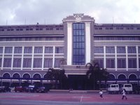
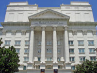
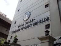
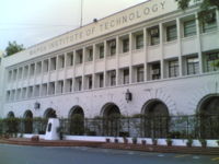
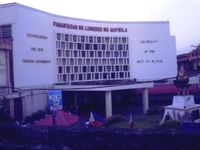
Manila is home to majority of the colleges and universities in Metro Manila. The University Belt or U-Belt, informally located in the districts of Malate, Ermita, Intramuros, Paco, San Miquel, Quiapo, and Sampaloc is the colloquial term for the high number of institutions of higher education that are located in the city. Among them are private school De La Salle University-Manila, all-girl school St. Scholastica's College and the state-owned University of the Philippines, Manila at Ermita, the private schools Far Eastern University, University of Santo Tomas and University of the East in Sampaloc, previously all-girl school Centro Escolar University and all-boy school San Beda College along Mendiola, private school Colegio de San Juan de Letran, technical school Mapua Institute of Technology, and the city-owned Pamantasan ng Lungsod ng Maynila at Intramuros, and the state-owned Polytechnic University of the Philippines in Santa Mesa.
The National Museum of the Philippines, where the Spoliarium of Juan Luna is housed, the Metropolitan Museum, the Museong Pambata (Children's Museum), as well as the National Library is also in Manila, located within Rizal Park.
Educational institutions
- Adamson University
- Centro Escolar University
- Chinese General Hospital College of Nursing and Liberal Arts
- Colegio de San Juan de Letran
- De La Salle-College of Saint Benilde
- De La Salle University-Manila
- Emilio Aguinaldo College
- Esteban Abada High School
- Far Eastern University
- FEATI University
- Lyceum of the Philippines University
- Manila Science High School
- Manuel L. Quezon University
- Mapua Institute of Technology
- National College of Business and Arts
- National University
- Pamantasan ng Lungsod ng Maynila
- Philippine Christian University
- Philippine Normal University
- Philippine School of Business Administration
- Polytechnic University of the Philippines
- San Beda College
- San Sebastian College - Recoletos
- St. Joseph's School - Pandacan
- St. Scholastica's College
- Technological University of the Philippines
- Universidad de Manila
- University of Manila
- University of Santo Tomas
- University of the East
- University of the Philippines, Manila
Economy
Commerce
Every district in the city with the exception of Port Area has its own public market, locally called the pamilihang bayan. Public markets are often divided into two, the dry goods section and the wet goods section. Commerce in these public markets is lively, especially in the early morning. Under the urban renewal program of the incumbent administration, some of the public markets had been refurbished and given a fresher look, like the Sta. Ana public market. It is one of the more advanced markets in the city featuring a modern 2-story building with an escalator.
The tropical climate in Manila plus the facilities of its world-class malls continue to attract Filipinos to the shopping malls. Modern shopping malls dot the city especially in the areas of Malate and Ermita. SM City Manila, part of the country's largest chain of malls, stands behind the Manila City Hall, while the original SM Department store still operates in Carriedo in Sta. Cruz while another called SM Centrepoint is located north east of the city in Sta. Mesa close to the Quezon City-San Juan boundary. One of the popular malls that lies at the heart of Manila is Robinson's Place Ermita. In the southern part of the city in Malate district is Harrison Plaza, one of the city's oldest shopping malls.
For the adventurous shoppers, you may venture beyond the hotel/shopping complex package and combine other interesting destinations for cheap buys such as in Divisoria and Quiapo districts. Bargaining is the major part of your shopping experience when you pass by on these areas, as it sells goods at rock-bottom prices. In Divisoria, there is already a shopping mall that caters to the adventurous shoppers. Tutuban Center in Divisoria gives a little comfort to the shoppers as it offers air-conditioned mall, but the price of the goods here is still very similar to the goods bought outside. In Quiapo, one unique spot is the marketplace under the bridge. It sells indigenous Filipino crafts and delicacies. Raon Centre is famous for its cheap electronic products. Though through the changing times, department stores began sprouting the Quiapo area, but still the flea market of Quiapo is still vibrant and very much popular among the average Filipinos. Photo and video enthusiasts looking for cheap equipment can proceed to R. Hidalgo street in the Quiapo district.
Manufacturing
Manila connects manufacturing facilities with design and sales departments, giving key stakeholders insight into how fluctuations in manufacturing capacity and demand impact them. It can also be used to connect decision-makers at different facilities. For instance, plant managers at a major auto manufacturer use a Manila site to post issues, troubleshoot problems, and hold discussions.
Transportation
Air
Ninoy Aquino International Airport (NAIA) outside the city proper serves Manila and the metro area, over 30 airlines provide daily service to over 26 cities and 19 countries worldwide. Approximately 14 million travellers use NAIA a year straining what was originally a domestic airport built in the 1930s. A second airport, the Terminal 2 or the Centennial Terminal was opened in October 1999. The International flag-carrier Philippine Airlines now uses this terminal solely for both its domestic and international and while all other international flights use NAIA Air Philippines is in the transition to the newer Terminal alongside PAL. A third airport T3 had been near completed until a controversy had been discovered by the current Arroyo administration that prompted a series of investigations and international court battle with the builders and the Philippine govt. Its considered as another "white elephant" project that is costing millions of money of the people.
The main carrier is the Philippine Airlines which has the most extensive network in the Philippines. Followed by the newly repackaged Cebu Pacific Airlines that uses all A320 aircraft and promotes online booking being the truly first Budget airline in the country. Air Philippines, a subsidiary of Philippine Airlines uses the old planes of the latter for certain routes and competes with Cebu Pacific on the budget market. Some 48-seater planes used by Asian Spirit, Sea Air are some of the little airlines in the city of Manila.
Another alternative point of embarkation and disembarkation is the DMIA, Diosdado Macapagal International airport in Clark. As of October 2006, flights from Singapore, Hong Kong, Macau, Seoul, Kota Kinabalu, Kuala Lumpur and chartered flights from Shanghai, Taipei uses this small airport because of its cheaper landing and parking fee. A mediocre shuttle system serves Clark and Manila.
Roads
The main roads of Metro Manila are organized around a set of radial and circumferential roads that radiate and circle in and around Manila proper. Roxas Boulevard, easily the most well-known of Manila's streets, line the southern shores of Manila with Manila Bay. The boulevard is part of the Radial Road 1 that leads south to the province of Cavite. Another well-known radial road is España Boulevard (part of Radial Road 7) that starts in Quiapo and ends at the Welcome Rotunda along the border with Quezon City. Pres. Sergio Osmeña Sr. Highway, part of the South Luzon Expressway or Radial Road 3 is the most important highway linking Manila with the provinces of southern Luzon.
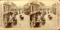
The most common types of public transportation are buses and the jeepney. Tricycles are used for short distances. Pedicabs are bicycles attached with sidecars, where the drivers uses foot pedals to propel the vehicle.
- Claro M. Recto Avenue
- Escolta
- España Boulevard
- Mendiola Street
- Rizal Avenue
- Roxas Boulevard
- Taft Avenue
- Quezon Boulevard
Bridges
There are eight (8) major bridge spans in Manila, more than half of the number of bridges that connects the north and south banks of the Pasig River in Metro Manila. There are two (2) rail bridges that crosses the river, the Light Rail Transit 1 and the Philippine National Railways track. The bridges listed below are in a west to east order, with the first bridge Del Pan, nearest to the mouth of the Pasig River into Manila Bay.
|
|
Rail transport
Manila is the hub of a railway system on Luzon. The main terminal of the Philippine National Railways is in the Tondo district. Railways extend from this terminal north to the city of San Fernando in Pampanga and south to Legazpi City in Albay, though only the southern railway is currently in operation.
Manila is also serviced by the Manila Light Rail Transit System along the length of Taft Avenue (R-2) and Rizal Avenue (R-9). A second line runs along Ramon Magsaysay Blvd (R-6) from Santa Cruz, through Quezon City, up to Santolan in Pasig City.
These are the major rail systems, with their station within Manila:
- LRT 1: R. Papa, J. Abad Santos, Blumentritt, Tayuman, Bambang, D. Jose, Carriedo, Central Station, UN Ave., P. Gil, Quirino Ave, and Vito Cruz
- LRT 2: C.M. Recto, Legarda, Pureza and V. Mapa
- PNR: Vito Cruz, Herran, Pandacan, Sta. Mesa, España, Laong Laan, Blumentritt and Tutuban.
Seaports and piers
The City of Manila is the chief seaport of the Philippines. North Harbor and South Harbour experience busy periods during long holidays such as Holy Week, All Saints Day and the Christmas holidays.
Communication
Postal Service
The Philippines central office for its postal service now called PhilPost and it is located at the foot of the Jones Bridge. The main office is housed in a huge art deco style building designed with huge columns at front, built during the American colonial period. The building houses the Philippine Postal Bank and the main mail sorting-distribution operations of the country.
Print & Publication
Among the Philippines major newspaper publications, both in broadsheet and in tabloid format established their editorial, publication offices and printing presses at the Port Area. Among the publications based in Manila include the country's oldest newspaper, The Manila Times, The Manila Bulletin and it's sister tabloid "Balita," The Philippine Star, The Manila Standard-Today, The Daily Tribune and others.
News Agencies
The city serves as host to a number of news and information offices, agencies or services that includes the Office of the Press Secretary and Radio-TV Malacañang or RTVM (the close-in news team of Philippine Presidents) located at the Malacañang Palace grounds.
The National Press Club's building office is located at the foot of the Jones bridge across the Post Office building and it houses the International Press Centre or IPC, a government agency tasked to accredit and grant working permits for visiting foreign agencies.
Manila is also home to the prestigious and exclusive organization of journalists called, "Samahang Plaridel," whose members include some of the prominent publishers, editors, reporters of the country.
The Associated Press, Japan's NHK and Fuji TV, and London-based Global Radio News, Ltd. made Manila as its base of newsgathering operations in the Philippines.
Utilities
Electricity & Water
Manila's source of electricity is part of the central franchise service area of the Manila Electric Company or Meralco. Water supply for the city is supplied by the Maynilad Water Services, except for portions of the district of Sta. Ana which is serviced by the Manila Water.
Telephone & Cable TV
The city's telecommunications infrastructure (landlines) are provided by PLDT, Eastern Telecoms, Bayantel and cellular service providers Smart Communications, Globe Telecom and Sun Cellular cover the city. Cable television access is provided by Sky Cable and Global Destiny.
Internet Service Providers
Internet Digital Subscriber Line or DSL coverage is provided by PLDT, and Eastern Telecoms, cable internet is serviced by Sky Cable's ZPDee brand and by Global Destiny. Wireless broadband is provided by Smart Communications. Availability of services from among the listed providers vary in the various districts of Manila, except in Malate and Ermita where all providers are available.
Government
Like all cities of the Philippines, Manila is governed by a mayor who heads the executive department of the city. The current mayor for the 2004-2007 term is Joselito L. Atienza, Jr., who has been re-elected for his third term in the 2004 elections. The city mayor is restricted for three consecutive terms (nine years), although he can be elected again after an interruption of one term.
Danilo B. Lacuna, the city's incumbent vice-mayor heads the legislative arm which is composed of the elected city councilors, six from each of the city's six congressional districts.
The city is divided into 897 barangays, which are the smallest unit of local government in the Philippines. Each barangay has its own chairperson and councilors. For administrative convenience, all the barangays in Manila are grouped into 100 zones and which are further grouped into 16 administrative districts. These zones and districts have no form of local government.
The city further has six representatives popularly elected to the House of Representatives, the lower legislative branch of the Philippines. Each representative represents one of the six congressional districts of Manila.
Places of interest
General landmarks
- Apolinario Mabini Shrine
- Chinatown (Binondo district)
- Embassy of the United States of America
- Ermita and Malate Districts, a place for Bohemian night life
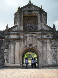
- Fort Santiago
- Intramuros, the walled city built by the Spaniards, originally considered to be the City of Manila
- Malacañang Palace, the official residence of the President of the Philippines
- Manila Baywalk
- Manila Boardwalk
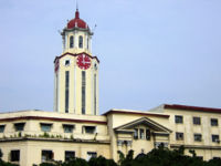
- Manila City Hall
- Manila Yacht Club
- Manila Zoological and Botanical Garden ( Manila Zoo)
- Metropolitan Theatre
- Museo Pambata
- National Library of the Philippines
- National Museum
- Paco Park, the location of the hit Paco Park Presents
- Plaza Miranda
- Quirino Grandstand
- Rajah Sulayman Park
- Remedios Circle
- Rizal Park, also known as Luneta
- The Manila Hotel
- The Supreme Court of the Philippines
- University Belt Area
- Victims of Martial Law Memorial Wall - Bonifacio Shrine (near City Hall)
Malls and shopping centers
- 168 Shopping Mall
- Divisoria Flea Market
- Ever Gotesco Manila Plaza (Recto)
- Harrison Plaza (SM Harrison; Shopwise; Rustan's)
- Isetann Department Store (Recto and Quiapo)
- Palengke or Pamilihan sa ilalim ng tulay (literally means "a marketplace under the bridge), a centre for indigenous Filipino products
- Quiapo Bargain Centre, home of endless bargain goods
- Robinson's Place - Manila
- SM City Manila
- SM City San Lazaro
- SM Department Store Quiapo
- Tutuban Centre (Cluster Building, Centermall & Primeblock)
Hospitals
|
|
Hotels
|
|
Places of worship
- Archdiocesan Shrine of St. Jude Thaddeus
- Basilica Minore de San Lorenzo Ruiz (Binondo Church)
- Basilica Minore de San Sebastian (San Sebastian Church), the only all-steel church in Gothic style in Asia
- Basilica Minore de la Immaculada Concepcion ( Manila Cathedral)
- Basilica Minore del Nazareno Negro (Quiapo Church)
- Buddhist Temple (Malate, Manila)
- Cathedral of the Child Jesus - Iglesia Filipina Independiente ( Aglipayan)
- Chinese Temple (Binondo, Manila)
- Mosque del Globo de Oro (Quiapo, Manila)
- Hindu Temple (Paco, Manila)
- Iglesia de la Parroquia de Santo Niño (Pandacan, Manila)
- Iglesia de Santa Cruz
- Nuestra Señora de Guia Church (Ermita Church)
- Nuestra Señora de Remedios Church (Malate Church)
- Parroquia de San Fernando de Dilao (Paco, Manila)
- San Agustin Church
Sporting venues
- Rizal Memorial Sports Complex (RMSC)
- San Andres Gym (foremrly Mail and More Arena, the home of the Manila MetroStars.)
Museums
- Bahay Tsinoy
- Intramuros Light and Sound Museum
- Museo ng Maynila (Museum of Manila)
- National Museum of the Filipino People
- Museo Pambata (Children's Museum)
- Parish of the Our Lady of the Abandoned - Sta. Ana (pre-Spanish artifacts)
- The Museum - De La Salle University-Manila
- UST Museum of Arts and Sciences
Cemeteries
- Chinese Cemetery
- La Loma Cemetery
- Manila American Cemetery and Memorial
- Manila North Cemetery
History
Pre-Spanish times
Manila began as a Muslim settlement at the mouth of the Pasig River along the shores of Manila Bay. The name came from the term maynilad, literally "there is nilad." Nilad is a white-flowered mangrove plant that grew in abundance in the area.
In the mid-16th century, the area of present-day Manila was governed by three rajahs, or Muslim community leaders. They were Rajah Sulayman and Rajah Matanda who ruled the communities south of the Pasig, and Rajah Lakandula who ruled the community north of the river. Manila was then the northernmost Muslim sultanate in the islands. It held ties with the sultanates of Brunei, Sulu, and Ternate in Cavite.
Spanish rule
In 1570, a Spanish expedition ordered by the conquistador Miguel López de Legazpi demanded the conquest of Manila. His second in command, Martín de Goiti departed from Cebu and arrived in Manila. The Muslim Tagalogs welcomed the foreigners, but Goiti had other plans. The Spanish force of 300 soldiers marched through Manila and a battle was fought with the heavily armed Spaniards quickly defeating the native settlements. Legazpi and his men followed the next year and made a peace pact with the three rajahs and organized a city council consisting of two mayors, 12 councilors, and a secretary. A walled city known as Intramuros, at the southern banks of Pasig River was built to protect the Spanish colonizers. On June 10, 1574, King Philip II of Spain gave Manila the title of Insigne y Siempre Leal Ciudad ("Distinguished and Ever Loyal City").
In 1595, Manila was proclaimed as the capital of the Philippine Islands and became a centre of trans-Pacific trade for more than three centuries. For example, the famous Manila galleons sailed between Manila and the port of Acapulco in today's Mexico. These Manila galleons carried silver and other precious metals from the New World to Manila to purchase goods and raw materials from throughout Asia — for example, spices transshipped from the Spice Islands to the south, and porcelain, ivory, lacquerware and processed silk cloth from China and Southeast Asia. Some of these Asian goods were used in Mexico, however, most of the cargo was transhipped across Mexico for delivery to Spain, to be sold in European markets.
British occupation
There was a brief British occupation of Manila from 1762-1764 as a result of the Seven Years' War, which was fought between France and England. Spain became a British enemy when it sided with France due to ties between their royal families. The British Occupation was confined to Manila and Cavite while Simón de Anda y Salazar, acting as a de facto Spanish governor general, kept the countryside for Spain with the help of Filipino soldiers. The Indian soldiers known as Sepoys, who came with the British, deserted in droves and settled in Cainta, Rizal, and explains the uniquely Indian features of generations of Cainta residents. French mercenaries who came with the British also settled in various locations around Manila.
U.S. occupation
U.S. Troops invaded Manila in 1898 and waged war with the Spaniards and Filipinos in the Spanish-American War and the Philippine-American War. Following the defeat of Spain, U.S. forces took control of the city and the islands. In the Treaty of Paris in 1898, Spain handed over the Philippines to the United States of America for US$ 20,000,000 and ending 377 years of Spanish rule in the islands.
The headquarters for USAFFE were located here as were the U.S. 31st Infantry Regiment and the U.S. 808th Military Police Company. The headquarters and bulk of the Philippine Division was located just to the south, at Fort William McKinley. The headquarters for the Far East Air Force was on the outskirts of town, at Nielson Field. Nearby, at Nichols Field was the U.S. 20th Air Base Group. A battalion of the U.S. 12th Quartermaster Regiment was located in the port area and training was conducted there for quartermasters of the Philippine Army.
There were 6 airfields, for the Far East Air Force, within 130 km of Manila, notably Clark, Nichols, and Nielson fields. All U.S. military and airforce bases was closed down in 1992.
World War II
American combat units were ordered to withdraw from the city and all military installations removed on December 30, 1941, Manila was declared an open city by President Manuel L. Quezon, to spare the city from death and destruction. Quezon issued a decree enlarging the safe zone to include outlying areas of Manila as safe zones, establishing the new administrative jurisdiction called Greater Manila.
The post of mayor of Greater Manila was given to Quezon's former Executive Secretary, Jorge B. Vargas. On the evening of New Year's Day of 1942, a Japanese courier delivered notice to Vargas that Japanese forces already bivouacked at Parañaque would enter Greater Manila the following day. From 9AM to 10AM of January 2, Japanese imperial forces marched into the City of Manila.
Vargas was tasked to hand over to the new authorities Greater Manila and present the remaining Filipino leaders to Japanese authorities. Vargas and the Filipino leaders present were asked to choose three options; (1) a purely Japanese military administration, (2) a dictatorial government run by a Filipino under Gen. Artemio Ricarte who went on self-exile to Japan after the Filipino-American war, or (3) a government by commission selected by Filipinos. Vargas and the local leaders chose the third option and established the Philippine Executive Commission to manage initially Greater Manila, and was later expanded to cover the whole Philippines.
Vargas assumed the position, chairman of the Philippine Executive Commission and appointed to the post of Mayor of Greater Manila in 1942, Leon G. Guinto Sr., a Secretary of Labor under the Philippine Commonwealth administration of President Manuel L. Quezon. Guinto held the position of Mayor of Greater Manila until the liberation of the city.
Under Guinto's war-time administration, the City of Manila that was expanded to Greater Manila included districts such as; "Bagumbayan" means New Town (South of Manila), "Bagumpanahon" means New Era (Sampaloc, Quiapo, San Miguel and Santa Cruz), "Bagumbuhay" means New Life (Tondo), "Bagong Diwa" means New Order (Binondo & San Nicholas), the then newly established Quezon City was collapsed and divided into two districts, while the municipalities of Caloocan, Las Piñas, Malabon, Makati, Mandaluyong, Navotas, Parañaque, Pasay, and San Juan became districts of Manila.
On February 5, 1944 American General Douglas MacArthur fulfilled a promise to return to the Philippines (see Battle of Leyte). From February 3 to March 3, after the climactic battle at Intramuros ended, the thoroughly devastated city of Manila was officially liberated. Allied troops did not reach the city in time to prevent the Manila Massacre though. Ironically, the carpet bombing and relentless shelling by the Americans killed many more than the fleeing Japanese.
Manila and security
Manila has been subject to militant attacks. The metropolis have been targeted twice by groups Moro Islamic Liberation Front and Abu Sayyaf. In addition, Al-Qaida cells have been discovered in the metropolis.
Project Bojinka, which was a large-scale attack being planned in late 1994 and early 1995, was being planned in Manila. The project was abandoned after the night of January 6, 1995 and the morning of January 7, when an apartment fire led investigators to a laptop computer containing the plans.
Sister cities
Manila has four sister cities, as designated by Sister Cities International, Inc. (SCI):
 Sacramento, California, USA
 San Francisco, California, USA
 Maui County, Hawaii, USA
 Honolulu City and County, Hawaii, USA
Other sister cities include:
