Jarvis Island
2007 Schools Wikipedia Selection. Related subjects: Geography of Oceania (Australasia)
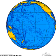
Jarvis Island is an uninhabited 4.5 square kilometer island located at in the South Pacific Ocean, about one-half of the way from Hawaii to the Cook Islands. It is one of the Line Islands, in the central part of the group. It is an unincorporated territory of the United States, part of the United States Minor Outlying Islands, administered from Washington, D.C. by the United States Fish and Wildlife Service of the United States Department of the Interior as part of the National Wildlife Refuge system.
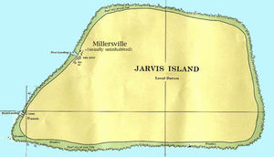
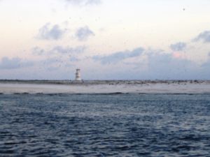
There are no ports or harbors, but there are offshore anchorage spots. There is one boat landing area in the middle of the west coast and another near the southwest corner of the island. A day beacon is near the middle of the west coast.
The climate is tropical, with scant rainfall, constant wind, and strong sun. Varying from sea level to 7 meters, the terrain is sandy, and the coral island is surrounded by a narrow fringing reef. Its sparse bunch grass, prostrate vines, and low-growing shrubs are primarily a nesting, roosting, and foraging habitat for seabirds, shorebirds, and marine wildlife. The island has no natural fresh water.
History
The island was discovered on August 21, 1821 by the British ship Eliza Francis, (or Eliza Frances, owned by Edward, Thomas, and William Jarvis; see an 1833 legal proceeding) and named by her commander, one Captain Brown. The uninhabited island was claimed for the U.S.A. in March 1857 and formally annexed by the U.S. on 27 February 1858, but abandoned in 1879 after tons of guano had been removed.
The UK annexed the island on 3 June 1889, but never carried out plans for further exploitation. The guano deposits were mined until the late 1800s.
The U.S. occupied and reclaimed the island in 1935 as an unincorporated territory, which was administered by U.S. Department of the Interior 13 May 1936 - 27 June 1974. It was colonized by the U.S. 26 March 1935 - 7 February 1942 under authority of the two consecutive Heads of the Baker, Howland and Jarvis Colonization Scheme (see Baker Island).
The Millersville settlement on the western side of the island was occasionally used as a weather station from 1935 until World War II, when it was abandoned; it was reoccupied in 1957 during the International Geophysical Year by scientists, and shortly had its only proper local authority, Station Chief for IGY Homung (d. 1958) 1957 - Nov 1958, but was again abandoned in 1958.
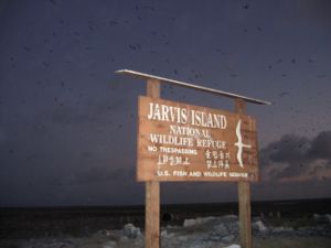
Since 27 June 1974 Jarvis Island has been administered by the U.S. Fish and Wildlife Service as Jarvis Island National Wildlife Refuge. Public entry to Jarvis Island requires a special-use permit and is generally restricted to scientists and educators only. The island is visited annually by the U.S. Fish and Wildlife Service and the United States Coast Guard.


