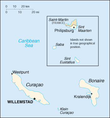
Image:Nt-map.png
From Wikipedia, the free encyclopedia
- Image
- File history
- File links

No higher resolution available.
Nt-map.png (351 × 377 pixel, file size: 9 KB, MIME type: image/png)
File links
The following pages on the English Wikipedia link to this file (pages on other projects are not listed):
- Sint Eustatius
- Islands of the Netherlands Antilles
Categories: Maps of the Netherlands Antilles | Maps of Curaçao | Maps of Saint Martin | Maps of Bonaire | Maps of Saba | Maps of Sint Eustatius

