Image:LocationTaiwan.png
From Wikipedia, the free encyclopedia
No higher resolution available.
LocationTaiwan.png (250 × 115 pixel, file size: 5 KB, MIME type: image/png)
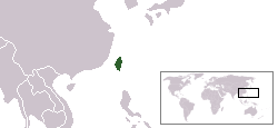
Location map for Taiwan (ROC)

Permission is granted to copy, distribute and/or modify this document under the terms of the GNU Free Documentation License, Version 1.2 or any later version published by the Free Software Foundation; with no Invariant Sections, no Front-Cover Texts, and no Back-Cover Texts.
Subject to disclaimers.
File history
Legend: (cur) = this is the current file, (del) = delete this old version, (rev) = revert to this old version.
Click on date to download the file or see the image uploaded on that date.
- (del) (cur) 09:04, 24 October 2003 . . Vardion ( Talk | contribs) . . 250×115 (5,516 bytes) (Location map for Taiwan (ROC))
-
Edit this file using an external application
See the setup instructions for more information.
File links
The following pages on the English Wikipedia link to this file (pages on other projects are not listed):
- Geography of Taiwan
- Politics of the Republic of China
- Taiwan
- History of the Republic of China
- Republic of Formosa
- User:DanielZM/test
- Template:Taiwan related articles
- Kingdom of Tungning
- Literature of Taiwan
- Transportation in Taiwan
- Portal:Taiwan
- Portal:Taiwan/Intro
- User:DownUnder555/sandbox/Taiwan
- User:DownUnder555/sandbox/Taiwan Island
- Religion in Taiwan
- Languages of Taiwan
- Taiwan under Japanese rule
Category: GFDL images