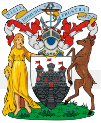
Image:Edinburgh-coa.png
From Wikipedia, the free encyclopedia
- Image
- File history
- File links

No higher resolution available.
Edinburgh-coa.png (209 × 254 pixel, file size: 36 KB, MIME type: image/png)
File links
The following pages on the English Wikipedia link to this file (pages on other projects are not listed):
- Edinburgh
- Politics of Edinburgh
- Dean Cemetery
- Water of Leith
- Newhaven, Edinburgh
- Edinburgh Mathematical Society
- Edinburgh Waverley railway station
- Royal Botanic Garden Edinburgh
- Royal Museum
- Murrayfield
- McEwan's (Beer)
- City of Edinburgh Music School
- Raeburn Place
- Bute House
- National Monument, Edinburgh
- Calton Hill
- Lesley Hinds
- Scottish Widows
- Haymarket, Edinburgh
- New College, Edinburgh
- Swanston, Edinburgh
- Edinburgh Park
- Royal College of Physicians of Edinburgh
- Edinburgh Capitals
- Sciennes
- Edinburgh Evening News
- Elsie Inglis Memorial Hospital
- Edinburgh Folk Festival
- Morningside, Edinburgh
- Queen's Gallery, Edinburgh
- Inchmickery
- Inchgarvie
- James Thin
- Duddingston
- Gorgie
- Silverknowes
- Davidson's Mains
- Barnton, Edinburgh
- St Andrew Square
- Pleasance
- Norman Irons
- Kirkliston
- Balerno
- William Chambers of Glenormiston
- Murder Rooms: The Dark Beginnings of Sherlock Holmes
- Edinburgh Business School
- Brunstane
- Stewart's Melville FP
- List of films set in Edinburgh
- Dalry, Edinburgh
- Inverleith
- User talk:Craigy144/Archive 4
- Abbeyhill
- Ardmillan
- Balgreen
- Blackford, Edinburgh
- Bonaly
- Juniper Green
- Wester Hailes
- Piershill
- Jock's Lodge
- Craigentinny
- Sighthill, Edinburgh
- Craigmillar
- Cameron Toll
- Saughton
- Longstone
- Royal College of Surgeons of Edinburgh
- South Gyle railway station
- South Gyle
- Ferry Road
- Burdiehouse
- Bankhead, Edinburgh
- Mortonhall
- Old College, University of Edinburgh
- Brunstane railway station
- Dalmeny railway station
- Edinburgh Park railway station
- Slateford railway station
- Scottish Equitable
- Aegon UK
- Fernieside
- East Craigs
- Gogarloch
- Edinburgh to Bathgate Line
- Heart of Midlothian (Royal Mile)
- Granton, Edinburgh
- Madelvic Motor Carriage Company
- Shooglenifty
- The Mound
- Gogar
- Meadowbank, Edinburgh
- The Calders
- Riccarton, Edinburgh
- Blackhall, Edinburgh
- Craigcrook
- Goldenacre
- Trinity, Edinburgh
- Powderhall
- Dalmeny
- Corstorphine Hill
- Craigievar Estate
- Craigleith, Edinburgh
- Wester Broom
- The Mary Erskine School
- Niddrie, Edinburgh
- Crewe Toll
- Pilton, Edinburgh
- Drumbrae
- Royal Edinburgh Hospital
- Tollcross, Edinburgh
- Oxgangs
- Maybury
- Murrayfield Racers
- The Pubic Triangle
- Mayfield, Edinburgh
- Seafield, Edinburgh
- The Grange, Edinburgh
- Standard Life
- Newcraighall
- Princes Street railway station
- Lady Stair's Close
- Ron Brown (Scottish politician)
- Template:Edinburgh-geo-stub
- Outlook Tower
- Murrayfield Ice Rink
- Polwarth, Edinburgh
- Edinburgh Royal Infirmary
- Dugald Stewart Monument
- Baberton Mains
- Queensberry House
- Broughton, Edinburgh
- Fountainbridge
- Alnwickhill
- Kaimes
- Craigmillar Park Golf Club
- Mortonhall Golf Club
- Baberton
- Beechmount
- Bingham, Edinburgh
- Bonnington, Edinburgh
- Braepark, Edinburgh
- Braid Hills
- Bughtlin
- Cammo
- Canonmills
- Chesser
- Clermiston
- Clerwood
- Comely Bank
- Comiston
- Curriehill
- Dalmahoy
- Drylaw
- Easter Road, Edinburgh
- Eastfield, Edinburgh
- Fairmilehead
- Ferniehill
- Firrhill, Edinburgh
- Gilmerton, Edinburgh
- Greendykes
- Greenhill, Edinburgh
- Hermiston, Edinburgh
- Holyrood, Edinburgh
- Ingliston
- Joppa, Edinburgh
- Kingsknowe
- Lauriston
- Liberton
- Little France
- Lochend, Edinburgh
- Lochrin
- Moredun
- Mountcastle, Edinburgh
- Newbridge, Edinburgh
- Muirhouse
- Northfield, Edinburgh
- Parkgrove
- Parkhead, Edinburgh
- Pilrig
- Prestonfield
- Ratho Station
- Ravelston
- Redford, Edinburgh
- Restalrig
- Roseburn
- Slateford
- Stenhouse
- Torphin
- Turnhouse
- Warriston
- West Coates
- West Craigs
- West Pilton
- Westfield, Edinburgh
- Church Hill, Edinburgh
- East Pilton
- Greenbank, Edinburgh
- Carrick Knowe
- Template:Edinburgh-stub
- The Bailie
- Bruntsfield Links
- Clifton Hall School
- St. Margaret's School
- Rose Street
- Template:Buildings and Structures in Edinburgh
- The Rivers Centre
- The Grange, Edinburgh (cricket and sports club)
- Informatics Forum
- New Register House
- Silvermills
- Chambers Street
- Edinburgh University Press
- Deantown
- Edinburgh Bus Station
