Image:Dalriada.jpg
From Wikipedia, the free encyclopedia

No higher resolution available.
Dalriada.jpg (509 × 531 pixel, file size: 27 KB, MIME type: image/jpeg)
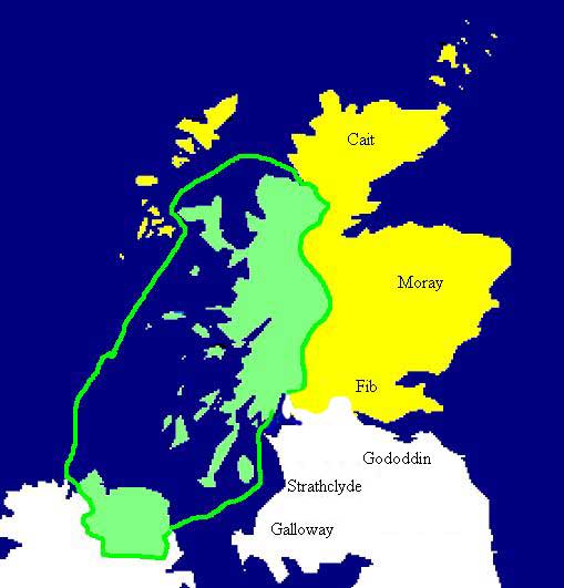
Extent of the Kingdom of Dál Riata (in green), c. AD 590. Yellow areas show occupation by the Picts.
File history
Legend: (cur) = this is the current file, (del) = delete this old version, (rev) = revert to this old version.
Click on date to download the file or see the image uploaded on that date.
- (del) (cur) 18:11, 8 January 2006 . . Dave souza ( Talk | contribs) . . 509×531 (28,041 bytes) (Extent of the Kingdom of Dalriada (in green), c.590 CE. Yellow areas show occupation by the Picts, white areas occupation by the Brythonic kingdom of Strathclyde, Gododdin and Galloway. {{PD}} [[Category:Historical maps by User:Bri)
- (del) (rev) 21:06, 28 July 2005 . . Briangotts ( Talk | contribs) . . 509×531 (35,007 bytes) (Extent of the Kingdom of Dalriada, c.590 CE. {{PD}})
-
Edit this file using an external application
See the setup instructions for more information.
File links
The following pages on the English Wikipedia link to this file (pages on other projects are not listed):
- Dál Riata
- Clan Donald
- Clan MacKay
Categories: Public domain images | Historical maps by User:Briangotts