Image:Dominican republic sm03.jpg
From Wikipedia, the free encyclopedia
Dominican_republic_sm03.jpg (331 × 356 pixel, file size: 18 KB, MIME type: image/jpeg)
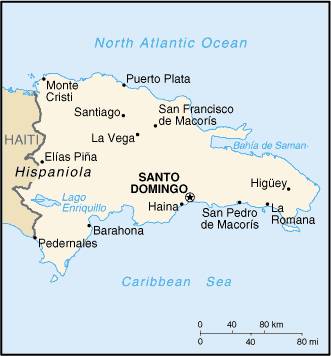
Map Of Dominican Republic from http://www.lib.utexas.edu/maps/cia03/dominican_republic_sm03.gif
According to the map is released in:
|
|
This image is a map or flag taken and/or modified from the Central Intelligence Agency's World Factbook. Under United States copyright law, all information and images from the World Factbook are in the public domain |
File history
Legend: (cur) = this is the current file, (del) = delete this old version, (rev) = revert to this old version.
Click on date to download the file or see the image uploaded on that date.
- (del) (cur) 22:08, 11 September 2003 . . Pascal ( Talk | contribs) . . 331×356 (18,131 bytes) (Map Of Dominican Republic from http://www.lib.utexas.edu/maps/cia03/dominican_republic_sm03.gif)
-
Edit this file using an external application
See the setup instructions for more information.
File links
- Dominican Republic
- Santo Domingo
- Talk:Dominican Republic
- List of cities in the Dominican Republic
- Catholic Church in the Dominican Republic
- Talk:Geography of the Dominican Republic
- Municipalities of the Dominican Republic
- List of municipalities and municipal districts of the Dominican Republic
Categories: CIA World Factbook images | Maps of the Dominican Republic