Image:Asian sj1.gif
From Wikipedia, the free encyclopedia

Asian_sj1.gif (500 × 375 pixel, file size: 22 KB, MIME type: image/gif)
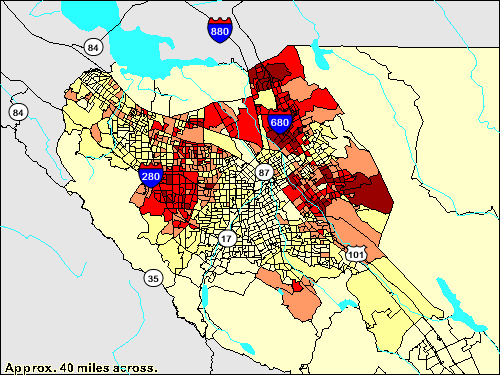
This image is a self-generated thematic map from the U.S. Census Bureau's American Factfinder at http://factfinder.census.gov/ by Wikipedia user Stevey7788.
Permission is granted to copy, distribute and/or modify this document under the terms of the GNU Free Documentation License, Version 1.2 or any later version published by the Free Software Foundation; with no Invariant Sections, no Front-Cover Texts, and no Back-Cover Texts.
Subject to disclaimers.
|
|
This picture/multimedia file is now available on Wikimedia Commons as Image:San Jose, California - map.gif. Images which have been tagged with this template may be deleted immediately after satisfying these conditions ( CSD I8). |

I, the creator of this work, hereby release it into the public domain. This applies worldwide.
In case this is not legally possible,
I grant any entity the right to use this work for any purpose, without any conditions, unless such conditions are required by law.
File history
Legend: (cur) = this is the current file, (del) = delete this old version, (rev) = revert to this old version.
Click on date to download the file or see the image uploaded on that date.
- (del) (cur) 06:20, 12 April 2005 . . Stevey7788 ( Talk | contribs) . . 500×375 (22,235 bytes) (These '''thematic maps''' of the San Jose, California metropolitan area illustrate the different neighborhoods and the contrasting demographics of the diverse city. The San Jose East Side neighborhoods are the poorest, while the affluent western c)
-
Edit this file using an external application
See the setup instructions for more information.
File links
- San Jose, California
- User:Stevey7788/Maps
- Maps of San Jose, California
Categories: GFDL images | Images on Wikimedia Commons as of 1 April 2007 | All images on Wikimedia Commons | User-created public domain images
