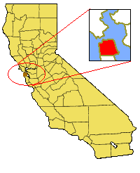
Image:California Map showing San Francisco County.png
From Wikipedia, the free encyclopedia

California_Map_showing_San_Francisco_County.png (200 × 246 pixel, file size: 13 KB, MIME type: image/png)
Licensing
I, the creator of this work, hereby grant the permission to copy, distribute and/or modify this document under the terms of the GNU Free Documentation License, Version 1.2 or any later version published by the Free Software Foundation; with no Invariant Sections, no Front-Cover Texts, and no Back-Cover Texts.
Subject to disclaimers.
File history
Legend: (cur) = this is the current file, (del) = delete this old version, (rev) = revert to this old version.
Click on date to download the file or see the image uploaded on that date.
- (del) (cur) 03:47, 8 September 2006 . . Physicq210 ( Talk | contribs) . . 200×246 (12,871 bytes) (better picture, although still in PNG format)
- (del) (rev) 02:59, 5 July 2006 . . Physicq210 ( Talk | contribs) . . 200×246 (13,589 bytes)
-
Edit this file using an external application
See the setup instructions for more information.
File links
- San Francisco, California
- Grand View Park
- Anza Vista, San Francisco, California
- Yerba Buena Gardens
- Eppleton Hall (1914)
- Pier 39
- McLaren Park
- Fisherman's Wharf, San Francisco, California
- Ghirardelli Square
- Western Addition, San Francisco, California
- Glen Park, San Francisco, California
- Washington Square, San Francisco
- St. Francis Wood, San Francisco, California
- Sea Cliff, San Francisco, California
- Excelsior District, San Francisco, California
- Glen Canyon Park
- Balboa Park, San Francisco, California
- Baker Beach
- Twin Peaks, San Francisco, California
- Duboce Park
- Eureka Valley, San Francisco, California
- Forest Hill, San Francisco, California
- Theatre District, San Francisco, California
- Mount Sutro
- Fitz Hugh Ludlow Memorial Library
- Mission Bay, San Francisco, California
- International Settlement (San Francisco)
- Fort Mason
- Diamond Heights, San Francisco, California
- 22nd Street (San Francisco)
- Filbert Street (San Francisco)
- Marina Green
- Seal Rock
- Musée Mécanique
- Sutro Heights Park
- California Coastal National Monument
- Target Video
- Visitacion Valley, San Francisco, California
- Warm Water Cove
- Fillmore Street
- Westwood Highlands, San Francisco, California
- User:DaveOinSF/Drafts
- San Andreas Lake
- Template:SanFranciscoCountyCA-geo-stub
- Sigmund Stern Recreation Grove
- Dirk Dirksen
- Cathedral Hill, San Francisco, California
- Yerba Buena Centre for the Arts
- Lower Pacific Heights, San Francisco, California
- Jerry Garcia Amphitheater
- Negative Trend
Categories: Map images which should be in SVG format | User-created GFDL images

