Image:Sthelens3.jpg
From Wikipedia, the free encyclopedia
- Image
- File history
- File links
Size of this preview: 392 × 599 pixel
Image in higher resolution (1931 × 2950 pixel, file size: 872 KB, MIME type: image/jpeg)
|
|
This is a file from the Wikimedia Commons. The description on its description page there is shown below. |
|
|
Summary
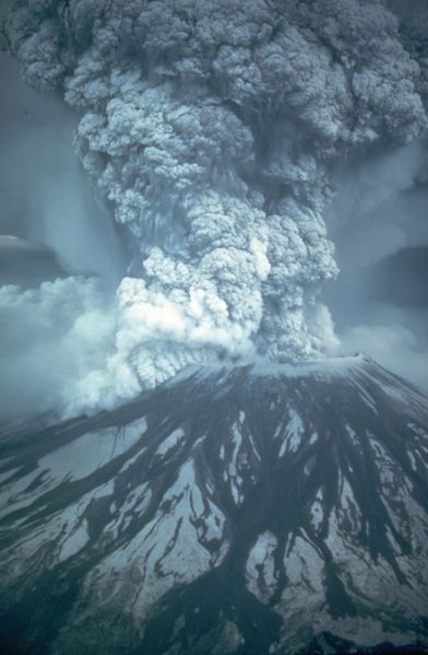
Caption: On May 18, 1980, at 8:32 a.m. Pacific Daylight Time, a magnitude 5.1 earthquake shook Mount St. Helens. The bulge and surrounding area slid away in a gigantic rockslide and debris avalanche, releasing pressure, and triggering a major pumice and ash eruption of the volcano. Thirteen-hundred feet (400 meters) of the peak collapsed or blew outwards. As a result, 24 square miles (62 square kilometers) of valley was filled by a debris avalanche, 250 square miles (650 square kilometers) of recreation, timber, and private lands were damaged by a lateral blast, and an estimated 200 million cubic yards (150 million cubic meters) of material was deposited directly by lahars (volcanic mudflows) into the river channels. Fifty-seven people were killed or are still missing. (May 18, 1980, by Austin Post, USGS)
From: http://vulcan.wr.usgs.gov/Volcanoes/MSH/SlideSet/ljt_slideset.html
 |
This image is in the public domain because it contains materials that originally came from the United States Geological Survey, an agency of the United States Department of Interior. For more information, see the official USGS copyright policy |
|
File links
- Mount St. Helens
- Wikipedia:Recent additions 9
- User:Rfl
- Wikipedia:Today's featured article/September 2004
- Wikipedia:Today's featured article/September 13, 2004
- History of Washington
- Volcano prediction
- User:Downy/FePi/Feb07
- Geology of the Pacific Northwest
- User:Eve Hall/sandbox