Image:Map image detroit.jpg
From Wikipedia, the free encyclopedia
Map_image_detroit.jpg (426 × 260 pixel, file size: 26 KB, MIME type: image/jpeg)
Summary
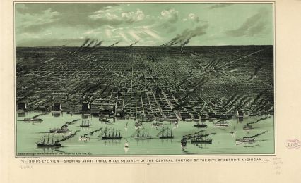
Image of Detroit taken from National Archives.
CREATED/PUBLISHED Detroit [1889?]
NOTES Perspective map not drawn to scale.
Reference: LC Panoramic maps (2nd ed.), 342
Licensing

This image is in the public domain in the United States. In most cases, this means that it was first published in the United States prior to January 1, 1923 (see the talk page for more cases). Other jurisdictions may have other rules, and this image might not be in the public domain outside the United States. See Wikipedia:Public domain and Wikipedia:Copyrights for more details.
File history
Legend: (cur) = this is the current file, (del) = delete this old version, (rev) = revert to this old version.
Click on date to download the file or see the image uploaded on that date.
- (del) (cur) 23:03, 16 April 2006 . . Jtmichcock ( Talk | contribs) . . 426×260 (26,696 bytes) (Image of Detroit taken from National Archives. CREATED/PUBLISHED Detroit [1889?] NOTES Perspective map not drawn to scale. Reference: LC Panoramic maps (2nd ed.), 342 )
-
Edit this file using an external application
See the setup instructions for more information.
File links
Categories: Images in the public domain in the United States | Images of Detroit, Michigan | Images of Michigan