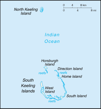
Image:Cocos (Keeling) Islands-CIA WFB Map.png
From Wikipedia, the free encyclopedia
- Image
- File history
- File links

No higher resolution available.
Cocos_(Keeling)_Islands-CIA_WFB_Map.png (329 × 355 pixel, file size: 5 KB, MIME type: image/png)
File links
The following pages on the English Wikipedia link to this file (pages on other projects are not listed):
- Cocos (Keeling) Islands
- Battle of Cocos
- Cocos Islands Mutiny
Category: Maps of the Cocos Islands

