Image:St Helens map showing 1980 eruption deposits.jpg
From Wikipedia, the free encyclopedia
St_Helens_map_showing_1980_eruption_deposits.jpg (714 × 600 pixel, file size: 24 KB, MIME type: image/gif)
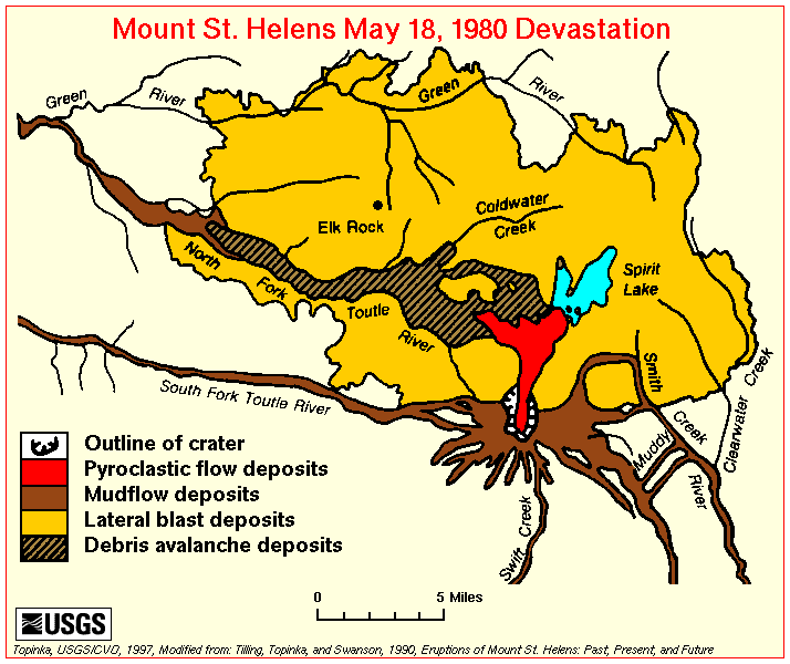
Map of the area around Mount St. Helens which were affected by the May 18, 1980 eruption. North is to the top.
USGS image from
This image is a work of a United States Geological Survey employee, taken or made during the course of the person's official duties. As a work of the United States Government, the image is in the public domain. For more information, see the USGS copyright policy.
File history
Legend: (cur) = this is the current file, (del) = delete this old version, (rev) = revert to this old version.
Click on date to download the file or see the image uploaded on that date.
- (del) (cur) 02:11, 23 May 2004 . . Maveric149 ( Talk | contribs) . . 714×600 (24,236 bytes) ( USGS image from [http://vulcan.wr.usgs.gov/Volcanoes/MSH/SlideSet/ljt_slideset_old.html]<br><br>{{msg:PD}})
-
Edit this file using an external application
See the setup instructions for more information.
File links
Category: USGS images