Image:Ph locator map negros oriental.png
From Wikipedia, the free encyclopedia
Ph_locator_map_negros_oriental.png (300 × 440 pixel, file size: 19 KB, MIME type: image/png)
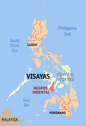
Map of the Philippines showing the location of Negros Oriental.
Created and copyright (2003) by seav. Released under the GNU FDL.

Permission is granted to copy, distribute and/or modify this document under the terms of the GNU Free Documentation License, Version 1.2 or any later version published by the Free Software Foundation; with no Invariant Sections, no Front-Cover Texts, and no Back-Cover Texts.
Subject to disclaimers.
File history
Legend: (cur) = this is the current file, (del) = delete this old version, (rev) = revert to this old version.
Click on date to download the file or see the image uploaded on that date.
- (del) (cur) 03:28, 28 December 2005 . . Seav ( Talk | contribs) . . 300×440 (19,012 bytes) (Updated map to use same colour scheme as other Philippine maps and as discussed in Wikipedia:WikiProject Maps.)
- (del) (rev) 06:30, 15 June 2003 . . Seav ( Talk | contribs) . . 300×450 (14,361 bytes) (More readable map.)
- (del) (rev) 19:57, 23 May 2003 . . Seav ( Talk | contribs) . . 300×450 (12,867 bytes) (Map of the Philippines showing the location of Negros Oriental.)
-
Edit this file using an external application
See the setup instructions for more information.
File links
- Wikipedia:WikiProject Philippine LGUs
- Negros Oriental
- User:Bluemask/Ph province locator maps
Category: GFDL images