Image:Canada Provinces Territories 1870.png
From Wikipedia, the free encyclopedia
Canada_Provinces_Territories_1870.png (280 × 230 pixel, file size: 20 KB, MIME type: image/png)
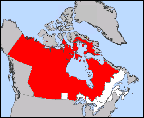
Images was created from Image:Northwest Territories-map.png to over come objections, please improve this map on anyway you see fit.

I, the creator of this work, hereby release it into the public domain. This applies worldwide.
In case this is not legally possible,
I grant any entity the right to use this work for any purpose, without any conditions, unless such conditions are required by law.
File history
Legend: (cur) = this is the current file, (del) = delete this old version, (rev) = revert to this old version.
Click on date to download the file or see the image uploaded on that date.
- (del) (cur) 02:36, 21 September 2005 . . Cloveious ( Talk | contribs) . . 280×230 (20,069 bytes) (Updated Labrador boundaries to be more accurate)
- (del) (rev) 02:21, 15 September 2005 . . Cloveious ( Talk | contribs) . . 281×230 (20,217 bytes) (Free version of the 1870 map to over come objections)
- (del) (rev) 09:25, 4 September 2005 . . Maclean25 ( Talk | contribs) . . 428×380 (16,360 bytes) (Image was taken from http://atlas.gc.ca with the following copyright notice: "Information on this site has been posted with the intent that it be readily available for personal and public non-commercial use and may be reproduced, in part or in whole and b)
-
Edit this file using an external application
See the setup instructions for more information.
File links
- List of Northwest Territories general elections
- History of Northwest Territories capital cities
- Benjamin Parkyn Richardson
Category: User-created public domain images