From Wikipedia, the free encyclopedia
 |
This is a file from the Wikimedia Commons. The description on its description page there is shown below. |
|
|
Commons is attempting to create a freely licensed media file repository. You can help.
|
Summary
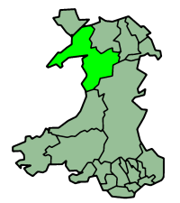
Map of Gwynedd — Walden69 12:16, 11 April 2006 (UTC)
| Description |
English map of Gwynedd (one of the subdivisions of Wales) |
| Source |
Morwen |
| Date |
of this version : 21 January 2004 |
| Author |
Morwen |
| Permission |
GFDL |
| Other versions |
en:Image:WalesGwynedd.png |
Image history on en:
| Date |
Author |
Edit summary |
| 23:36, 21 January 2004 |
en:Morwen (Talk) |
200x225 (22,409 bytes) (one of the en:subdivisions of Wales) |
Licensing
 |
Permission is granted to copy, distribute and/or modify this document under the terms of the GNU Free Documentation License, Version 1.2 or any later version published by the Free Software Foundation; with no Invariant Sections, no Front-Cover Texts, and no Back-Cover Texts.
Subject to disclaimers. |
File links
The following pages on the English Wikipedia link to this file (pages on other projects are not listed):
-
Gwynedd
-
Blaenau Ffestiniog
-
Porthmadog
-
Bangor, Gwynedd
-
Bethesda, Gwynedd
-
Harlech
-
Criccieth
-
Pwllheli
-
Llanberis
-
Barmouth
-
Dolgellau
-
Tywyn
-
Bala, Gwynedd
-
Y Felinheli
-
Corris
-
User:Oosoom/sandbox2
-
Deiniolen
-
Template talk:Infobox UK place

