Image:AralSeaAug1964-keyhole.jpg
From Wikipedia, the free encyclopedia
AralSeaAug1964-keyhole.jpg (450 × 450 pixel, file size: 35 KB, MIME type: image/jpeg)
Summary
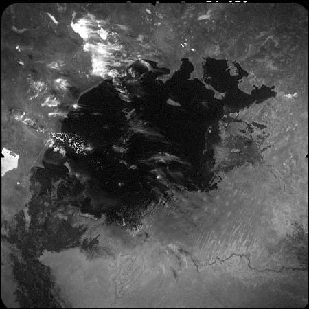
This image of the Aral Sea was acquired in August of 1964 by a United States Argon intelligence mapping/geodesy satellite.
KH-5 Mission 9064-A (incorrectly mislabeled 9066-A in the USGS archive) carried the A-22 mapping camera. A TAT-Agena carried this camera into an orbit of 114.96 degrees of inclination with a period of 84 minutes, a perigee of 219 degrees and an apogee of 232 degrees.
International Launch Designation: 1964-043A
Launch Date: August 21, 1964
Mission Duration: approximately 6 days
Licensing
 |
This work is in the public domain in the United States because it is a work of the United States Federal Government under the terms of 17 U.S.C. § 105. See Copyright. Note: This only applies to works of the Federal Government and not to the work of any individual US state, territory, commonwealth, county, subdivision, or municipality. |
 |
File history
Legend: (cur) = this is the current file, (del) = delete this old version, (rev) = revert to this old version.
Click on date to download the file or see the image uploaded on that date.
- (del) (cur) 05:48, 5 July 2006 . . Hartze11 ( Talk | contribs) . . 450×450 (35,583 bytes) (This image of the Aral Sea was acquired in August of 1964 by a United States intelligence mapping satellite.)
-
Edit this file using an external application
See the setup instructions for more information.
File links
Category: United States government images