Image:Duitstalige GemeenschapLocatie.png
From Wikipedia, the free encyclopedia
- Image
- File history
- File links
No higher resolution available.
Duitstalige_GemeenschapLocatie.png (270 × 270 pixel, file size: 2 KB, MIME type: image/png)
|
|
This is a file from the Wikimedia Commons. The description on its description page there is shown below. |
|
|
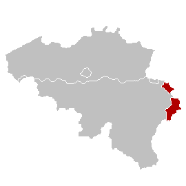
Deutsch: Lage der Deutschsprachigen Gemeinschaft Belgiens
English: map of Belgium showing the autonomous " German Speaking Community" in red.
Nederlands: kaart gemaakt door w:nl:gebruiker:LennartBolks in in het publieke domein geplaatst.
Walon : mape del Beldjike, avou l' Kiminålté Tîxhon-Cåzante e rodje coleur.
 |
This image has been released into the public domain by its author, LennartBolks. This applies worldwide. In some countries this may not be legally possible; if so: |
|
English | Français | +/- |
|
File links
The following pages on the English Wikipedia link to this file (pages on other projects are not listed):
- Belgium
- Ethnic German
- Communities, regions and linguistic regions of Belgium
- German-speaking Community of Belgium
- German-speaking electoral college