From Wikipedia, the free encyclopedia
 |
This is a file from the Wikimedia Commons. The description on its description page there is shown below. |
|
|
Commons is attempting to create a freely licensed media file repository. You can help.
|
| Description |
Summary
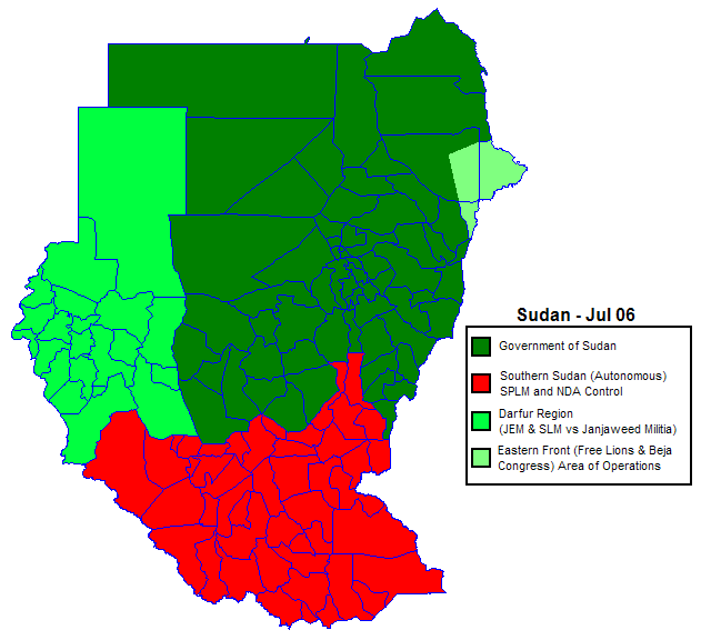
I, (user: Orthuberra), has created this map from the District map of Sudan, editing it to show the current political situation and factions within the country of Sudan from various news reports. |
| Source |
own work, based on Image:Sudan districts.png |
| Date |
|
| Author |
User Orthuberra on en.wikipedia |
| Permission |
 |
Orthuberra at the wikipedia project, the creator of this work, hereby grants permission to copy, distribute and/or modify this document under the terms of the GNU Free Documentation License, Version 1.2 or any later version published by the Free Software Foundation; with no Invariant Sections, no Front-Cover Texts, and no Back-Cover Texts. A copy of the license is included in the section entitled " GNU Free Documentation License." |
|
| Other versions |
Originally from en.wikipedia; description page is (was) here * 20:19, 2 August 2006 [[:en:User:Orthuberra|Orthuberra]] 631×576 (30,878 bytes) <span class="comment">(I, (user: Orthuberra), has created this map from the District map of Sudan, editing it to show the current political situation and factions within the country of Sudan from various news reports.)</span> |
(Uploaded using CommonsHelper or PushForCommons)
File links
The following pages on the English Wikipedia link to this file (pages on other projects are not listed):