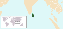
Image:LocationSriLanka.png
From Wikipedia, the free encyclopedia
- Image
- File history
- File links

No higher resolution available.
LocationSriLanka.png (250 × 115 pixel, file size: 5 KB, MIME type: image/png)
File links
The following pages on the English Wikipedia link to this file (pages on other projects are not listed):
- Sri Lanka
- User:DanielZM/test
- Indo-Sri Lanka Accord
- Indian Peace Keeping Force
- Black July
- Naguleswaram temple
- Navaly Church bombing
- 1990 Batticaloa massacre
- Kumarapuram massacre
- Allaipiddy massacres
- 2006 Trincomalee massacre
- 2006 Mannar massacres
- Prison massacres in Sri Lanka
- Eastern University massacre
- Jaffna lagoon massacre
- Kumudini boat massacre
- Akkaraipattu massacre
- Place names in North and East of Sri Lanka
- 2006 Kathiraveli massacre
- Padahuthurai bombing
- Sendai Habitat
