Image:Somalia&land map.png
From Wikipedia, the free encyclopedia
- Image
- File history
- File links
No higher resolution available.
Somalia&land_map.png (330 × 355 pixel, file size: 9 KB, MIME type: image/png)
|
|
This is a file from the Wikimedia Commons. The description on its description page there is shown below. |
|
|
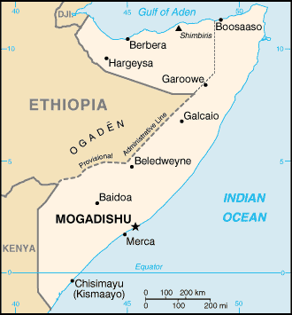
Map of Somalia, showing the capital Mogadishu
adopted from the CIA map by adding the boundary of the self-proclaimed but internationally unrecognized Somaliland.
Taken from Wiki En (uploaded by en:User:Ahoerstemeier)
 |
This image is in the public domain because it contains materials that originally came from the United States Central Intelligence Agency's World Factbook. |
 |
File links
The following pages on the English Wikipedia link to this file (pages on other projects are not listed):
- Mogadishu
- List of cities in Somalia
- Somalia Affair
- Sultanate of Mohamoud Ali Shire
- Battle of Mogadishu (2006)
Category: Maps of Somalia