Image:SolomonIslandsMap.png
From Wikipedia, the free encyclopedia
No higher resolution available.
SolomonIslandsMap.png (324 × 347 pixel, file size: 13 KB, MIME type: image/png)
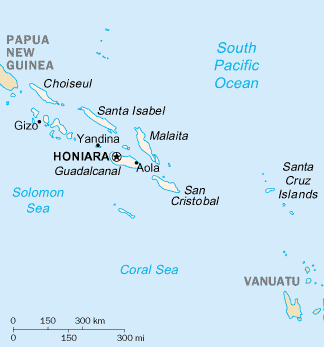
Solomon Islands map (modified from PCL map collection Courtesy of the University of Texas Libraries, The University of Texas at Austin.
|
|
This file has been released into the public domain by the copyright holder, its copyright has expired, or it is ineligible for copyright. This applies worldwide. |
Note: This tag is deprecated! Please use instead:
|
File history
Legend: (cur) = this is the current file, (del) = delete this old version, (rev) = revert to this old version.
Click on date to download the file or see the image uploaded on that date.
- (del) (cur) 06:28, 9 July 2003 . . Hephaestos ( Talk | contribs) . . 324×347 (12,992 bytes) (Solomon Islands map (modified from [http://www.lib.utexas.edu/maps/index.html PCL map collection])
-
Edit this file using an external application
See the setup instructions for more information.
File links
The following pages on the English Wikipedia link to this file (pages on other projects are not listed):
- Geography of the Solomon Islands
- Solomon Islands
- List of cities, towns and villages in the Solomon Islands
- Regional Assistance Mission to the Solomon Islands
Category: Public domain images