Image:Map of Saint Pierre and Miquelon.gif
From Wikipedia, the free encyclopedia
Map_of_Saint_Pierre_and_Miquelon.gif (330 × 354 pixel, file size: 7 KB, MIME type: image/gif)
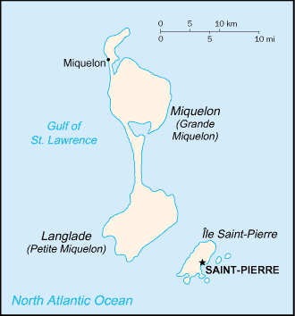
This is a map of Saint Pierre et Miquelon from the CIA world factbook (retrieved from https://www.cia.gov/cia/publications/factbook/geos/sb.html ). According to the copyright notice on the website, all information of the World Factbook is in the public domain.
 |
This work is in the public domain in the United States because it is a work of the United States Federal Government under the terms of 17 U.S.C. § 105. See Copyright. Note: This only applies to works of the Federal Government and not to the work of any individual US state, territory, commonwealth, county, subdivision, or municipality. |
 |
File history
Legend: (cur) = this is the current file, (del) = delete this old version, (rev) = revert to this old version.
Click on date to download the file or see the image uploaded on that date.
- (del) (cur) 19:02, 17 November 2004 . . Sietse Snel ( Talk | contribs) . . 330×354 (6,729 bytes) (Map of Saint Pierre et Miquelon from the CIA world factbook)
-
Edit this file using an external application
See the setup instructions for more information.
File links
- Saint Pierre and Miquelon
- Miquelon-Langlade
- Saint-Pierre, Saint Pierre and Miquelon
- Langlade Island
Category: United States government images