Image:Thames map.png
From Wikipedia, the free encyclopedia
No higher resolution available.
Thames_map.png (347 × 205 pixel, file size: 6 KB, MIME type: image/png)
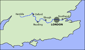
Map of the River Thames (England)
Created by ChrisO, February 15, 2004

Permission is granted to copy, distribute and/or modify this document under the terms of the GNU Free Documentation License, Version 1.2 or any later version published by the Free Software Foundation; with no Invariant Sections, no Front-Cover Texts, and no Back-Cover Texts.
Subject to disclaimers.
File history
Legend: (cur) = this is the current file, (del) = delete this old version, (rev) = revert to this old version.
Click on date to download the file or see the image uploaded on that date.
- (del) (cur) 17:36, 15 February 2004 . . Metz2000 ( Talk | contribs) . . 347×205 (5,880 bytes) (Optimised PNG image using PNGRewrite and PNGOut. No loss of quality.)
- (del) (rev) 16:03, 15 February 2004 . . ChrisO ( Talk | contribs) . . 347×205 (8,161 bytes) (Map of the River Thames (England))
-
Edit this file using an external application
See the setup instructions for more information.
File links
The following pages on the English Wikipedia link to this file (pages on other projects are not listed):
Category: GFDL images