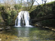
Yorkshire Dales
2007 Schools Wikipedia Selection. Related subjects: Geography of Great Britain
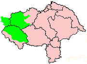
The Yorkshire Dales are an area of high ground in North Yorkshire, West Yorkshire, and Cumbria, England. They constitute one of the twelve National parks of England and Wales
Although many valleys all over Yorkshire are called "(name of river)+ dale", such as Airedale or Calderdale, the Yorkshire Dales are usually deemed to be those valleys north of the Wharfe. Exceptions to the naming rule are Wensleydale, which is named after the town of Wensley rather than the River Ure, and Arkengarthdale, which was formed by Arkle Beck.
Geography
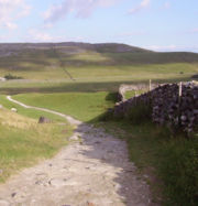
The characteristic scenery is green upland pastures separated by dry-stone walls and grazed by sheep and cattle. The dales themselves are 'U' and 'V' shaped valleys, which were enlarged and shaped by glaciers, mainly in the most recent, Devensian ice age. The underlying rock is principally Carboniferous limestone (which results in a number of areas of limestone pavement) in places interspersed with shale and sandstone and topped with millstone grit. However, to the north of the Dent fault, the hills are principally older Silurian and Ordovician rocks, which make up the Howgill Fells.
Many of the upland areas consist of heather moorland, used for grouse shooting in the months following August 12 each year (the ' Glorious Twelfth').
Yorkshire Dales National Park
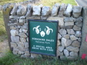
In 1954 an area of 1,770 km² was designated the Yorkshire Dales National Park. Most of the National Park is in North Yorkshire, but thanks to local government reforms in 1974 a small part now lies in Cumbria. Over 20,000 residents live and work in the park, which attracts over eight million visitors every year.
Places and sights within the National Park include:
- Aysgarth Falls
- Clapham
- Cautley Spout waterfall
- Gaping Gill
- Grassington
- Hardraw Force
- Hawes
- Horton in Ribblesdale
- Kisdon Force waterfall in Swaledale
- Malham
- Reeth
- Sedbergh
- Settle
- The Yorkshire three peaks
List of Dales
- Arkengarthdale
- Birkdale
- Bishopdale
- Coverdale
- Dentdale
- Garsdale
- Langstrothdale
- Littondale
- Malhamdale
- Nidderdale
- Ribblesdale
- Swaledale
- Wensleydale
- Wharfedale
