Port Louis
2007 Schools Wikipedia Selection. Related subjects: African Geography
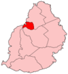
Port Louis (pronounced locally as paw-louee) is the capital of Mauritius. It is a port on the Indian Ocean, and the nation's largest city and main port. It is located in the Port Louis District. The population is 147,688 ( 2003 census).
History
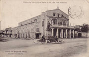
Port Louis was founded by the French in circa 1735 as a revictualling halt for their ships travelling around the Cape of Good Hope, and was named in honour of King Louis XV. The first Governor was Count Bertrand-François Mahé de La Bourdonnais.
Geography
The City of Port Louis is located at 20°10' South, 57°31'30" East (-20.1667, 57.525). . Its localities include Plaine Verte, Chinatown, Ward IV, Valle Pitot, Tranqebard and city centre. Port Louis is capital of the District of Port Louis.
Sights
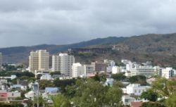
Port Louis has conserved many historic and colonial buildings through the years. One of them is a fortification named Fort Adelaide or La Citadelle, built by the British in 1835. The latter dominates the city. From there, one can observe most of the city's architecture. Port Louis is surrounded by a mountain range, called the Port Louis Moka Range. Among its most famous mountains are Le Pouce and Pieter Both which stand about 800 metres from sea level. One of the most popular spot, is the country's national derby called Champ de Mars, the latter is the oldest race course (1812) in the Indian Ocean and the second oldest in the southern Hemisphere. Other famous spots are the Police Barracks known as Les Casernes and the Port Louis Waterfront.
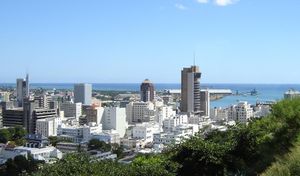
But the feature that probably strikes the most is the city's skyline which is by far the best in the country. The skyline of Port Louis has completely changed in the last fifteen years mainly due to construction booms in the 1990s and 2000s, where many of the tallest high-rise buildings have been built. The city centre has the tallest buildings in Mauritius, including some skyscrapers.
The Mauritius Institute, dedicated to the study of the island's flora and fauna, is in Port Louis. Citizens often climb up the Signaux mountain, which is a 3 km track, that leads to over 300 metres high. From there, one can appreciate the landscape of the city.
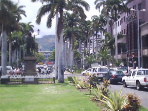
Attractions include the Caudan Waterfront, Port Louis Bazaar, the Mauritian Chinatown and the old Port Louis theatre. The capital has also three museums which are: the Mauritius Natural History Museum, the Blue Penny Museum and the Mauritius Stamp Museum. The biggest and oldest post office in Mauritius is found near the Caudan Waterfront. Situated in the heart of the city, the Place d'Armes is easily recognizable by its tall palm trees. It is the main entrance to and out of Port Louis.
Port Louis is the busiest city of the country. It faces heavy traffic congestion as there is only one motorway which leads in and out of the city. The busiest hours are 8am and 5pm, which roughly correspond to the working hours for the majority of enterprises. Parking is another big problem the city faces. The financial centre is also located there, with the Bank of Mauritius, the Mauritius Commercial Bank Ltd and the State Bank of Mauritius, all having their headquarters there.
The busiest street is probably Sir Seewoosagur Ramgoolam Street, formerly known as Rue Desforges. It leads directly to the Municipality of Port Louis, the Jummah Mosque and Kadafi Square, which is a hot place for local food.
There is also a Chinese Burial ground where elaborate memorials have been erected. Dead bodies are kept in the Kit Lock which is located in the centre of the city.
Port Louis also harbours some major schools. The Royal College of Port Louis and the Loreto College of Port Louis are two of the best secondary schools of the country. Bell Village SSS and Moneron SSS schools are also found in the capital of Mauritius.
Economy
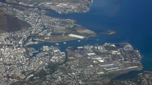
The economy is dominated by its port, which handles Mauritius' international trade. The port was founded by the French who preferred Port Louis as the City is shielded by the Port Louis/Moka mountain range. Manufacturing is dominated by clothing and textiles, but also includes chemicals, plastics, and pharmaceuticals. Tourism is also important. The development of the Caudan Waterfront, central to Port Louis, with shopping and cinema facilities, appeals to tourists visiting the city. Port Louis is the second most important financial centre in Africa after Johannesburg. It is the city with the highest per capita income in Africa.
Demographics
The population of the city is now largely made up of the descendants of laborers who were hired for labor from India in the 19th century. Slaves were previously introduced by the British and French who colonized the island in the 18th century. After the abolition of slavery in 1835, many Indian and Chinese workers were brought to work the land, and cultivate sugar cane, at that time used to produce rum. The Immigration Depot in Port Louis is a World Heritage Site commemorating this great migration.
Currently, the majority of the population, more than 75 percent, are Indians of mixed origins (a significant percentage being followers of the Hindu and Muslim faith), with the rest from Africa and a minority of Chinese and Eurasian.
