Lake Tahoe
2007 Schools Wikipedia Selection. Related subjects: General Geography
| Lake Tahoe | |
|---|---|
|
|
|
| Coordinates | |
| Lake type | geologic block faulting |
| Primary sources | |
| Primary outflows | Truckee River |
| Basin countries | USA (California, Nevada) |
| Max-length | 22 miles (35 km) |
| Max-width | 12 miles (19 km) |
| Surface area | 193 miles² (500 km²) |
| Average depth | 989 feet (301 m) |
| Max-depth | 1,645 feet (501 m) |
| Water volume | 122,160,280 acre-feet (151 km³) |
| Shore length1 | 71 miles (114 km) |
| Surface elevation | 6,229 feet (1,899 m) |
| Settlements | South Lake Tahoe, California Stateline, Nevada Tahoe City, California |
| 1 Shore length is an imprecise measure which may not be standardized for this article. | |
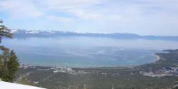
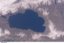
Lake Tahoe is a freshwater lake in the Sierra Nevada, located where the borders of the U.S. states of California and Nevada bend, near Carson City. Approximately two-thirds of the shoreline is in California. The area, referred to as Tahoe, is home to a number of ski resorts and summer outdoor recreation.
It is the second deepest lake in the United States, the eleventh deepest on Earth, and the fourth deepest in average depth.
Geography
Lake Tahoe is one of the deepest (1645 feet/501 m), largest (192 sq. mi./497 km²) ¹, and highest (6229 feet/1898 m) lakes in the United States. Only Oregon's Crater Lake is deeper at 1930 feet (588 m).
Although for much of Tahoe's perimeter, highways run within sight of the lake shore, some important parts of the California shoreline now lie within state parks or are protected by the United States Forest Service. Lake Tahoe is about 22 mi (35 km) long and 12 mi (19 km) wide and has 72 mi (116 km) of shoreline and a surface area of 191 square miles or 495 square kilometers.
The Lake Tahoe Basin was formed by geologic block (normal) faulting about 2 to 3 million years ago. A geologic block fault is a fracture in the Earth's crust causing blocks of land to move up or down. Uplifted blocks created the Carson Range on the east and the Sierra Nevada on the west. Down-dropped blocks created the Lake Tahoe Basin in between. Some of the highest peaks of the Lake Tahoe Basin that formed during this process were Freel Peak at 10,891 ft (3320 m), Monument Peak at 10,067 ft (3068 m) (the present Heavenly Valley Ski Area), Pyramid Peak at 9,983 ft (3043 m) (in the Desolation Wilderness), and Mount Tallac at 9,735 ft (2967 m).
Snowmelt filled the southern and lowest part of the basin, forming the ancestral Lake Tahoe, with rain and runoff adding additional water. Modern Lake Tahoe was shaped and landscaped by the scouring glaciers during the Ice Age (the Great Ice Age began a million or more years ago). Many streams flow into Lake Tahoe, but the lake is drained only by the Truckee River, which flows northeast through Reno, Nevada and into Pyramid Lake in Nevada.
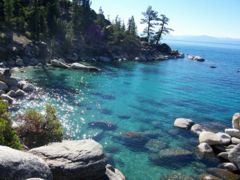
Emerald Bay State Park. A view from the east side of the lakeMean annual precipitation ranges from over 55 inches/year or 140 cm in watersheds on the west side of the basin to about 26 inches/year or 67 cm near the lake on the east side of the basin. Most of the precipitation falls as snow between November and April, although rainstorms combined with rapid snowmelt account for the largest floods. There is a pronounced annual runoff of snowmelt in late spring and early summer, the timing of which varies from year to year. In some years, summertime monsoonal storms from the Great Basin bring intense rainfall, especially to high elevations on the east side of the basin. As the climate in the northern Sierra warms, hydrologists anticipate that an increasing fraction of the precipitation in basin will fall as rain rather than snow.
Vegetation in the basin is dominated by a mixed conifer forest of Jeffrey pine (P. Jeffreyi), lodgepole pine (P. murrayana), white fir (Abies concolor), and red fir (A. magnifica). The basin also contains significant areas of wet meadows and riparian areas, dry meadows, brush fields (with Arctostaphylos and Ceanothus) and rock outcrop areas, especially at higher elevations. Ceanothus is capable of fixing nitrogen, but mountain alder (Alnus tenuifolia), which grows along many of the basin’s streams, springs and seeps, fixes far greater quantities, and contributes measurably to nitrate-N concentrations in some small streams.
Soils of the basin are derived primarily from andesitic volcanic rocks and granodiorite, with minor areas of metamorphic rock. Some of the valley bottoms and lower hillslopes are mantled with glacial moraines, or glacial outwash material derived from the parent rock. Cryopsamments, Cryumbrepts, rockland, rock outcrops and rubble and stoney colluvium account for over 70% of the land area in the basin (see USA soil taxonomy). The basin soils (in the < 2 mm fraction) are generally 65-85% sand (0.05–2.0 mm).
The south shore is dominated by the lake's largest city, South Lake Tahoe, California, which neighbors Stateline, Nevada. Tahoe City, California is located on the lake's northwest shore.
The lake's position is 39°N, 120°W.
History
Tahoe’s history began 2–3 million years ago when the faults that created the Carson Range simultaneously molded the Tahoe Basin. Eruptions from the extinct volcano Mt. Pluto formed a dam on the north side. The Pleistocene ( Ice Age) molded the basin to its current form followed by drainage from ice and snow which filled the lake.
The area around Lake Tahoe was originally inhabited by the Washoe tribe of Native Americans. Lake Tahoe was the centre and heart of Washoe Indian territory, including the upper valleys of the Walker, Carson, and Truckee Rivers. They called this area "Da ow a ga", which means "edge of lake". When early pioneers came they mispronounced this word, saying "Da ow", it later evolved into what we call it today, Lake "Tahoe".. Lt. John C. Frémont and Kit Carson were the first non-indigenous people to see Lake Tahoe. It was Fremont's 2nd exploratory expedition. On February 14, 1844, while searching for the Bonaventura river he first sighted the lake from Red Lake Peak in what is now the Carson Pass. After arriving at Sutter's Fort he designated it Lake Bonpland, in honour of the French explorer and botanist Aimé Jacques Alexandre Bonpland. John Calhoun Johnson, Sierra explorer and founder of "Johnson's Cutoff" (now Hwy 50), was the first white-man to see Meeks Bay and from a peak above the lake he named " Fallen Leaf Lake, California" after his Indian guide. His first employment in the west was in the government service, carrying the mail on snowshoes from Placerville to Nevada City, during which time he gave the name of Lake Bigler to that beautiful body of water now known as Lake Tahoe in honour of California’s governor John Bigler. In 1853 William Eddy, the surveyor general of California, identified Tahoe as Lake Bigler. In 1862 the U.S. Department of the Interior first introduced the name Tahoe which continued a debate about naming the lake, in which both names were used until well into the next decade. It wasn’t until 1945 that it was finally and officially named Lake Tahoe. The compromise to partition Tahoe with 2/3 to California and 1/3 to Nevada was reached when California became a state. Putting the state line right through the middle of the lake and then at 39 degrees north latitude, the stateline obliques southeasterly towards the Colorado River. Upon discovery of gold in the South Fork of the American River in 1848, thousands of west-bound gold seekers passed near the basin on their way to the gold fields. European civilization first made its mark in the Lake Tahoe basin with the 1858 discovery of the Comstock Lode, a silver deposit just 15 miles (24 km) to the east in Virginia City, Nevada. From 1858 until about 1890, logging in the basin supplied large timbers to shore up the underground workings of the Comstock mines. The logging was so extensive that almost all of the native forest was cut. In 1864, Tahoe City was founded as a resort community for Virginia City, the first recognition of the basin’s potential as a destination resort area.
Public appreciation of the Tahoe basin grew, and during the 1912, 1913, and 1918 Congressional sessions, unsuccessful efforts were made to designate the basin as a national park. During the first half of the 20th century, development around the lake consisted of a few vacation homes. The post-World War II population and building boom, followed by construction of gambling casinos in the Nevada part of the basin during the mid- 1950s, and completion of the interstate highway links for the 1960 Squaw Valley Olympics, resulted in a dramatic increase in development within the basin. From 1960 to 1980, the permanent resident population increased from about 10,000 to greater than 50,000, and the summer population grew from about 10,000 to about 90,000. Since the 1980s, development has slowed somewhat due to land use controls.
Limnology and water quality
In spite of land-use planning and export of treated sewage effluent from the basin, the lake is becoming increasingly eutrophic (richer in nutrients), with primary productivity increasing by more than 5% annually, and clarity decreasing at an average rate of 0.25 meters per year. Fine sediment, much of it resulting from land disturbance in the basin, accounts for about half of the loss in clarity.
Until the early 1980s, nutrient limitation studies showed that primary productivity in the lake was nitrogen-limited. Now, after a half-century of accelerated nitrogen input (much of it from direct atmospheric deposition), the lake is phosphorus-limited. Because the volume of the lake is so large (156 km³) and its hydraulic residence time so long (about 650 years), its eutrophication may be essentially irreversible.
Lake Tahoe never freezes. Since 1970, it has mixed to a depth of at least 400 m a total of 6 or 7 times. Dissolved oxygen is relatively high from top to bottom.
Analysis of the temperature records in Lake Tahoe has shown that the lake warmed (between 1969 and 2002) at an average rate of 0.015 degrees C per year. The warming is caused primarily by increasing air temperatures, and secondarily by increasing downward long-wave radiation. Both of these factors are associated with global warming. The warming trend is reducing the frequency of deep mixing in the lake, and may have important effects on water clarity and nutrient cycling.
Since the 1960s, the Lake’s food web and zooplankton populations have undergone major changes. In 1963-65, opossum shrimp (Mysis relicta) were introduced to enhance the food supply for the introduced kokanee salmon (Onchorhynchus nerka). The shrimp began feeding on the Lake’s cladocerans (Daphnia and Bosmina), and their populations virtually disappeared by 1971. The shrimp provide a food resource for salmon and trout, but also compete with juvenile fish for zooplankton. Since the 1970s, the cladoceran populations have somewhat recovered, but not to former levels.
Lake Tahoe is actually a tributary watershed drainage element within the Truckee River Basin, and its sole outlet is the Truckee River, which continues on to discharge to Pyramid Lake. Because of the sensitivity of Truckee River water quality (involving two protected species, the cui-ui sucker fish and the Lahontan cutthroat trout), this drainage basin has been studied extensively. The primary investigations were stimulated by the U.S. Environmental Protection Agency, who funded the development of the DSSAM model to analyze water quality below Lake Tahoe.
Environmental protection
Lake Tahoe has suffered from too much use. Until recently construction on the banks of the Lake had been, more or less, under the control of wealthy real estate developers. Construction activities had been linked to a 'clouding' of the amazingly blue waters of the Lake. Currently, the Tahoe Regional Planning Agency is regulating construction along the shoreline (and has won two Federal Supreme Court battles over recent decisions). Many residents are enraged by the laws that they have passed, especially those in the Tahoe Lakefront Homeowners Association.
The League to Save Lake Tahoe (Keep Tahoe Blue) has been the public interest watchdog in the Lake Tahoe Basin for over 45 years. Founded when a proposal to build a four-lane highway around the lake - with a bridge over the entrance to Emerald Bay - was proposed in 1959, the League has repeatedly thwarted poorly designed development projects and environmentally unsound planning. Currently evaluating the "Pathways 2007" comprehensive plan being developed by TRPA, the League embraces responsible and diversified use of the Lake's resources while protecting and restoring its natural attributes.
Since 1980, the Lake Tahoe Interagency Monitoring Program (LTIMP) has been measuring stream discharge and concentrations of nutrients and sediment in up to 10 tributary streams in the Lake Tahoe Basin, California-Nevada. The objectives of the LTIMP are to acquire and disseminate the water quality information necessary to support science-based environmental planning and decision making in the basin. The LTIMP is a cooperative program with support from 12 federal and state agencies with interests in the Tahoe Basin. This data set, together with more recently acquired data on urban runoff water quality, is being used by the Lahontan Regional Water Quality Control Board to develop a program (mandated by the Clean Water Act) to limit the flux of nutrients and fine sediment to the Lake.
Tourist activities
Much of the area surrounding Lake Tahoe is devoted to the tourism industry and there are many restaurants, ski slopes and casinos catering to visitors.
Winter sports
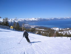
During ski season, thousands of people from all over California, including Los Angeles and the San Francisco Bay Area, flock to the slopes for some of the best skiing in the world. Lake Tahoe, in addition to its panoramic beauty, is well known for its blizzards.
Some of the major ski areas in Tahoe include:
- Heavenly Mountain Resort: the largest ski area in California and Nevada, located near Stateline, Nevada
- Squaw Valley: the second largest ski area, known for its hosting of the 1960 Winter Olympics, located near Tahoe City
- Alpine Meadows: a medium sized ski area on the north shore only a few miles from Squaw Valley
- Diamond Peak: a small ski area located in Incline Village, NV
- Northstar at Tahoe: a popular north shore ski area
- Kirkwood Ski Resort: a south shore ski area which gets more snow than any other ski area in Tahoe
- Sierra-at-Tahoe: a small south shore ski area
- Boreal Ski Resort: a small ski area on Donner Pass
- Sugar Bowl Ski Resort: a medium sized ski area in Donner Pass
- Donner Ski Ranch: a very small ski area on Donner Pass
- Homewood Ski Resort: a medium sized ski area on the west shore
- Mount Rose: a medium sized ski area north-east of the Lake, on Slide Mountain
For an instant overview of the locations and conditions of Tahoe ski resorts, see Ski Bonk's resort map.
Scattered throughout Tahoe are public and private sled parks. Some, such as Granlibakken are equipped with rope tows to help sledders get up the hill.
Many ski areas in Tahoe also have Snow tubing, such as Squaw Valley. Snow tubing is popular among people who are interested in alternative sports. Throughout Tahoe, Cross Country Skiing, Snowmobile riding, and Snowshoeing are also popular, thus there are many trails for them.
Water sports
During the summer, the lake is popular for water sports and beach activities. The two cities most identified with the Lake Tahoe tourist area are South Lake Tahoe, California and the smaller Stateline, Nevada; smaller centers on the northern shoreline include Tahoe City and Kings Beach.
Boating, the primary activity in Tahoe in the summer, is known worldwide. There are lakefront restaurants all over the Lake, most equipped with docks and buoys (See the restaurants section) There are all sorts of boating events, such as sailboat racing, firework shows over the lake, guided cruises, and more. Lake Tahoe also has its own Coast Guard
List of Tahoe Marinas:
- Camp Richardson
- Homewood High and Dry Marina
- Lakeside
- Meeks Bay Marina
- Sierra Boat Company
- Ski Run Marina
- Tahoe City Marina
- Tahoe Keys Marina
- Timber Cove Marina
List of Lake Tahoe Cruise Ships:
- M.S. Dixie
- Tahoe Gal
- Tahoe Queen
Hiking and mountain biking
There are hundreds of hiking/mountain biking trails all around the lake. They range in size, length, difficulty, and popularity. One of the most famous of Tahoe's trails is the Tahoe Rim Trail, a 165 mile trail that circumnavigates the lake. Directly to the west of the lake is the Desolation Wilderness which provides great hiking and wilderness camping. One of the most popular trailheads is the Eagle Lake Trailhead.
Gambling
Gambling is legal on the Nevada side of Lake Tahoe. On the North Shore is Crystal Bay and Incline Village, while Stateline is on the South Shore.
Stateline is home to 6 major casinos including:
-  Harrah's Lake Tahoe
-  Harveys at Tahoe
-  Lake Tahoe Horizon Casino Resort
-  Bill's Casino Lake Tahoe
- Mont Bleu Resort
- Lakeside Inn
Each having a variety of slots and table games. The Hard Rock Cafe is located inside of Harveys.
Peaks and Mountains
- Mt. Tallac (9,735')
- Mt. Pluto (8,610')
- Rubicon Peak (9,183')
- Genoa Peak (9,150')
- Freel Peak (10,881')
- Mt. Rose (10,778')
- Ellis Peak (8,740')
- Scott Peak (8,289')
- Ward Peak (8,637')
- Dick's Peak (9,974')
- Maggies Peak (8,699')
- Jakes Peak (9,187')
- Monument Peak n(10,067')
- Duane Bliss Peak (8,729')


