Boundary Waters Canoe Area Wilderness
2007 Schools Wikipedia Selection. Related subjects: North American Geography
| Boundary Waters Canoe Area Wilderness | |
|---|---|
| IUCN Category Ib ( Wilderness Area) | |
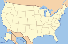
| Location: | Minnesota, USA |
| Nearest city: | Duluth, MN |
| Coordinates: | |
| Area: | 1,090,000 acres (1,703 sq mi - 4,411 km²) |
| Established: | 1964 |
| Governing body: | U.S. Forest Service |
The Boundary Waters Canoe Area Wilderness (BWCAW or BWCA, sometimes simply the bee-dub) is a 1.09 million acre wilderness area within the Superior National Forest in northern Minnesota ( USA) under the administration of the U.S. Forest Service. The BWCAW is renowned as a destination for both canoeing and fishing on its many lakes, and is the most visited wilderness in the United States.
Geography
The BWCAW is located on the U.S.-Canadian border, and along with Voyageurs National Park to the west and the Canadian Quetico and La Verendrye Provincial Parks to the north, they make up a large area of contiguous wilderness lakes and forests called the "Quetico-Superior country", or simply the Boundary Waters. Lake Superior lies to the east of the Boundary Waters.
The continental divide between the Great Lakes and Hudson Bay watersheds runs northeast-southwest through the east side of the BWCAW, and was an important landmark for the fur-trading Voyageurs of the 18th and 19th centuries. The wilderness also includes the highest peak in Minnesota, Eagle Mountain (2,301 feet / 701 m).
The two main communities with visitor services near the BWCAW are Ely and Grand Marais, Minnesota. The smaller town of Tofte is another gateway community. Several historic roads, such as the Gunflint Trail, the Echo Trail, and Fernberg Road allow access to the many wilderness entry points.
Natural history
Geology
The lakes of the BWCAW were carved from bedrock of the Canadian Shield by the movement of the Laurentide ice sheet during a succession of ice ages during the past two million years. Because glacial ice erodes softer and weaker rocks more easily, the size and shape of most lakes in the BWCAW were controlled both by the type of bedrock and the presence of geologic faults. The resulting depressions in the landscape later filled with water, becoming the lakes of today.
Many varieties of Precambrian bedrock are exposed, including granite, basalt, greenstone, gneiss, as well as metamorphic rocks derived from volcanic and sedimentary rocks. Greenstone located near Ely, Minnesota is up to 2.7 billion years old, some of the oldest exposed rock in the United States.
Forest ecology
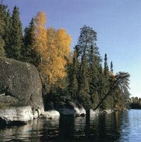
The plants and animals of the Boundary Waters Canoe Area are representative of the boreal forest biome, and their ranges continue into southern Canada and the rest of the upper Great Lakes region. Trees found within the wilderness area include red pine, eastern white pine, jack pine, birch, balsam fir, white spruce, and white cedar. Blueberries are common in many parts of the BWCAW, as are raspberries. The BWCAW is estimated to contain some 400,000 acres of old growth forest, woods which may have burned but which have never been logged. Forest fires were a natural part of the Boundary Waters ecosystem before fire suppression efforts during the 20th century, with recurrence intervals of 30 - 300 years in most areas.
On July 4, 1999, a powerful wind storm, or derecho, swept across Minnesota and southern Canada, knocking down millions of trees and affecting about 370,000 acres (1,500 km²) within the BWCAW. This event became known officially as the Boundary Waters-Canadian Derecho, commonly referred to as "the Boundary Waters blowdown". Although campsites and portages were quickly cleared after the storm, an increased risk of wildfire continues to remain a concern due to the large number of downed trees. The U.S. Forest Service has undertaken a schedule of prescribed burns to reduce the forest fuel load in the event of a wildfire.
The first major wildfire within the blowdown occurred in August 2005, burning approximately 1,400 acres (5.7 km²) north of Seagull Lake in the northeastern BWCAW. In July 2006 the Cavity Lake fire burned over 30,000 acres (125 km²), while the Turtle Lake Fire burned 2,000 acres (8 km²).
Wildlife
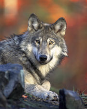
Animals native to the region include moose, beaver, bears, bobcats, bald eagles, peregrine falcons and loons. The Boundary Waters is within the range of the largest population of wolves in the continental United States, as well as an unknown number of Canada lynx. Woodland caribou once inhabited the region but have since disappeared due to loss of habitat, encroachment by deer, and the brainworm parasite carried by deer which is lethal to caribou. Increasing deer numbers may also affect the future of vegetation in this region as they favour some species over others, such as white cedar.
Human history
Native peoples
Within the BWCAW are hundreds of prehistoric pictographs and petroglyphs on rock ledges and cliffs. The BWCAW is part of the historic homeland of the Ojibwe people, who traveled the waterways in canoes made of birch bark. Prior to Ojibwe settlement, the area was sparsely populated by the Sioux who dispersed westward following the arrival of the Ojibwe. The Grand Portage Indian Reservation, just east of the BWCAW at the settlement of Grand Portage, is home to a number of Ojibwe to this day.
The fur trade
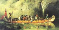
In 1688, the French explorer Jacques de Noyon became the first European to travel through the Boundary Waters. Later during the 1730s, La Verendrye and others opened the region to trade, mainly in beaver pelts. By the end of the 18th century, the fur trade had been organized into groups of canoe-paddling voyageurs working for the competing North West and Hudson's Bay Companies, with a North West Company fort located at Grand Portage on Lake Superior.
Development and protection
In the 1920s Edward Backus, a local industrialist, proposed building several dams in the region, which was successfully opposed by Ernest Oberholtzer. By 1926, the Superior Roadless Area had been designated by the U.S. Forest Service, offering some protection from mining, logging, and hydroelectric projects. The Wilderness Act of 1964 made the BWCAW legal wilderness as a unit of the National Wilderness Preservation System, while the 1978 BWCA Act established the Boundary Waters regulations much as they are today with motors allowed only on a few large entry point lakes.
Several aspects of the management of the BWCAW remain controversial today, including the use of motorboats, snowmobiles, motorized portages, permit availability and allocation, as well as suggestions to expand the wilderness area.
Recreation
The BWCAW contains over a thousand lakes and attracts visitors with its reputation for canoeing, canoe touring, fishing, backpacking, dog sledding, and remote wilderness character. Permits are required for all overnight visits to the wilderness area. The BWCAW is one of Minnesota's top tourist attractions, drawing visitors from all over the United States as well as abroad.
Canoeing
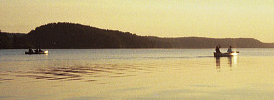
Although there are numerous campgrounds surrounding the wilderness, most campsites in the BWCAW are accessible only by water. As of 1999, about 75% of the BWCAW's water area was reserved for non-motorized boat travel. Most lakes and rivers are interconnected by portage trails, resulting in over 1000 miles (1,600 km) of canoe routes. Routes are easily chosen by selecting chains of lakes and portages of any length and difficulty. Some of the most popular entry points include Lake One, Trout Lake, Moose Lake, and Snowbank Lake near Ely, Saganaga Lake and Seagull Lake at the end of the Gunflint Trail, and Sawbill Lake near Tofte.
Canoe campers often use Duluth packs, designed for easy portaging and loading in canoes, to carry their gear.
Fishing
Fishing in the BWCAW can be some of the best in Minnesota. Game species include northern pike, walleye, largemouth and smallmouth bass, yellow perch, whitefish, and lake trout, among others. Popular lures include rapalas, jigs, and spoons, while live bait such as leeches are also used. Multi-sectioned or collapsible fishing rods are often used for ease in carrying while portaging.
Hiking
In addition to shorter trails to Eagle Mountain, Magnetic Rock, and Angleworm Lake, the Boundary Waters has several long-distance trails. The Border Route Trail runs east-west for over 60 miles through the eastern BWCAW, following the ridges between the long border lakes such as Loon, South, and Rose. Eventually, a connection is planned from the eastern end of the Border Route Trail to the northern end of the Superior Hiking Trail. The Kekekabic Trail traverses the Boundary Waters from the Gunflint Trail on the east to Snowbank Lake on the west and is the only footpath through the centre of the wilderness. There are also three longer loop trails in the Boundary Waters: the Pow Wow Trail, the Snowbank Lake Trail, and the Sioux-Hustler Trail. These longer trails see a variable amount of maintenance; current conditions should be determined locally before use.
Notable people
Sigurd Olson, Minnesota author and conservationist, wrote extensively about the Boundary Waters and worked to ensure preservation of the wilderness. Dorothy Molter, known as the "Rootbeer Lady," lived alone in the BWCAW for 56 years until her death in 1986.
